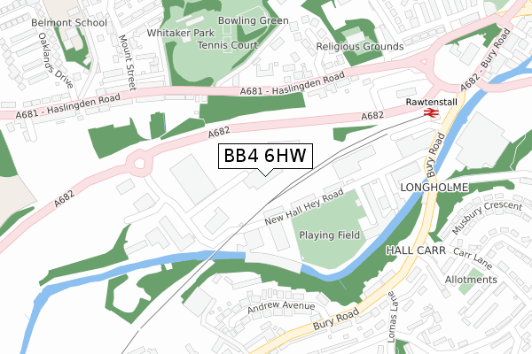
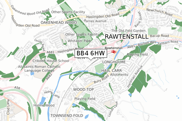
BB4 6HW is located in the Longholme electoral ward, within the local authority district of Rossendale and the English Parliamentary constituency of Rossendale and Darwen. The Sub Integrated Care Board (ICB) Location is NHS Lancashire and South Cumbria ICB - 01A and the police force is Lancashire. This postcode has been in use since May 2018.


GetTheData
Source: OS Open Zoomstack (Ordnance Survey)
Licence: Open Government Licence (requires attribution)
Attribution: Contains OS data © Crown copyright and database right 2024
Source: Open Postcode Geo
Licence: Open Government Licence (requires attribution)
Attribution: Contains OS data © Crown copyright and database right 2024; Contains Royal Mail data © Royal Mail copyright and database right 2024; Source: Office for National Statistics licensed under the Open Government Licence v.3.0
| Easting | 380586 |
| Northing | 422406 |
| Latitude | 53.697743 |
| Longitude | -2.295515 |
GetTheData
Source: Open Postcode Geo
Licence: Open Government Licence
| Country | England |
| Postcode District | BB4 |
| ➜ BB4 open data dashboard ➜ See where BB4 is on a map ➜ Where is Rawtenstall? | |
GetTheData
Source: Land Registry Price Paid Data
Licence: Open Government Licence
| Ward | Longholme |
| Constituency | Rossendale And Darwen |
GetTheData
Source: ONS Postcode Database
Licence: Open Government Licence
| January 2024 | Anti-social behaviour | On or near Oakley Street | 422m |
| September 2023 | Violence and sexual offences | On or near Oakley Street | 422m |
| August 2023 | Anti-social behaviour | On or near Oakley Street | 422m |
| ➜ Get more crime data in our Crime section | |||
GetTheData
Source: data.police.uk
Licence: Open Government Licence
| Business Village (New Hall Hey Road) | Rawtenstall | 125m |
| Whitaker Park (Haslingden Road) | Rawtenstall | 167m |
| Business Village (New Hall Hey Road) | Rawtenstall | 189m |
| Whitaker Park (Haslingden Road) | Rawtenstall | 222m |
| Mount Street (Haslingden Road) | Rawtenstall | 269m |
| Rawtenstall (East Lancashire Railway) | Longholme | 331m |
GetTheData
Source: NaPTAN
Licence: Open Government Licence
GetTheData
Source: ONS Postcode Database
Licence: Open Government Licence


➜ Get more ratings from the Food Standards Agency
GetTheData
Source: Food Standards Agency
Licence: FSA terms & conditions
| Last Collection | |||
|---|---|---|---|
| Location | Mon-Fri | Sat | Distance |
| Railway Station | 16:45 | 12:30 | 389m |
| Rossendale Delivery Office | 17:45 | 13:00 | 874m |
| Sidmouth Avenue | 17:30 | 12:15 | 1,368m |
GetTheData
Source: Dracos
Licence: Creative Commons Attribution-ShareAlike
| Facility | Distance |
|---|---|
| Fit Therapy (Closed) New Hall Hey Road, Rossendale Health and Fitness Gym, Studio | 138m |
| Thrive Gym (Rawtenstall) New Hall Hey Road, Rawtenstall, Rossendale Health and Fitness Gym, Studio | 199m |
| New Hall Hey Cricket Ground New Hall Hey Road, Rawtenstall, Rossendale Grass Pitches | 215m |
GetTheData
Source: Active Places
Licence: Open Government Licence
| School | Phase of Education | Distance |
|---|---|---|
| Belmont School Haslingden Road, Rawtenstall, Rossendale, Rossendale, BB4 6RX | Not applicable | 436m |
| Rawtenstall Cribden House Community Special School Haslingden Road, Rawtenstall, Rossendale, BB4 6RX | Not applicable | 515m |
| Rawtenstall Balladen Community Primary School Linden Lea, Rawtenstall, Rossendale, BB4 6DX | Primary | 652m |
GetTheData
Source: Edubase
Licence: Open Government Licence
| Risk of BB4 6HW flooding from rivers and sea | Low |
| ➜ BB4 6HW flood map | |
GetTheData
Source: Open Flood Risk by Postcode
Licence: Open Government Licence
The below table lists the International Territorial Level (ITL) codes (formerly Nomenclature of Territorial Units for Statistics (NUTS) codes) and Local Administrative Units (LAU) codes for BB4 6HW:
| ITL 1 Code | Name |
|---|---|
| TLD | North West (England) |
| ITL 2 Code | Name |
| TLD4 | Lancashire |
| ITL 3 Code | Name |
| TLD46 | East Lancashire |
| LAU 1 Code | Name |
| E07000125 | Rossendale |
GetTheData
Source: ONS Postcode Directory
Licence: Open Government Licence
The below table lists the Census Output Area (OA), Lower Layer Super Output Area (LSOA), and Middle Layer Super Output Area (MSOA) for BB4 6HW:
| Code | Name | |
|---|---|---|
| OA | E00128838 | |
| LSOA | E01033281 | Rossendale 004G |
| MSOA | E02005281 | Rossendale 004 |
GetTheData
Source: ONS Postcode Directory
Licence: Open Government Licence
| BB4 6HP | Railway Terrace | 115m |
| BB4 6HL | New Hall Hey Road | 121m |
| BB4 6HJ | Holme Bank | 241m |
| BB4 6RE | Haslingden Road | 244m |
| BB4 6RG | Hayes Buildings | 246m |
| BB4 6EU | Andrew Avenue | 251m |
| BB4 6EX | Crabtree Terrace | 265m |
| BB4 6RH | Fieldings Buildings | 269m |
| BB4 6ET | Crabtree Buildings | 284m |
| BB4 6RL | Whitaker Green | 285m |
GetTheData
Source: Open Postcode Geo; Land Registry Price Paid Data
Licence: Open Government Licence