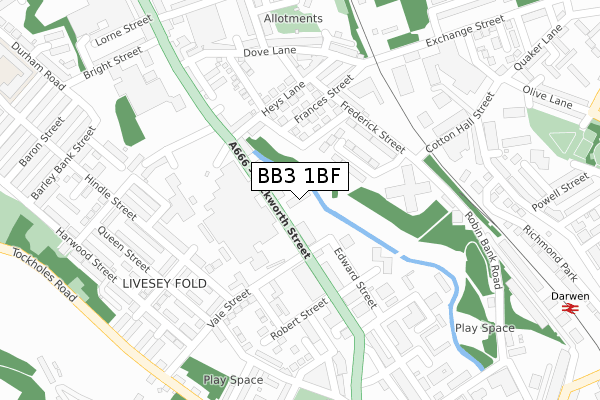
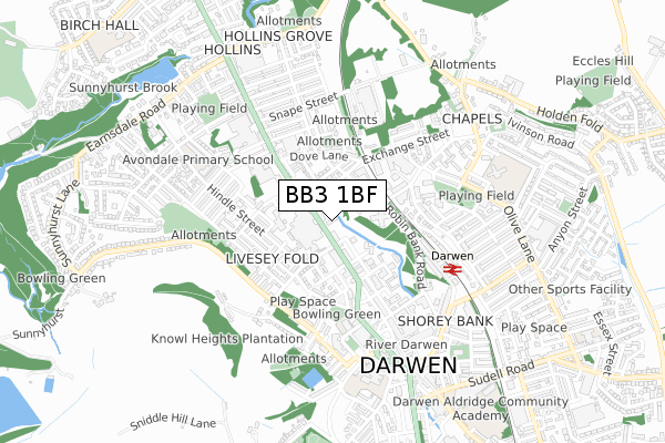
BB3 1BF is located in the Darwen East electoral ward, within the unitary authority of Blackburn with Darwen and the English Parliamentary constituency of Rossendale and Darwen. The Sub Integrated Care Board (ICB) Location is NHS Lancashire and South Cumbria ICB - 00Q and the police force is Lancashire. This postcode has been in use since December 2018.


GetTheData
Source: OS Open Zoomstack (Ordnance Survey)
Licence: Open Government Licence (requires attribution)
Attribution: Contains OS data © Crown copyright and database right 2024
Source: Open Postcode Geo
Licence: Open Government Licence (requires attribution)
Attribution: Contains OS data © Crown copyright and database right 2024; Contains Royal Mail data © Royal Mail copyright and database right 2024; Source: Office for National Statistics licensed under the Open Government Licence v.3.0
| Easting | 368954 |
| Northing | 422715 |
| Latitude | 53.699956 |
| Longitude | -2.471714 |
GetTheData
Source: Open Postcode Geo
Licence: Open Government Licence
| Country | England |
| Postcode District | BB3 |
| ➜ BB3 open data dashboard ➜ See where BB3 is on a map ➜ Where is Darwen? | |
GetTheData
Source: Land Registry Price Paid Data
Licence: Open Government Licence
| Ward | Darwen East |
| Constituency | Rossendale And Darwen |
GetTheData
Source: ONS Postcode Database
Licence: Open Government Licence
| January 2024 | Violence and sexual offences | On or near Nelson Street | 129m |
| January 2024 | Violence and sexual offences | On or near Nelson Street | 129m |
| January 2024 | Criminal damage and arson | On or near Preston Street | 408m |
| ➜ Get more crime data in our Crime section | |||
GetTheData
Source: data.police.uk
Licence: Open Government Licence
| British Queen (Duckworth Street) | Darwen | 35m |
| Vale Street (Duckworth Street) | Darwen | 110m |
| Heys Lane (Duckworth Street) | Darwen | 243m |
| Hacking Street (Bury Street) | Darwen | 280m |
| Duckworth Street (Market Street) | Darwen | 399m |
| Darwen Station | 0.5km |
| Mill Hill (Lancs) Station | 4.4km |
| Cherry Tree Station | 4.8km |
GetTheData
Source: NaPTAN
Licence: Open Government Licence
GetTheData
Source: ONS Postcode Database
Licence: Open Government Licence


➜ Get more ratings from the Food Standards Agency
GetTheData
Source: Food Standards Agency
Licence: FSA terms & conditions
| Last Collection | |||
|---|---|---|---|
| Location | Mon-Fri | Sat | Distance |
| 68 Birch Hall Avenue | 16:30 | 11:00 | 683m |
| Royal Arms | 12:00 | 09:00 | 2,723m |
| Moorgate | 16:15 | 11:15 | 3,686m |
GetTheData
Source: Dracos
Licence: Creative Commons Attribution-ShareAlike
| Facility | Distance |
|---|---|
| Darwen Leisure Centre (Closed) Green Street, Darwen Sports Hall, Swimming Pool, Health and Fitness Gym, Squash Courts | 417m |
| Darwen Leisure Centre The Green, Darwen Swimming Pool, Health and Fitness Gym, Sports Hall, Studio | 444m |
| Avondale Primary School Durham Road, Darwen Grass Pitches | 557m |
GetTheData
Source: Active Places
Licence: Open Government Licence
| School | Phase of Education | Distance |
|---|---|---|
| Darwen Aldridge Enterprise Studio Police Street, Darwen, BB3 1AF | Secondary | 400m |
| Avondale Primary School Durham Road, Darwen, BB3 1NN | Primary | 557m |
| Holy Trinity VC School Bank Top, Darwen, BB3 2RW | Primary | 586m |
GetTheData
Source: Edubase
Licence: Open Government Licence
| Risk of BB3 1BF flooding from rivers and sea | Medium |
| ➜ BB3 1BF flood map | |
GetTheData
Source: Open Flood Risk by Postcode
Licence: Open Government Licence
The below table lists the International Territorial Level (ITL) codes (formerly Nomenclature of Territorial Units for Statistics (NUTS) codes) and Local Administrative Units (LAU) codes for BB3 1BF:
| ITL 1 Code | Name |
|---|---|
| TLD | North West (England) |
| ITL 2 Code | Name |
| TLD4 | Lancashire |
| ITL 3 Code | Name |
| TLD41 | Blackburn with Darwen |
| LAU 1 Code | Name |
| E06000008 | Blackburn with Darwen |
GetTheData
Source: ONS Postcode Directory
Licence: Open Government Licence
The below table lists the Census Output Area (OA), Lower Layer Super Output Area (LSOA), and Middle Layer Super Output Area (MSOA) for BB3 1BF:
| Code | Name | |
|---|---|---|
| OA | E00063757 | |
| LSOA | E01012649 | Blackburn with Darwen 016A |
| MSOA | E02002630 | Blackburn with Darwen 016 |
GetTheData
Source: ONS Postcode Directory
Licence: Open Government Licence
| BB3 1AT | Duckworth Street | 37m |
| BB3 1DU | Dobson Street | 134m |
| BB3 1DX | Nelson Street | 139m |
| BB3 1DY | Frederick Street | 156m |
| BB3 1DT | Heys Lane | 165m |
| BB3 1NQ | Higher Lawrence Street | 180m |
| BB3 1BY | Market Street | 183m |
| BB3 1NG | Hindle Street | 196m |
| BB3 1DZ | Frances Street | 200m |
| BB3 1EG | Garibaldi Terrace | 203m |
GetTheData
Source: Open Postcode Geo; Land Registry Price Paid Data
Licence: Open Government Licence