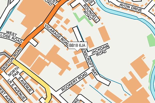
BB18 6JA is located in the Earby & Coates electoral ward, within the local authority district of Pendle and the English Parliamentary constituency of Pendle. The Sub Integrated Care Board (ICB) Location is NHS Lancashire and South Cumbria ICB - 01A and the police force is Lancashire. This postcode has been in use since December 1997.


GetTheData
Source: OS OpenMap – Local (Ordnance Survey)
Source: OS VectorMap District (Ordnance Survey)
Licence: Open Government Licence (requires attribution)
| Easting | 388113 |
| Northing | 447140 |
| Latitude | 53.920275 |
| Longitude | -2.182482 |
GetTheData
Source: Open Postcode Geo
Licence: Open Government Licence
| Country | England |
| Postcode District | BB18 |
➜ See where BB18 is on a map ➜ Where is Barnoldswick? | |
GetTheData
Source: Land Registry Price Paid Data
Licence: Open Government Licence
Elevation or altitude of BB18 6JA as distance above sea level:
| Metres | Feet | |
|---|---|---|
| Elevation | 150m | 492ft |
Elevation is measured from the approximate centre of the postcode, to the nearest point on an OS contour line from OS Terrain 50, which has contour spacing of ten vertical metres.
➜ How high above sea level am I? Find the elevation of your current position using your device's GPS.
GetTheData
Source: Open Postcode Elevation
Licence: Open Government Licence
| Ward | Earby & Coates |
| Constituency | Pendle |
GetTheData
Source: ONS Postcode Database
Licence: Open Government Licence
| Roundell Road (Skipton Road) | Coates | 216m |
| Roundell Road (Skipton Road) | Coates | 218m |
| Wellhouse Road (Skipton Road) | Barnoldswick | 228m |
| Wellhouse Road (Skipton Road) | Barnoldswick | 267m |
| Lower North Ave (Skipton Road) | Barnoldswick | 368m |
GetTheData
Source: NaPTAN
Licence: Open Government Licence
GetTheData
Source: ONS Postcode Database
Licence: Open Government Licence


➜ Get more ratings from the Food Standards Agency
GetTheData
Source: Food Standards Agency
Licence: FSA terms & conditions
| Last Collection | |||
|---|---|---|---|
| Location | Mon-Fri | Sat | Distance |
| Barnoldswick Post Office | 18:30 | 12:00 | 564m |
| Ghyll Meadows | 17:30 | 11:30 | 733m |
| Salterforth Post Office | 17:30 | 11:15 | 1,893m |
GetTheData
Source: Dracos
Licence: Creative Commons Attribution-ShareAlike
The below table lists the International Territorial Level (ITL) codes (formerly Nomenclature of Territorial Units for Statistics (NUTS) codes) and Local Administrative Units (LAU) codes for BB18 6JA:
| ITL 1 Code | Name |
|---|---|
| TLD | North West (England) |
| ITL 2 Code | Name |
| TLD4 | Lancashire |
| ITL 3 Code | Name |
| TLD46 | East Lancashire |
| LAU 1 Code | Name |
| E07000122 | Pendle |
GetTheData
Source: ONS Postcode Directory
Licence: Open Government Licence
The below table lists the Census Output Area (OA), Lower Layer Super Output Area (LSOA), and Middle Layer Super Output Area (MSOA) for BB18 6JA:
| Code | Name | |
|---|---|---|
| OA | E00127871 | |
| LSOA | E01025192 | Pendle 001B |
| MSOA | E02005240 | Pendle 001 |
GetTheData
Source: ONS Postcode Directory
Licence: Open Government Licence
| BB18 6DY | Vicarage Road | 76m |
| BB18 6EB | Roundell Road | 156m |
| BB18 6DU | Masons Way | 167m |
| BB18 6EA | Edward Street | 178m |
| BB18 6BA | Havre Park | 200m |
| BB18 6DZ | Oak Terrace | 202m |
| BB18 6AZ | Valley Road | 205m |
| BB18 6DQ | East Parade | 215m |
| BB18 6FA | Coates Wharf | 218m |
| BB18 6DL | South Parade | 220m |
GetTheData
Source: Open Postcode Geo; Land Registry Price Paid Data
Licence: Open Government Licence