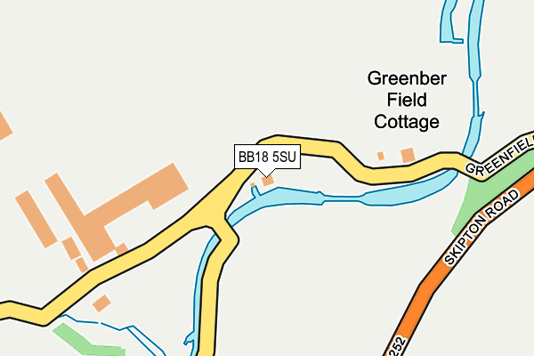
BB18 5SU is located in the Earby & Coates electoral ward, within the local authority district of Pendle and the English Parliamentary constituency of Pendle. The Sub Integrated Care Board (ICB) Location is NHS Lancashire and South Cumbria ICB - 01A and the police force is Lancashire. This postcode has been in use since December 1997.


GetTheData
Source: OS OpenMap – Local (Ordnance Survey)
Source: OS VectorMap District (Ordnance Survey)
Licence: Open Government Licence (requires attribution)
| Easting | 388719 |
| Northing | 448180 |
| Latitude | 53.929622 |
| Longitude | -2.173291 |
GetTheData
Source: Open Postcode Geo
Licence: Open Government Licence
| Country | England |
| Postcode District | BB18 |
➜ See where BB18 is on a map | |
GetTheData
Source: Land Registry Price Paid Data
Licence: Open Government Licence
Elevation or altitude of BB18 5SU as distance above sea level:
| Metres | Feet | |
|---|---|---|
| Elevation | 150m | 492ft |
Elevation is measured from the approximate centre of the postcode, to the nearest point on an OS contour line from OS Terrain 50, which has contour spacing of ten vertical metres.
➜ How high above sea level am I? Find the elevation of your current position using your device's GPS.
GetTheData
Source: Open Postcode Elevation
Licence: Open Government Licence
| Ward | Earby & Coates |
| Constituency | Pendle |
GetTheData
Source: ONS Postcode Database
Licence: Open Government Licence
| Coates Lane | Coates | 219m |
| Ghyll Lane (Skipton Road) | Coates | 476m |
| Coates Lane | Coates | 498m |
| Coates Lane | Coates | 499m |
| Ghyll Golf Club (Skipton Road) | Thornton In Craven | 662m |
GetTheData
Source: NaPTAN
Licence: Open Government Licence
| Percentage of properties with Next Generation Access | 100.0% |
| Percentage of properties with Superfast Broadband | 0.0% |
| Percentage of properties with Ultrafast Broadband | 0.0% |
| Percentage of properties with Full Fibre Broadband | 0.0% |
Superfast Broadband is between 30Mbps and 300Mbps
Ultrafast Broadband is > 300Mbps
| Percentage of properties unable to receive 2Mbps | 0.0% |
| Percentage of properties unable to receive 5Mbps | 0.0% |
| Percentage of properties unable to receive 10Mbps | 0.0% |
| Percentage of properties unable to receive 30Mbps | 100.0% |
GetTheData
Source: Ofcom
Licence: Ofcom Terms of Use (requires attribution)
GetTheData
Source: ONS Postcode Database
Licence: Open Government Licence


➜ Get more ratings from the Food Standards Agency
GetTheData
Source: Food Standards Agency
Licence: FSA terms & conditions
| Last Collection | |||
|---|---|---|---|
| Location | Mon-Fri | Sat | Distance |
| Ghyll Meadows | 17:30 | 11:30 | 475m |
| Barnoldswick Post Office | 18:30 | 12:00 | 1,767m |
| Orchard Cottage, Old Road | 16:00 | 10:00 | 2,098m |
GetTheData
Source: Dracos
Licence: Creative Commons Attribution-ShareAlike
The below table lists the International Territorial Level (ITL) codes (formerly Nomenclature of Territorial Units for Statistics (NUTS) codes) and Local Administrative Units (LAU) codes for BB18 5SU:
| ITL 1 Code | Name |
|---|---|
| TLD | North West (England) |
| ITL 2 Code | Name |
| TLD4 | Lancashire |
| ITL 3 Code | Name |
| TLD46 | East Lancashire |
| LAU 1 Code | Name |
| E07000122 | Pendle |
GetTheData
Source: ONS Postcode Directory
Licence: Open Government Licence
The below table lists the Census Output Area (OA), Lower Layer Super Output Area (LSOA), and Middle Layer Super Output Area (MSOA) for BB18 5SU:
| Code | Name | |
|---|---|---|
| OA | E00127874 | |
| LSOA | E01025193 | Pendle 001C |
| MSOA | E02005240 | Pendle 001 |
GetTheData
Source: ONS Postcode Directory
Licence: Open Government Licence
| BB18 6HP | Meadow Way | 341m |
| BB18 6HX | Green Bank | 365m |
| BB18 6HL | Coates Lane | 366m |
| BB18 6HU | Valley Drive | 401m |
| BB18 6YN | Whitworth Way | 448m |
| BB18 6YW | Coates Fields | 450m |
| BB18 6YP | Banks Bridge Close | 465m |
| BB18 6HW | Ghyll Meadows | 489m |
| BB18 6JB | Pickard Close | 537m |
| BB18 6HJ | Coates Lane | 553m |
GetTheData
Source: Open Postcode Geo; Land Registry Price Paid Data
Licence: Open Government Licence