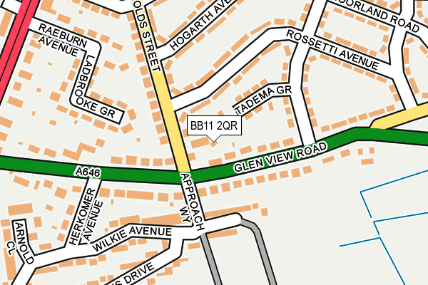
BB11 2QR is located in the Rosehill with Burnley Wood electoral ward, within the local authority district of Burnley and the English Parliamentary constituency of Burnley. The Sub Integrated Care Board (ICB) Location is NHS Lancashire and South Cumbria ICB - 01A and the police force is Lancashire. This postcode has been in use since January 1980.


GetTheData
Source: OS OpenMap – Local (Ordnance Survey)
Source: OS VectorMap District (Ordnance Survey)
Licence: Open Government Licence (requires attribution)
| Easting | 383527 |
| Northing | 430888 |
| Latitude | 53.774065 |
| Longitude | -2.251428 |
GetTheData
Source: Open Postcode Geo
Licence: Open Government Licence
| Country | England |
| Postcode District | BB11 |
➜ See where BB11 is on a map ➜ Where is Burnley? | |
GetTheData
Source: Land Registry Price Paid Data
Licence: Open Government Licence
Elevation or altitude of BB11 2QR as distance above sea level:
| Metres | Feet | |
|---|---|---|
| Elevation | 240m | 787ft |
Elevation is measured from the approximate centre of the postcode, to the nearest point on an OS contour line from OS Terrain 50, which has contour spacing of ten vertical metres.
➜ How high above sea level am I? Find the elevation of your current position using your device's GPS.
GetTheData
Source: Open Postcode Elevation
Licence: Open Government Licence
| Ward | Rosehill With Burnley Wood |
| Constituency | Burnley |
GetTheData
Source: ONS Postcode Database
Licence: Open Government Licence
| Reynolds Street (Glen View Road) | Rosehill | 35m |
| Reynolds Street (Glen View Road) | Rosehill | 65m |
| Herkomer Ave (Glen View Road) | Rosehill | 182m |
| Herkomer Avenue (Glen View Road) | Summitt | 228m |
| Coaching House (Glen View Road) | Rosehill | 245m |
| Burnley Manchester Road Station | 1.2km |
| Burnley Barracks Station | 1.9km |
| Burnley Central Station | 2.2km |
GetTheData
Source: NaPTAN
Licence: Open Government Licence
| Percentage of properties with Next Generation Access | 100.0% |
| Percentage of properties with Superfast Broadband | 100.0% |
| Percentage of properties with Ultrafast Broadband | 100.0% |
| Percentage of properties with Full Fibre Broadband | 0.0% |
Superfast Broadband is between 30Mbps and 300Mbps
Ultrafast Broadband is > 300Mbps
| Percentage of properties unable to receive 2Mbps | 0.0% |
| Percentage of properties unable to receive 5Mbps | 0.0% |
| Percentage of properties unable to receive 10Mbps | 0.0% |
| Percentage of properties unable to receive 30Mbps | 0.0% |
GetTheData
Source: Ofcom
Licence: Ofcom Terms of Use (requires attribution)
GetTheData
Source: ONS Postcode Database
Licence: Open Government Licence


➜ Get more ratings from the Food Standards Agency
GetTheData
Source: Food Standards Agency
Licence: FSA terms & conditions
| Last Collection | |||
|---|---|---|---|
| Location | Mon-Fri | Sat | Distance |
| Burnley Post Office | 18:30 | 11:00 | 1,697m |
| Burnley Post Office | 18:30 | 11:00 | 1,698m |
| Burnley Delivery Office | 19:00 | 13:00 | 1,724m |
GetTheData
Source: Dracos
Licence: Creative Commons Attribution-ShareAlike
The below table lists the International Territorial Level (ITL) codes (formerly Nomenclature of Territorial Units for Statistics (NUTS) codes) and Local Administrative Units (LAU) codes for BB11 2QR:
| ITL 1 Code | Name |
|---|---|
| TLD | North West (England) |
| ITL 2 Code | Name |
| TLD4 | Lancashire |
| ITL 3 Code | Name |
| TLD46 | East Lancashire |
| LAU 1 Code | Name |
| E07000117 | Burnley |
GetTheData
Source: ONS Postcode Directory
Licence: Open Government Licence
The below table lists the Census Output Area (OA), Lower Layer Super Output Area (LSOA), and Middle Layer Super Output Area (MSOA) for BB11 2QR:
| Code | Name | |
|---|---|---|
| OA | E00126401 | |
| LSOA | E01024905 | Burnley 014G |
| MSOA | E02006881 | Burnley 014 |
GetTheData
Source: ONS Postcode Directory
Licence: Open Government Licence
| BB11 2QW | Glen View Road | 69m |
| BB11 2NS | Tadema Grove | 74m |
| BB11 2QP | Glen View Road | 104m |
| BB11 2NP | Rossetti Avenue | 108m |
| BB11 2NL | Reynolds Street | 128m |
| BB11 2QN | Glen View Road | 144m |
| BB11 2NR | Creswick Avenue | 166m |
| BB11 2NW | Hogarth Avenue | 170m |
| BB11 2QF | Ladbrooke Grove | 183m |
| BB11 3QE | Wilkie Avenue | 195m |
GetTheData
Source: Open Postcode Geo; Land Registry Price Paid Data
Licence: Open Government Licence