BB1 5SW maps, stats, and open data
BB1 5SW is located in the Little Harwood & Whitebirk electoral ward, within the unitary authority of Blackburn with Darwen and the English Parliamentary constituency of Blackburn. The Sub Integrated Care Board (ICB) Location is NHS Lancashire and South Cumbria ICB - 00Q and the police force is Lancashire. This postcode has been in use since January 1995.
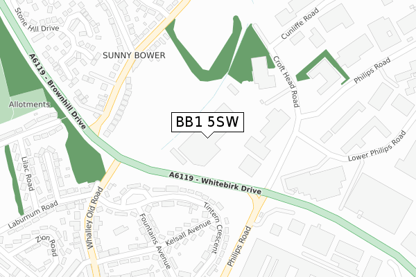
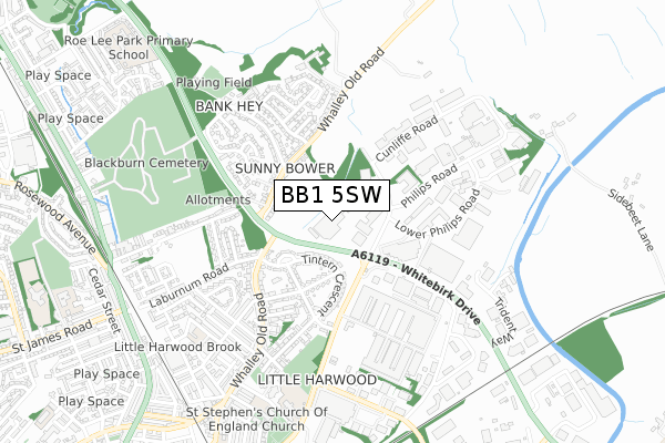
BB1 5SW maps


Licence: Open Government Licence (requires attribution)
Attribution: Contains OS data © Crown copyright and database right 2025
Source: Open Postcode Geo
Licence: Open Government Licence (requires attribution)
Attribution: Contains OS data © Crown copyright and database right 2025; Contains Royal Mail data © Royal Mail copyright and database right 2025; Source: Office for National Statistics licensed under the Open Government Licence v.3.0
BB1 5SW geodata
| Easting | 369757 |
| Northing | 429935 |
| Latitude | 53.764879 |
| Longitude | -2.460262 |
Where is BB1 5SW?
| Country | England |
| Postcode District | BB1 |
BB1 5SW Elevation
Elevation or altitude of BB1 5SW as distance above sea level:
| Metres | Feet | |
|---|---|---|
| Elevation | 160m | 525ft |
Elevation is measured from the approximate centre of the postcode, to the nearest point on an OS contour line from OS Terrain 50, which has contour spacing of ten vertical metres.
➜ How high above sea level am I? Find the elevation of your current position using your device's GPS.
Politics
| Ward | Little Harwood & Whitebirk |
|---|---|
| Constituency | Blackburn |
Transport
Nearest bus stops to BB1 5SW
| Promethean (Croft Head Road) | Blackburn | 173m |
| Elc (Croft Head Road) | Blackburn | 193m |
| Bank Hey Lane (Whalley Old Road) | Sunnybower | 255m |
| Fountains Ave | Little Harwood | 263m |
| Bank Hey Lane (Whalley Old Road) | Sunnybower | 263m |
Nearest railway stations to BB1 5SW
| Ramsgreave & Wilpshire Station | 2km |
| Blackburn Station | 2.4km |
| Rishton Station | 2.6km |
Deprivation
69.2% of English postcodes are less deprived than BB1 5SW:Food Standards Agency
Three nearest food hygiene ratings to BB1 5SW (metres)


➜ Get more ratings from the Food Standards Agency
Nearest post box to BB1 5SW
| Last Collection | |||
|---|---|---|---|
| Location | Mon-Fri | Sat | Distance |
| Phillips Road | 18:00 | 12:30 | 904m |
| Whitebirk Ind Estate | 17:15 | 12:30 | 1,018m |
| Furthergate Ind Estate | 18:00 | 00:01 | 1,365m |
BB1 5SW ITL and BB1 5SW LAU
The below table lists the International Territorial Level (ITL) codes (formerly Nomenclature of Territorial Units for Statistics (NUTS) codes) and Local Administrative Units (LAU) codes for BB1 5SW:
| ITL 1 Code | Name |
|---|---|
| TLD | North West (England) |
| ITL 2 Code | Name |
| TLD4 | Lancashire |
| ITL 3 Code | Name |
| TLD41 | Blackburn with Darwen |
| LAU 1 Code | Name |
| E06000008 | Blackburn with Darwen |
BB1 5SW census areas
The below table lists the Census Output Area (OA), Lower Layer Super Output Area (LSOA), and Middle Layer Super Output Area (MSOA) for BB1 5SW:
| Code | Name | |
|---|---|---|
| OA | E00063550 | |
| LSOA | E01012607 | Blackburn with Darwen 001A |
| MSOA | E02002615 | Blackburn with Darwen 001 |
Nearest postcodes to BB1 5SW
| BB1 5RT | Tintern Crescent | 192m |
| BB1 5RH | Whalley Old Road | 222m |
| BB1 5RY | Tintern Crescent | 282m |
| BB1 5RX | Fountains Avenue | 291m |
| BB1 5RU | Kelsall Avenue | 298m |
| BB1 5SP | Rowan Close | 318m |
| BB1 5QS | Hazelwood Close | 322m |
| BB1 5QL | Whalley Old Road | 338m |
| BB1 5RS | Whalley Old Road | 342m |
| BB1 5SE | Furness Avenue | 376m |