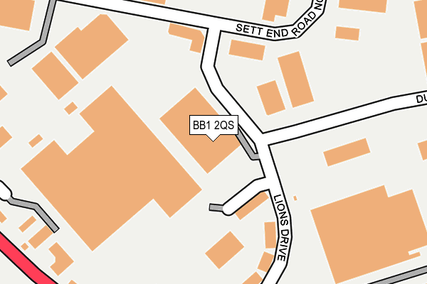
BB1 2QS is located in the Blackburn South East electoral ward, within the unitary authority of Blackburn with Darwen and the English Parliamentary constituency of Blackburn. The Sub Integrated Care Board (ICB) Location is NHS Lancashire and South Cumbria ICB - 00Q and the police force is Lancashire. This postcode has been in use since June 2002.


GetTheData
Source: OS OpenMap – Local (Ordnance Survey)
Source: OS VectorMap District (Ordnance Survey)
Licence: Open Government Licence (requires attribution)
| Easting | 370552 |
| Northing | 426210 |
| Latitude | 53.731461 |
| Longitude | -2.447845 |
GetTheData
Source: Open Postcode Geo
Licence: Open Government Licence
| Country | England |
| Postcode District | BB1 |
➜ See where BB1 is on a map ➜ Where is Blackburn? | |
GetTheData
Source: Land Registry Price Paid Data
Licence: Open Government Licence
Elevation or altitude of BB1 2QS as distance above sea level:
| Metres | Feet | |
|---|---|---|
| Elevation | 200m | 656ft |
Elevation is measured from the approximate centre of the postcode, to the nearest point on an OS contour line from OS Terrain 50, which has contour spacing of ten vertical metres.
➜ How high above sea level am I? Find the elevation of your current position using your device's GPS.
GetTheData
Source: Open Postcode Elevation
Licence: Open Government Licence
| Ward | Blackburn South East |
| Constituency | Blackburn |
GetTheData
Source: ONS Postcode Database
Licence: Open Government Licence
| Lions Drive | Guide | 207m |
| Mc Cambridge (Sett End Road West) | Guide | 224m |
| Lions Drive | Guide | 227m |
| Mc Cambridge (Sett End Road West) | Guide | 233m |
| Duttons Way | Guide | 233m |
| Blackburn Station | 2.7km |
| Mill Hill (Lancs) Station | 3.6km |
| Darwen Station | 3.9km |
GetTheData
Source: NaPTAN
Licence: Open Government Licence
| Median download speed | 65.8Mbps |
| Average download speed | 53.3Mbps |
| Maximum download speed | 80.00Mbps |
| Median upload speed | 19.6Mbps |
| Average upload speed | 12.5Mbps |
| Maximum upload speed | 20.00Mbps |
GetTheData
Source: Ofcom
Licence: Ofcom Terms of Use (requires attribution)
GetTheData
Source: ONS Postcode Database
Licence: Open Government Licence


➜ Get more ratings from the Food Standards Agency
GetTheData
Source: Food Standards Agency
Licence: FSA terms & conditions
| Last Collection | |||
|---|---|---|---|
| Location | Mon-Fri | Sat | Distance |
| Old Bank Lane | 16:15 | 11:00 | 1,449m |
| Longton Street | 17:15 | 13:15 | 1,763m |
| 188 Burnley Road | 16:30 | 11:30 | 2,313m |
GetTheData
Source: Dracos
Licence: Creative Commons Attribution-ShareAlike
The below table lists the International Territorial Level (ITL) codes (formerly Nomenclature of Territorial Units for Statistics (NUTS) codes) and Local Administrative Units (LAU) codes for BB1 2QS:
| ITL 1 Code | Name |
|---|---|
| TLD | North West (England) |
| ITL 2 Code | Name |
| TLD4 | Lancashire |
| ITL 3 Code | Name |
| TLD41 | Blackburn with Darwen |
| LAU 1 Code | Name |
| E06000008 | Blackburn with Darwen |
GetTheData
Source: ONS Postcode Directory
Licence: Open Government Licence
The below table lists the Census Output Area (OA), Lower Layer Super Output Area (LSOA), and Middle Layer Super Output Area (MSOA) for BB1 2QS:
| Code | Name | |
|---|---|---|
| OA | E00171894 | |
| LSOA | E01012632 | Blackburn with Darwen 011F |
| MSOA | E02002625 | Blackburn with Darwen 011 |
GetTheData
Source: ONS Postcode Directory
Licence: Open Government Licence
| BB1 2NW | Sett End Road North | 225m |
| BB1 2NF | Haslingden Road | 323m |
| BB1 2EH | Wilkinson Way | 347m |
| BB1 2QP | Partnership Way | 362m |
| BB1 2JX | Copster Hill Close | 370m |
| BB1 2LW | School Lane | 387m |
| BB1 2PT | Sett End Road North | 388m |
| BB1 2QU | Hurstwood Court | 418m |
| BB1 2JT | Nuttalls Way | 433m |
| BB1 2NG | Haslingden Road | 464m |
GetTheData
Source: Open Postcode Geo; Land Registry Price Paid Data
Licence: Open Government Licence