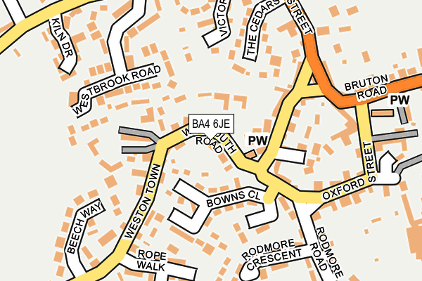
BA4 6JE lies on Enfield Terrace in Evercreech, Shepton Mallet. BA4 6JE is located in the Mendip South electoral ward, within the unitary authority of Somerset and the English Parliamentary constituency of Somerton and Frome. The Sub Integrated Care Board (ICB) Location is NHS Somerset ICB - 11X and the police force is Avon and Somerset. This postcode has been in use since January 1980.


GetTheData
Source: OS OpenMap – Local (Ordnance Survey)
Source: OS VectorMap District (Ordnance Survey)
Licence: Open Government Licence (requires attribution)
| Easting | 364694 |
| Northing | 138639 |
| Latitude | 51.145917 |
| Longitude | -2.506103 |
GetTheData
Source: Open Postcode Geo
Licence: Open Government Licence
| Street | Enfield Terrace |
| Locality | Evercreech |
| Town/City | Shepton Mallet |
| Country | England |
| Postcode District | BA4 |
➜ See where BA4 is on a map ➜ Where is Evercreech? | |
GetTheData
Source: Land Registry Price Paid Data
Licence: Open Government Licence
Elevation or altitude of BA4 6JE as distance above sea level:
| Metres | Feet | |
|---|---|---|
| Elevation | 80m | 262ft |
Elevation is measured from the approximate centre of the postcode, to the nearest point on an OS contour line from OS Terrain 50, which has contour spacing of ten vertical metres.
➜ How high above sea level am I? Find the elevation of your current position using your device's GPS.
GetTheData
Source: Open Postcode Elevation
Licence: Open Government Licence
| Ward | Mendip South |
| Constituency | Somerton And Frome |
GetTheData
Source: ONS Postcode Database
Licence: Open Government Licence
| Church (Weymouth Road) | Evercreech | 80m |
| Garage (Weymouth Road) | Evercreech | 91m |
| St Peters Church (Oxford Street) | Stoney Stratton | 221m |
| Westontown House (Weston Town) | Evercreech | 226m |
| St Peters Church (Bruton Road) | Stoney Stratton | 226m |
| Bruton Station | 5.6km |
GetTheData
Source: NaPTAN
Licence: Open Government Licence
| Percentage of properties with Next Generation Access | 100.0% |
| Percentage of properties with Superfast Broadband | 100.0% |
| Percentage of properties with Ultrafast Broadband | 0.0% |
| Percentage of properties with Full Fibre Broadband | 0.0% |
Superfast Broadband is between 30Mbps and 300Mbps
Ultrafast Broadband is > 300Mbps
| Percentage of properties unable to receive 2Mbps | 0.0% |
| Percentage of properties unable to receive 5Mbps | 0.0% |
| Percentage of properties unable to receive 10Mbps | 0.0% |
| Percentage of properties unable to receive 30Mbps | 0.0% |
GetTheData
Source: Ofcom
Licence: Ofcom Terms of Use (requires attribution)
GetTheData
Source: ONS Postcode Database
Licence: Open Government Licence


➜ Get more ratings from the Food Standards Agency
GetTheData
Source: Food Standards Agency
Licence: FSA terms & conditions
| Last Collection | |||
|---|---|---|---|
| Location | Mon-Fri | Sat | Distance |
| Cannards Grave | 12:30 | 09:45 | 3,850m |
| Car Park | 12:00 | 10:00 | 4,200m |
| Cranmore Railway Station | 15:30 | 08:30 | 4,818m |
GetTheData
Source: Dracos
Licence: Creative Commons Attribution-ShareAlike
The below table lists the International Territorial Level (ITL) codes (formerly Nomenclature of Territorial Units for Statistics (NUTS) codes) and Local Administrative Units (LAU) codes for BA4 6JE:
| ITL 1 Code | Name |
|---|---|
| TLK | South West (England) |
| ITL 2 Code | Name |
| TLK2 | Dorset and Somerset |
| ITL 3 Code | Name |
| TLK23 | Somerset CC |
| LAU 1 Code | Name |
| E07000187 | Mendip |
GetTheData
Source: ONS Postcode Directory
Licence: Open Government Licence
The below table lists the Census Output Area (OA), Lower Layer Super Output Area (LSOA), and Middle Layer Super Output Area (MSOA) for BA4 6JE:
| Code | Name | |
|---|---|---|
| OA | E00147834 | |
| LSOA | E01029028 | Mendip 010D |
| MSOA | E02006056 | Mendip 010 |
GetTheData
Source: ONS Postcode Directory
Licence: Open Government Licence
| BA4 6JF | Prospect Villas | 45m |
| BA4 6LT | The Drang | 66m |
| BA4 6JQ | Bowns Close | 103m |
| BA4 6JG | Weston Town | 106m |
| BA4 6JB | Weymouth Road | 106m |
| BA4 6JA | Fernleigh Close | 133m |
| BA4 6JX | Martins Close | 141m |
| BA4 6NY | Bowns Close | 150m |
| BA4 6JW | Victoria Lane | 152m |
| BA4 6LR | Westbrook Road | 164m |
GetTheData
Source: Open Postcode Geo; Land Registry Price Paid Data
Licence: Open Government Licence