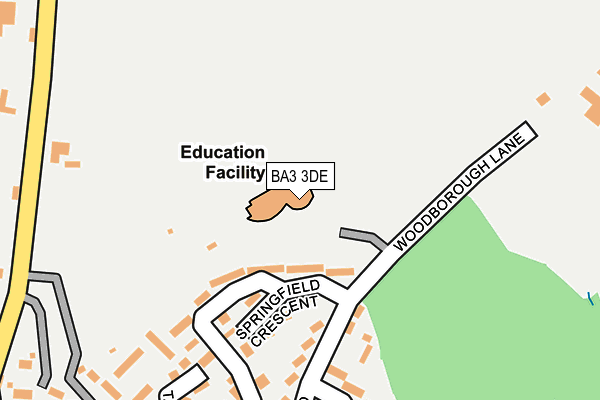
BA3 3DE is located in the Radstock electoral ward, within the unitary authority of Bath and North East Somerset and the English Parliamentary constituency of North East Somerset. The Sub Integrated Care Board (ICB) Location is NHS Bath and North East Somerset, Swindon and Wiltshire ICB - 92 and the police force is Avon and Somerset. This postcode has been in use since February 2008.


GetTheData
Source: OS OpenMap – Local (Ordnance Survey)
Source: OS VectorMap District (Ordnance Survey)
Licence: Open Government Licence (requires attribution)
| Easting | 369244 |
| Northing | 155568 |
| Latitude | 51.298395 |
| Longitude | -2.442518 |
GetTheData
Source: Open Postcode Geo
Licence: Open Government Licence
| Country | England |
| Postcode District | BA3 |
➜ See where BA3 is on a map ➜ Where is Radstock? | |
GetTheData
Source: Land Registry Price Paid Data
Licence: Open Government Licence
Elevation or altitude of BA3 3DE as distance above sea level:
| Metres | Feet | |
|---|---|---|
| Elevation | 130m | 427ft |
Elevation is measured from the approximate centre of the postcode, to the nearest point on an OS contour line from OS Terrain 50, which has contour spacing of ten vertical metres.
➜ How high above sea level am I? Find the elevation of your current position using your device's GPS.
GetTheData
Source: Open Postcode Elevation
Licence: Open Government Licence
| Ward | Radstock |
| Constituency | North East Somerset |
GetTheData
Source: ONS Postcode Database
Licence: Open Government Licence
| Springfield Crescent | Tyning | 93m |
| Morley Terrace (Woodborough Road) | Tyning | 377m |
| Smallcombe Road (Bath New Road) | Clandown | 793m |
| Smallcombe Road (Bath New Road) | Clandown | 806m |
| Smallcombe Road (Bath New Road) | Clandown | 808m |
GetTheData
Source: NaPTAN
Licence: Open Government Licence
GetTheData
Source: ONS Postcode Database
Licence: Open Government Licence


➜ Get more ratings from the Food Standards Agency
GetTheData
Source: Food Standards Agency
Licence: FSA terms & conditions
| Last Collection | |||
|---|---|---|---|
| Location | Mon-Fri | Sat | Distance |
| Radstock Post Office Radco | 17:30 | 12:00 | 758m |
| Frederick Avenue | 17:30 | 10:00 | 1,665m |
| Skinners Hill | 11:00 | 10:00 | 1,983m |
GetTheData
Source: Dracos
Licence: Creative Commons Attribution-ShareAlike
The below table lists the International Territorial Level (ITL) codes (formerly Nomenclature of Territorial Units for Statistics (NUTS) codes) and Local Administrative Units (LAU) codes for BA3 3DE:
| ITL 1 Code | Name |
|---|---|
| TLK | South West (England) |
| ITL 2 Code | Name |
| TLK1 | Gloucestershire, Wiltshire and Bath/Bristol area |
| ITL 3 Code | Name |
| TLK12 | Bath and North East Somerset, North Somerset and South Gloucestershire |
| LAU 1 Code | Name |
| E06000022 | Bath and North East Somerset |
GetTheData
Source: ONS Postcode Directory
Licence: Open Government Licence
The below table lists the Census Output Area (OA), Lower Layer Super Output Area (LSOA), and Middle Layer Super Output Area (MSOA) for BA3 3DE:
| Code | Name | |
|---|---|---|
| OA | E00072972 | |
| LSOA | E01014448 | Bath and North East Somerset 024A |
| MSOA | E02003008 | Bath and North East Somerset 024 |
GetTheData
Source: ONS Postcode Directory
Licence: Open Government Licence
| BA3 3JE | Woodborough Road | 140m |
| BA3 3JB | Springfield Buildings | 177m |
| BA3 3JD | Coronation Villas | 181m |
| BA3 3JL | Walnut Buildings | 233m |
| BA3 3AU | Colliers Rise | 237m |
| BA3 3HG | Bath Old Road | 253m |
| BA3 3HY | Woodborough Road | 305m |
| BA3 3HX | Northfield | 315m |
| BA3 3HF | Bath Old Road | 328m |
| BA3 3HU | Morley Terrace | 349m |
GetTheData
Source: Open Postcode Geo; Land Registry Price Paid Data
Licence: Open Government Licence