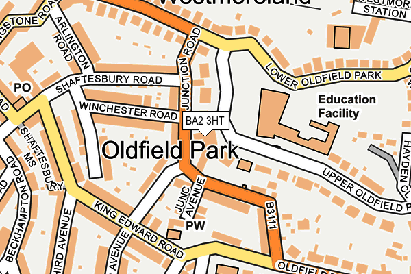
BA2 3HT lies on Upper Oldfield Park in Bath. BA2 3HT is located in the Oldfield Park electoral ward, within the unitary authority of Bath and North East Somerset and the English Parliamentary constituency of Bath. The Sub Integrated Care Board (ICB) Location is NHS Bath and North East Somerset, Swindon and Wiltshire ICB - 92 and the police force is Avon and Somerset. This postcode has been in use since January 1980.


GetTheData
Source: OS OpenMap – Local (Ordnance Survey)
Source: OS VectorMap District (Ordnance Survey)
Licence: Open Government Licence (requires attribution)
| Easting | 374069 |
| Northing | 164212 |
| Latitude | 51.376364 |
| Longitude | -2.373947 |
GetTheData
Source: Open Postcode Geo
Licence: Open Government Licence
| Street | Upper Oldfield Park |
| Town/City | Bath |
| Country | England |
| Postcode District | BA2 |
➜ See where BA2 is on a map ➜ Where is Bath? | |
GetTheData
Source: Land Registry Price Paid Data
Licence: Open Government Licence
Elevation or altitude of BA2 3HT as distance above sea level:
| Metres | Feet | |
|---|---|---|
| Elevation | 40m | 131ft |
Elevation is measured from the approximate centre of the postcode, to the nearest point on an OS contour line from OS Terrain 50, which has contour spacing of ten vertical metres.
➜ How high above sea level am I? Find the elevation of your current position using your device's GPS.
GetTheData
Source: Open Postcode Elevation
Licence: Open Government Licence
| Ward | Oldfield Park |
| Constituency | Bath |
GetTheData
Source: ONS Postcode Database
Licence: Open Government Licence
PART FIRST FLOOR, 45, UPPER OLDFIELD PARK, BATH, BA2 3HT 2008 4 APR £302,906 |
GetTheData
Source: HM Land Registry Price Paid Data
Licence: Contains HM Land Registry data © Crown copyright and database right 2025. This data is licensed under the Open Government Licence v3.0.
| Junction Road (Lower Oldfield Park) | Oldfield Park | 140m |
| Junction Road (Lower Oldfield Park) | Oldfield Park | 145m |
| Cedar Park (Oldfield Road) | Oldfield Park | 169m |
| Second Avenue (King Edward Road) | Oldfield Park | 170m |
| Cedar Park (Oldfield Road) | Oldfield Park | 175m |
| Oldfield Park Station | 0.6km |
| Bath Spa Station | 1.2km |
GetTheData
Source: NaPTAN
Licence: Open Government Licence
GetTheData
Source: ONS Postcode Database
Licence: Open Government Licence


➜ Get more ratings from the Food Standards Agency
GetTheData
Source: Food Standards Agency
Licence: FSA terms & conditions
| Last Collection | |||
|---|---|---|---|
| Location | Mon-Fri | Sat | Distance |
| Lower Oldfield Park | 17:30 | 12:45 | 176m |
| Third Avenue | 17:30 | 11:45 | 216m |
| Brougham Hayes | 17:30 | 11:45 | 377m |
GetTheData
Source: Dracos
Licence: Creative Commons Attribution-ShareAlike
The below table lists the International Territorial Level (ITL) codes (formerly Nomenclature of Territorial Units for Statistics (NUTS) codes) and Local Administrative Units (LAU) codes for BA2 3HT:
| ITL 1 Code | Name |
|---|---|
| TLK | South West (England) |
| ITL 2 Code | Name |
| TLK1 | Gloucestershire, Wiltshire and Bath/Bristol area |
| ITL 3 Code | Name |
| TLK12 | Bath and North East Somerset, North Somerset and South Gloucestershire |
| LAU 1 Code | Name |
| E06000022 | Bath and North East Somerset |
GetTheData
Source: ONS Postcode Directory
Licence: Open Government Licence
The below table lists the Census Output Area (OA), Lower Layer Super Output Area (LSOA), and Middle Layer Super Output Area (MSOA) for BA2 3HT:
| Code | Name | |
|---|---|---|
| OA | E00073132 | |
| LSOA | E01014484 | Bath and North East Somerset 012F |
| MSOA | E02002996 | Bath and North East Somerset 012 |
GetTheData
Source: ONS Postcode Directory
Licence: Open Government Licence
| BA2 3LB | Upper Oldfield Park | 29m |
| BA2 3LE | Livingstone Terrace | 45m |
| BA2 3LD | Junction Road | 76m |
| BA2 3NH | Junction Road | 83m |
| BA2 3NL | Second Avenue | 95m |
| BA2 3NJ | Junction Avenue | 114m |
| BA2 3LF | Winchester Road | 124m |
| BA2 3LQ | Shaftesbury Road | 143m |
| BA2 3NQ | Junction Road | 151m |
| BA2 3NF | Oldfield Road | 161m |
GetTheData
Source: Open Postcode Geo; Land Registry Price Paid Data
Licence: Open Government Licence