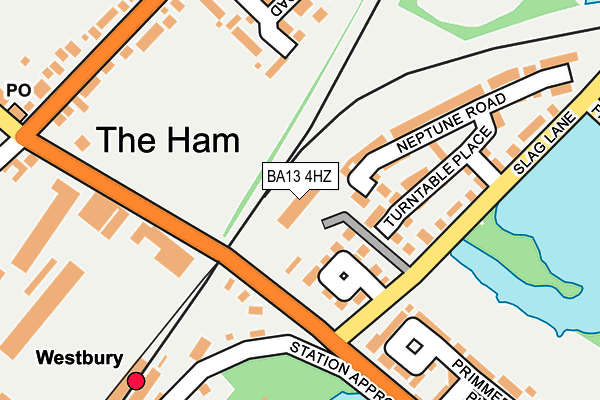
BA13 4HZ is located in the Westbury North electoral ward, within the unitary authority of Wiltshire and the English Parliamentary constituency of South West Wiltshire. The Sub Integrated Care Board (ICB) Location is NHS Bath and North East Somerset, Swindon and Wiltshire ICB - 92 and the police force is Wiltshire. This postcode has been in use since March 1983.


GetTheData
Source: OS OpenMap – Local (Ordnance Survey)
Source: OS VectorMap District (Ordnance Survey)
Licence: Open Government Licence (requires attribution)
| Easting | 386347 |
| Northing | 152139 |
| Latitude | 51.268238 |
| Longitude | -2.197080 |
GetTheData
Source: Open Postcode Geo
Licence: Open Government Licence
| Country | England |
| Postcode District | BA13 |
➜ See where BA13 is on a map ➜ Where is Westbury? | |
GetTheData
Source: Land Registry Price Paid Data
Licence: Open Government Licence
Elevation or altitude of BA13 4HZ as distance above sea level:
| Metres | Feet | |
|---|---|---|
| Elevation | 60m | 197ft |
Elevation is measured from the approximate centre of the postcode, to the nearest point on an OS contour line from OS Terrain 50, which has contour spacing of ten vertical metres.
➜ How high above sea level am I? Find the elevation of your current position using your device's GPS.
GetTheData
Source: Open Postcode Elevation
Licence: Open Government Licence
| Ward | Westbury North |
| Constituency | South West Wiltshire |
GetTheData
Source: ONS Postcode Database
Licence: Open Government Licence
| Railway Station (Station Approach) | Westbury | 217m |
| The Ham Post Office (The Ham) | Westbury | 251m |
| The Ham | Westbury | 257m |
| Railway Inn (Station Road) | Westbury | 277m |
| Railway Inn (Station Road) | Westbury | 320m |
| Westbury (Wilts) Station | 0.2km |
| Dilton Marsh Station | 2.3km |
GetTheData
Source: NaPTAN
Licence: Open Government Licence
GetTheData
Source: ONS Postcode Database
Licence: Open Government Licence

➜ Get more ratings from the Food Standards Agency
GetTheData
Source: Food Standards Agency
Licence: FSA terms & conditions
| Last Collection | |||
|---|---|---|---|
| Location | Mon-Fri | Sat | Distance |
| The Ham Post Office | 17:15 | 12:00 | 287m |
| Rosefield Way | 17:30 | 12:00 | 539m |
| Queens Square Post Office | 17:15 | 12:00 | 797m |
GetTheData
Source: Dracos
Licence: Creative Commons Attribution-ShareAlike
The below table lists the International Territorial Level (ITL) codes (formerly Nomenclature of Territorial Units for Statistics (NUTS) codes) and Local Administrative Units (LAU) codes for BA13 4HZ:
| ITL 1 Code | Name |
|---|---|
| TLK | South West (England) |
| ITL 2 Code | Name |
| TLK1 | Gloucestershire, Wiltshire and Bath/Bristol area |
| ITL 3 Code | Name |
| TLK15 | Wiltshire |
| LAU 1 Code | Name |
| E06000054 | Wiltshire |
GetTheData
Source: ONS Postcode Directory
Licence: Open Government Licence
The below table lists the Census Output Area (OA), Lower Layer Super Output Area (LSOA), and Middle Layer Super Output Area (MSOA) for BA13 4HZ:
| Code | Name | |
|---|---|---|
| OA | E00166414 | |
| LSOA | E01032116 | Wiltshire 040B |
| MSOA | E02006691 | Wiltshire 040 |
GetTheData
Source: ONS Postcode Directory
Licence: Open Government Licence
| BA13 4GA | Cossington Square | 80m |
| BA13 4GB | Turntable Place | 123m |
| BA13 4HR | Westbury Industrial Estate | 184m |
| BA13 4GD | Neptune Road | 202m |
| BA13 4GE | Slag Lane | 220m |
| BA13 4HS | Paxmans Road | 236m |
| BA13 4QZ | Primmers Place | 238m |
| BA13 4HD | The Ham | 274m |
| BA13 4HH | Hawkeridge Park | 334m |
| BA13 4HL | Hawkeridge Park | 343m |
GetTheData
Source: Open Postcode Geo; Land Registry Price Paid Data
Licence: Open Government Licence