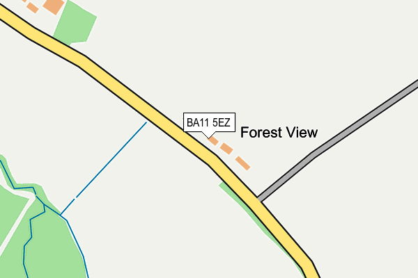
BA11 5EZ is in Gare Hill, Frome. BA11 5EZ is located in the Mendip Central and East electoral ward, within the unitary authority of Somerset and the English Parliamentary constituency of Somerton and Frome. The Sub Integrated Care Board (ICB) Location is NHS Somerset ICB - 11X and the police force is Avon and Somerset. This postcode has been in use since January 1980.


GetTheData
Source: OS OpenMap – Local (Ordnance Survey)
Source: OS VectorMap District (Ordnance Survey)
Licence: Open Government Licence (requires attribution)
| Easting | 377183 |
| Northing | 140956 |
| Latitude | 51.167388 |
| Longitude | -2.327716 |
GetTheData
Source: Open Postcode Geo
Licence: Open Government Licence
| Locality | Gare Hill |
| Town/City | Frome |
| Country | England |
| Postcode District | BA11 |
➜ See where BA11 is on a map | |
GetTheData
Source: Land Registry Price Paid Data
Licence: Open Government Licence
Elevation or altitude of BA11 5EZ as distance above sea level:
| Metres | Feet | |
|---|---|---|
| Elevation | 110m | 361ft |
Elevation is measured from the approximate centre of the postcode, to the nearest point on an OS contour line from OS Terrain 50, which has contour spacing of ten vertical metres.
➜ How high above sea level am I? Find the elevation of your current position using your device's GPS.
GetTheData
Source: Open Postcode Elevation
Licence: Open Government Licence
| Ward | Mendip Central And East |
| Constituency | Somerton And Frome |
GetTheData
Source: ONS Postcode Database
Licence: Open Government Licence
| Percentage of properties with Next Generation Access | 100.0% |
| Percentage of properties with Superfast Broadband | 0.0% |
| Percentage of properties with Ultrafast Broadband | 0.0% |
| Percentage of properties with Full Fibre Broadband | 0.0% |
Superfast Broadband is between 30Mbps and 300Mbps
Ultrafast Broadband is > 300Mbps
| Percentage of properties unable to receive 2Mbps | 0.0% |
| Percentage of properties unable to receive 5Mbps | 100.0% |
| Percentage of properties unable to receive 10Mbps | 100.0% |
| Percentage of properties unable to receive 30Mbps | 100.0% |
GetTheData
Source: Ofcom
Licence: Ofcom Terms of Use (requires attribution)
Estimated total energy consumption in BA11 5EZ by fuel type, 2015.
| Consumption (kWh) | 28,057 |
|---|---|
| Meter count | 6 |
| Mean (kWh/meter) | 4,676 |
| Median (kWh/meter) | 4,847 |
GetTheData
Source: Postcode level gas estimates: 2015 (experimental)
Source: Postcode level electricity estimates: 2015 (experimental)
Licence: Open Government Licence
GetTheData
Source: ONS Postcode Database
Licence: Open Government Licence


➜ Get more ratings from the Food Standards Agency
GetTheData
Source: Food Standards Agency
Licence: FSA terms & conditions
| Last Collection | |||
|---|---|---|---|
| Location | Mon-Fri | Sat | Distance |
| Witham Friary | 15:45 | 10:30 | 2,755m |
| Stalls Farm | 16:15 | 09:30 | 3,380m |
| Maiden Bradley Post Office | 16:10 | 11:15 | 3,587m |
GetTheData
Source: Dracos
Licence: Creative Commons Attribution-ShareAlike
The below table lists the International Territorial Level (ITL) codes (formerly Nomenclature of Territorial Units for Statistics (NUTS) codes) and Local Administrative Units (LAU) codes for BA11 5EZ:
| ITL 1 Code | Name |
|---|---|
| TLK | South West (England) |
| ITL 2 Code | Name |
| TLK2 | Dorset and Somerset |
| ITL 3 Code | Name |
| TLK23 | Somerset CC |
| LAU 1 Code | Name |
| E07000187 | Mendip |
GetTheData
Source: ONS Postcode Directory
Licence: Open Government Licence
The below table lists the Census Output Area (OA), Lower Layer Super Output Area (LSOA), and Middle Layer Super Output Area (MSOA) for BA11 5EZ:
| Code | Name | |
|---|---|---|
| OA | E00147961 | |
| LSOA | E01029053 | Mendip 001D |
| MSOA | E02006047 | Mendip 001 |
GetTheData
Source: ONS Postcode Directory
Licence: Open Government Licence
| BA11 5EX | Gare Hill Road | 921m |
| BA11 5EY | 1089m | |
| BA11 5ER | 1868m | |
| BA11 5HA | 1911m | |
| BA11 5HJ | 2544m | |
| BA11 5HE | 2562m | |
| BA11 5HG | Friary Close | 2637m |
| BA11 5HQ | Kerry Croft | 2638m |
| BA11 5HW | New Friary Cottages | 2674m |
| BA11 5HN | Manor Gardens | 2680m |
GetTheData
Source: Open Postcode Geo; Land Registry Price Paid Data
Licence: Open Government Licence