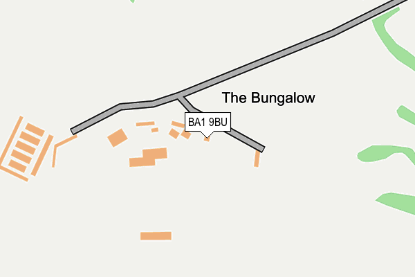
BA1 9BU is located in the Bathavon North electoral ward, within the unitary authority of Bath and North East Somerset and the English Parliamentary constituency of North East Somerset. The Sub Integrated Care Board (ICB) Location is NHS Bath and North East Somerset, Swindon and Wiltshire ICB - 92 and the police force is Avon and Somerset. This postcode has been in use since January 1980.


GetTheData
Source: OS OpenMap – Local (Ordnance Survey)
Source: OS VectorMap District (Ordnance Survey)
Licence: Open Government Licence (requires attribution)
| Easting | 371860 |
| Northing | 168918 |
| Latitude | 51.418569 |
| Longitude | -2.406057 |
GetTheData
Source: Open Postcode Geo
Licence: Open Government Licence
| Country | England |
| Postcode District | BA1 |
➜ See where BA1 is on a map | |
GetTheData
Source: Land Registry Price Paid Data
Licence: Open Government Licence
Elevation or altitude of BA1 9BU as distance above sea level:
| Metres | Feet | |
|---|---|---|
| Elevation | 230m | 755ft |
Elevation is measured from the approximate centre of the postcode, to the nearest point on an OS contour line from OS Terrain 50, which has contour spacing of ten vertical metres.
➜ How high above sea level am I? Find the elevation of your current position using your device's GPS.
GetTheData
Source: Open Postcode Elevation
Licence: Open Government Licence
| Ward | Bathavon North |
| Constituency | North East Somerset |
GetTheData
Source: ONS Postcode Database
Licence: Open Government Licence
| Bath Racecourse | Lansdown | 64m |
| Langridge Turn (Lansdown Hill) | Lansdown | 586m |
| Langridge Turn (Lansdown Hill) | Lansdown | 603m |
| Blathwayt Arms (Lansdown Hill) | Lansdown | 865m |
| Blathwayt Arms (Lansdown Hill) | Lansdown | 967m |
| Oldfield Park Station | 4.7km |
| Bath Spa Station | 5.7km |
GetTheData
Source: NaPTAN
Licence: Open Government Licence
GetTheData
Source: ONS Postcode Database
Licence: Open Government Licence


➜ Get more ratings from the Food Standards Agency
GetTheData
Source: Food Standards Agency
Licence: FSA terms & conditions
| Last Collection | |||
|---|---|---|---|
| Location | Mon-Fri | Sat | Distance |
| Chapel Farm | 10:00 | 09:00 | 786m |
| Langridge Lane | 10:30 | 09:30 | 1,152m |
| Battlefields | 10:00 | 09:00 | 1,600m |
GetTheData
Source: Dracos
Licence: Creative Commons Attribution-ShareAlike
The below table lists the International Territorial Level (ITL) codes (formerly Nomenclature of Territorial Units for Statistics (NUTS) codes) and Local Administrative Units (LAU) codes for BA1 9BU:
| ITL 1 Code | Name |
|---|---|
| TLK | South West (England) |
| ITL 2 Code | Name |
| TLK1 | Gloucestershire, Wiltshire and Bath/Bristol area |
| ITL 3 Code | Name |
| TLK12 | Bath and North East Somerset, North Somerset and South Gloucestershire |
| LAU 1 Code | Name |
| E06000022 | Bath and North East Somerset |
GetTheData
Source: ONS Postcode Directory
Licence: Open Government Licence
The below table lists the Census Output Area (OA), Lower Layer Super Output Area (LSOA), and Middle Layer Super Output Area (MSOA) for BA1 9BU:
| Code | Name | |
|---|---|---|
| OA | E00072609 | |
| LSOA | E01014375 | Bath and North East Somerset 010C |
| MSOA | E02002994 | Bath and North East Somerset 010 |
GetTheData
Source: ONS Postcode Directory
Licence: Open Government Licence
| BA1 9BY | 729m | |
| BA1 9BT | 752m | |
| BA1 9BZ | 764m | |
| BA1 9BR | 879m | |
| BA1 9BP | Down Cottages | 925m |
| BA1 4LL | Broadmoor Lane | 934m |
| BA1 9BX | Langridge Lane | 1148m |
| BA1 9BW | 1331m | |
| BA1 9DB | 1350m | |
| BA1 4LJ | Broadmoor Lane | 1431m |
GetTheData
Source: Open Postcode Geo; Land Registry Price Paid Data
Licence: Open Government Licence