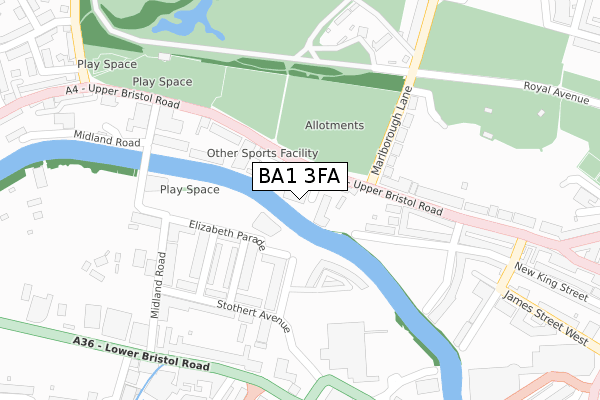
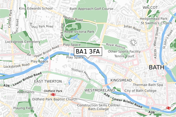
BA1 3FA is located in the Kingsmead electoral ward, within the unitary authority of Bath and North East Somerset and the English Parliamentary constituency of Bath. The Sub Integrated Care Board (ICB) Location is NHS Bath and North East Somerset, Swindon and Wiltshire ICB - 92 and the police force is Avon and Somerset. This postcode has been in use since October 2019.


GetTheData
Source: OS Open Zoomstack (Ordnance Survey)
Licence: Open Government Licence (requires attribution)
Attribution: Contains OS data © Crown copyright and database right 2024
Source: Open Postcode Geo
Licence: Open Government Licence (requires attribution)
Attribution: Contains OS data © Crown copyright and database right 2024; Contains Royal Mail data © Royal Mail copyright and database right 2024; Source: Office for National Statistics licensed under the Open Government Licence v.3.0
| Easting | 374118 |
| Northing | 165048 |
| Latitude | 51.383880 |
| Longitude | -2.373303 |
GetTheData
Source: Open Postcode Geo
Licence: Open Government Licence
| Country | England |
| Postcode District | BA1 |
| ➜ BA1 open data dashboard ➜ See where BA1 is on a map ➜ Where is Bath? | |
GetTheData
Source: Land Registry Price Paid Data
Licence: Open Government Licence
| Ward | Kingsmead |
| Constituency | Bath |
GetTheData
Source: ONS Postcode Database
Licence: Open Government Licence
| January 2024 | Anti-social behaviour | On or near Petrol Station | 295m |
| January 2024 | Anti-social behaviour | On or near Petrol Station | 295m |
| January 2024 | Anti-social behaviour | On or near Petrol Station | 295m |
| ➜ Get more crime data in our Crime section | |||
GetTheData
Source: data.police.uk
Licence: Open Government Licence
| Comfortable Place (Upper Bristol Road) | Lower Weston | 63m |
| Comfortable Place (Upper Bristol Road) | Lower Weston | 64m |
| Nile Street (Upper Bristol Road) | Kingsmead | 161m |
| Western Riverside | Oldfield Park | 198m |
| Brougham Hayes (Lower Bristol Road) | Oldfield Park | 316m |
| Oldfield Park Station | 0.7km |
| Bath Spa Station | 1.3km |
GetTheData
Source: NaPTAN
Licence: Open Government Licence
GetTheData
Source: ONS Postcode Database
Licence: Open Government Licence


➜ Get more ratings from the Food Standards Agency
GetTheData
Source: Food Standards Agency
Licence: FSA terms & conditions
| Last Collection | |||
|---|---|---|---|
| Location | Mon-Fri | Sat | Distance |
| Farmborough P.o. | 17:00 | 11:00 | 323m |
| Crescent Gardens | 17:30 | 13:00 | 325m |
| Marlborough Buildings | 17:30 | 11:30 | 436m |
GetTheData
Source: Dracos
Licence: Creative Commons Attribution-ShareAlike
| Facility | Distance |
|---|---|
| Phase One Comfortable Place, Bath Health and Fitness Gym, Studio | 100m |
| Puregym (Bath Victoria Park) Upper Bristol Road, Bath Health and Fitness Gym | 257m |
| The Royal Crescent Hotel & Spa Royal Crescent, Bath Health and Fitness Gym, Swimming Pool | 537m |
GetTheData
Source: Active Places
Licence: Open Government Licence
| School | Phase of Education | Distance |
|---|---|---|
| Oldfield Park Infant School Dorset Close, Bath, BA2 3RF | Primary | 454m |
| St Andrew's Church School Northampton Street, Julian Road, Bath, BA1 2SN | Primary | 665m |
| Bath Academy 27 Queen Square, Bath, BA1 2HX | Not applicable | 690m |
GetTheData
Source: Edubase
Licence: Open Government Licence
| Risk of BA1 3FA flooding from rivers and sea | Medium |
| ➜ BA1 3FA flood map | |
GetTheData
Source: Open Flood Risk by Postcode
Licence: Open Government Licence
The below table lists the International Territorial Level (ITL) codes (formerly Nomenclature of Territorial Units for Statistics (NUTS) codes) and Local Administrative Units (LAU) codes for BA1 3FA:
| ITL 1 Code | Name |
|---|---|
| TLK | South West (England) |
| ITL 2 Code | Name |
| TLK1 | Gloucestershire, Wiltshire and Bath/Bristol area |
| ITL 3 Code | Name |
| TLK12 | Bath and North East Somerset, North Somerset and South Gloucestershire |
| LAU 1 Code | Name |
| E06000022 | Bath and North East Somerset |
GetTheData
Source: ONS Postcode Directory
Licence: Open Government Licence
The below table lists the Census Output Area (OA), Lower Layer Super Output Area (LSOA), and Middle Layer Super Output Area (MSOA) for BA1 3FA:
| Code | Name | |
|---|---|---|
| OA | E00072768 | |
| LSOA | E01033080 | Bath and North East Somerset 009E |
| MSOA | E02002993 | Bath and North East Somerset 009 |
GetTheData
Source: ONS Postcode Directory
Licence: Open Government Licence
| BA1 3AY | Victoria Bridge Road | 42m |
| BA1 3AH | Onega Terrace | 52m |
| BA1 3AF | Albion Terrace | 56m |
| BA1 3AJ | Comfortable Place | 82m |
| BA1 3AD | Albion Place | 87m |
| BA1 3AE | Upper Bristol Road | 121m |
| BA2 3FQ | Victoria Bridge Road | 130m |
| BA2 3WH | Longmead Terrace | 138m |
| BA2 3WL | Longmead Terrace | 138m |
| BA1 2BD | Nelson Villas | 142m |
GetTheData
Source: Open Postcode Geo; Land Registry Price Paid Data
Licence: Open Government Licence