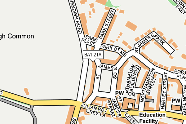
BA1 2TA lies on Park Street in Bath. BA1 2TA is located in the Lansdown electoral ward, within the unitary authority of Bath and North East Somerset and the English Parliamentary constituency of Bath. The Sub Integrated Care Board (ICB) Location is NHS Bath and North East Somerset, Swindon and Wiltshire ICB - 92 and the police force is Avon and Somerset. This postcode has been in use since January 1980.


GetTheData
Source: OS OpenMap – Local (Ordnance Survey)
Source: OS VectorMap District (Ordnance Survey)
Licence: Open Government Licence (requires attribution)
| Easting | 374435 |
| Northing | 165680 |
| Latitude | 51.389580 |
| Longitude | -2.368795 |
GetTheData
Source: Open Postcode Geo
Licence: Open Government Licence
| Street | Park Street |
| Town/City | Bath |
| Country | England |
| Postcode District | BA1 |
➜ See where BA1 is on a map ➜ Where is Bath? | |
GetTheData
Source: Land Registry Price Paid Data
Licence: Open Government Licence
Elevation or altitude of BA1 2TA as distance above sea level:
| Metres | Feet | |
|---|---|---|
| Elevation | 60m | 197ft |
Elevation is measured from the approximate centre of the postcode, to the nearest point on an OS contour line from OS Terrain 50, which has contour spacing of ten vertical metres.
➜ How high above sea level am I? Find the elevation of your current position using your device's GPS.
GetTheData
Source: Open Postcode Elevation
Licence: Open Government Licence
| Ward | Lansdown |
| Constituency | Bath |
GetTheData
Source: ONS Postcode Database
Licence: Open Government Licence
| Park Place (Cavendish Road) | Lansdown | 64m |
| Park Place (Cavendish Road) | Lansdown | 82m |
| Marlborough Buildings (Cavendish Road) | Lansdown | 90m |
| Marlborough Buildings (Crescent Lane) | Lansdown | 141m |
| Marlborough Buildings (Weston Road) | Lansdown | 161m |
| Oldfield Park Station | 1.4km |
| Bath Spa Station | 1.6km |
GetTheData
Source: NaPTAN
Licence: Open Government Licence
| Percentage of properties with Next Generation Access | 100.0% |
| Percentage of properties with Superfast Broadband | 100.0% |
| Percentage of properties with Ultrafast Broadband | 0.0% |
| Percentage of properties with Full Fibre Broadband | 0.0% |
Superfast Broadband is between 30Mbps and 300Mbps
Ultrafast Broadband is > 300Mbps
| Percentage of properties unable to receive 2Mbps | 0.0% |
| Percentage of properties unable to receive 5Mbps | 0.0% |
| Percentage of properties unable to receive 10Mbps | 0.0% |
| Percentage of properties unable to receive 30Mbps | 0.0% |
GetTheData
Source: Ofcom
Licence: Ofcom Terms of Use (requires attribution)
GetTheData
Source: ONS Postcode Database
Licence: Open Government Licence

➜ Get more ratings from the Food Standards Agency
GetTheData
Source: Food Standards Agency
Licence: FSA terms & conditions
| Last Collection | |||
|---|---|---|---|
| Location | Mon-Fri | Sat | Distance |
| Cavendish Place | 17:30 | 11:30 | 85m |
| St Andrews P.o. | 17:15 | 12:45 | 152m |
| Marlborough Buildings | 17:30 | 11:30 | 277m |
GetTheData
Source: Dracos
Licence: Creative Commons Attribution-ShareAlike
The below table lists the International Territorial Level (ITL) codes (formerly Nomenclature of Territorial Units for Statistics (NUTS) codes) and Local Administrative Units (LAU) codes for BA1 2TA:
| ITL 1 Code | Name |
|---|---|
| TLK | South West (England) |
| ITL 2 Code | Name |
| TLK1 | Gloucestershire, Wiltshire and Bath/Bristol area |
| ITL 3 Code | Name |
| TLK12 | Bath and North East Somerset, North Somerset and South Gloucestershire |
| LAU 1 Code | Name |
| E06000022 | Bath and North East Somerset |
GetTheData
Source: ONS Postcode Directory
Licence: Open Government Licence
The below table lists the Census Output Area (OA), Lower Layer Super Output Area (LSOA), and Middle Layer Super Output Area (MSOA) for BA1 2TA:
| Code | Name | |
|---|---|---|
| OA | E00072763 | |
| LSOA | E01033080 | Bath and North East Somerset 009E |
| MSOA | E02002993 | Bath and North East Somerset 009 |
GetTheData
Source: ONS Postcode Directory
Licence: Open Government Licence
| BA1 2TB | Park Street | 28m |
| BA1 2TD | Park Street | 38m |
| BA1 2TR | St James's Square | 54m |
| BA1 2TS | St James's Square | 54m |
| BA1 2SZ | Park Street Mews | 72m |
| BA1 2TY | Park Place | 75m |
| BA1 2TZ | Great Bedford Street | 83m |
| BA1 2TT | St James's Square | 105m |
| BA1 2UA | Great Bedford Street | 105m |
| BA1 2UB | Cavendish Place | 116m |
GetTheData
Source: Open Postcode Geo; Land Registry Price Paid Data
Licence: Open Government Licence