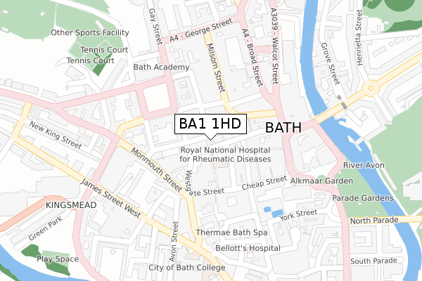
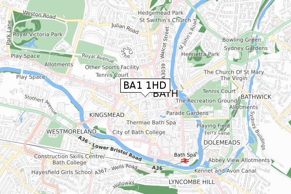
BA1 1HD lies on Trim Bridge in Bath. BA1 1HD is located in the Kingsmead electoral ward, within the unitary authority of Bath and North East Somerset and the English Parliamentary constituency of Bath. The Sub Integrated Care Board (ICB) Location is NHS Bath and North East Somerset, Swindon and Wiltshire ICB - 92 and the police force is Avon and Somerset. This postcode has been in use since January 1980.


GetTheData
Source: OS Open Zoomstack (Ordnance Survey)
Licence: Open Government Licence (requires attribution)
Attribution: Contains OS data © Crown copyright and database right 2025
Source: Open Postcode Geo
Licence: Open Government Licence (requires attribution)
Attribution: Contains OS data © Crown copyright and database right 2025; Contains Royal Mail data © Royal Mail copyright and database right 2025; Source: Office for National Statistics licensed under the Open Government Licence v.3.0
| Easting | 374921 |
| Northing | 164892 |
| Latitude | 51.382517 |
| Longitude | -2.361754 |
GetTheData
Source: Open Postcode Geo
Licence: Open Government Licence
| Street | Trim Bridge |
| Town/City | Bath |
| Country | England |
| Postcode District | BA1 |
➜ See where BA1 is on a map ➜ Where is Bath? | |
GetTheData
Source: Land Registry Price Paid Data
Licence: Open Government Licence
Elevation or altitude of BA1 1HD as distance above sea level:
| Metres | Feet | |
|---|---|---|
| Elevation | 30m | 98ft |
Elevation is measured from the approximate centre of the postcode, to the nearest point on an OS contour line from OS Terrain 50, which has contour spacing of ten vertical metres.
➜ How high above sea level am I? Find the elevation of your current position using your device's GPS.
GetTheData
Source: Open Postcode Elevation
Licence: Open Government Licence
| Ward | Kingsmead |
| Constituency | Bath |
GetTheData
Source: ONS Postcode Database
Licence: Open Government Licence
| Queen Square | Bath City Centre | 123m |
| Westgate Buildings | Bath City Centre | 160m |
| Broad Street | Bath City Centre | 165m |
| Milsom Street | Bath City Centre | 167m |
| Westgate Buildings | Bath City Centre | 172m |
| Bath Spa Station | 0.6km |
| Oldfield Park Station | 1.4km |
| Freshford Station | 6.2km |
GetTheData
Source: NaPTAN
Licence: Open Government Licence
| Percentage of properties with Next Generation Access | 100.0% |
| Percentage of properties with Superfast Broadband | 100.0% |
| Percentage of properties with Ultrafast Broadband | 100.0% |
| Percentage of properties with Full Fibre Broadband | 100.0% |
Superfast Broadband is between 30Mbps and 300Mbps
Ultrafast Broadband is > 300Mbps
| Percentage of properties unable to receive 2Mbps | 0.0% |
| Percentage of properties unable to receive 5Mbps | 0.0% |
| Percentage of properties unable to receive 10Mbps | 0.0% |
| Percentage of properties unable to receive 30Mbps | 0.0% |
GetTheData
Source: Ofcom
Licence: Ofcom Terms of Use (requires attribution)
GetTheData
Source: ONS Postcode Database
Licence: Open Government Licence

➜ Get more ratings from the Food Standards Agency
GetTheData
Source: Food Standards Agency
Licence: FSA terms & conditions
| Last Collection | |||
|---|---|---|---|
| Location | Mon-Fri | Sat | Distance |
| Stall Street | 17:30 | 12:30 | 145m |
| Head Office | 17:30 | 13:00 | 157m |
| Queen Square | 17:30 | 12:45 | 158m |
GetTheData
Source: Dracos
Licence: Creative Commons Attribution-ShareAlike
The below table lists the International Territorial Level (ITL) codes (formerly Nomenclature of Territorial Units for Statistics (NUTS) codes) and Local Administrative Units (LAU) codes for BA1 1HD:
| ITL 1 Code | Name |
|---|---|
| TLK | South West (England) |
| ITL 2 Code | Name |
| TLK1 | Gloucestershire, Wiltshire and Bath/Bristol area |
| ITL 3 Code | Name |
| TLK12 | Bath and North East Somerset, North Somerset and South Gloucestershire |
| LAU 1 Code | Name |
| E06000022 | Bath and North East Somerset |
GetTheData
Source: ONS Postcode Directory
Licence: Open Government Licence
The below table lists the Census Output Area (OA), Lower Layer Super Output Area (LSOA), and Middle Layer Super Output Area (MSOA) for BA1 1HD:
| Code | Name | |
|---|---|---|
| OA | E00072573 | |
| LSOA | E01014370 | Bath and North East Somerset 007A |
| MSOA | E02002991 | Bath and North East Somerset 007 |
GetTheData
Source: ONS Postcode Directory
Licence: Open Government Licence
| BA1 1HB | Trim Street | 20m |
| BA1 1HA | Trim Street | 32m |
| BA1 1HE | Queen Street | 47m |
| BA1 1EY | Sawclose | 56m |
| BA1 1HF | Harington Place | 58m |
| BA1 2JU | Quiet Street | 70m |
| BA1 1RR | Union Street | 82m |
| BA1 1EA | Westgate Street | 85m |
| BA1 1BL | New Bond Street Buildings | 94m |
| BA1 2JS | Quiet Street | 96m |
GetTheData
Source: Open Postcode Geo; Land Registry Price Paid Data
Licence: Open Government Licence