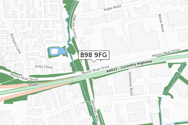
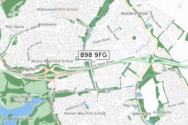
B98 9FG is located in the Church Hill electoral ward, within the local authority district of Redditch and the English Parliamentary constituency of Redditch. The Sub Integrated Care Board (ICB) Location is NHS Herefordshire and Worcestershire ICB - 18C and the police force is West Mercia. This postcode has been in use since January 2018.


GetTheData
Source: OS Open Zoomstack (Ordnance Survey)
Licence: Open Government Licence (requires attribution)
Attribution: Contains OS data © Crown copyright and database right 2024
Source: Open Postcode Geo
Licence: Open Government Licence (requires attribution)
Attribution: Contains OS data © Crown copyright and database right 2024; Contains Royal Mail data © Royal Mail copyright and database right 2024; Source: Office for National Statistics licensed under the Open Government Licence v.3.0
| Easting | 407115 |
| Northing | 268116 |
| Latitude | 52.311126 |
| Longitude | -1.897051 |
GetTheData
Source: Open Postcode Geo
Licence: Open Government Licence
| Country | England |
| Postcode District | B98 |
| ➜ B98 open data dashboard ➜ See where B98 is on a map ➜ Where is Redditch? | |
GetTheData
Source: Land Registry Price Paid Data
Licence: Open Government Licence
| Ward | Church Hill |
| Constituency | Redditch |
GetTheData
Source: ONS Postcode Database
Licence: Open Government Licence
| June 2022 | Criminal damage and arson | On or near Arley Close | 269m |
| June 2022 | Other crime | On or near Arley Close | 269m |
| June 2022 | Other crime | On or near Arley Close | 269m |
| ➜ Get more crime data in our Crime section | |||
GetTheData
Source: data.police.uk
Licence: Open Government Licence
| South & East Moons Moat (Winyates Way) | Moon's Moat | 158m |
| South & East Moons Moat (Winyates Way) | Moon's Moat | 177m |
| North Moons Moat (Winyates Way) | Moon's Moat | 194m |
| North Moons Moat (Winyates Way) | Moon's Moat | 199m |
| Eagle Road (Church Hill Way) | Church Hill | 404m |
| Redditch Station | 3.3km |
| Wood End Station | 5.1km |
| Alvechurch Station | 6.2km |
GetTheData
Source: NaPTAN
Licence: Open Government Licence
GetTheData
Source: ONS Postcode Database
Licence: Open Government Licence


➜ Get more ratings from the Food Standards Agency
GetTheData
Source: Food Standards Agency
Licence: FSA terms & conditions
| Last Collection | |||
|---|---|---|---|
| Location | Mon-Fri | Sat | Distance |
| Ibstock Close / Whitehouse Lan | 17:30 | 11:30 | 739m |
| Churchill Post Office | 17:30 | 12:00 | 846m |
| Impney Drive / Home Meadow Lan | 17:30 | 10:30 | 862m |
GetTheData
Source: Dracos
Licence: Creative Commons Attribution-ShareAlike
| Facility | Distance |
|---|---|
| Fit4less (Redditch) (Closed) Battens Drive, Redditch Health and Fitness Gym, Studio, Squash Courts | 640m |
| Ymca (Redditch) (Closed) Loxley Close, Redditch Sports Hall | 681m |
| Willow Trees Community Centre Loxley Close, Redditch Sports Hall | 754m |
GetTheData
Source: Active Places
Licence: Open Government Licence
| School | Phase of Education | Distance |
|---|---|---|
| Moons Moat First School Cleeve Close, Church Hill, Redditch, B98 9HR | Primary | 561m |
| Arrow Valley First School Colts Lane, Redditch, B98 0LH | Primary | 683m |
| Church Hill Middle School Wood Piece Lane, Church Hill, Redditch, B98 9LR | Middle deemed secondary | 812m |
GetTheData
Source: Edubase
Licence: Open Government Licence
| Risk of B98 9FG flooding from rivers and sea | Medium |
| ➜ B98 9FG flood map | |
GetTheData
Source: Open Flood Risk by Postcode
Licence: Open Government Licence
The below table lists the International Territorial Level (ITL) codes (formerly Nomenclature of Territorial Units for Statistics (NUTS) codes) and Local Administrative Units (LAU) codes for B98 9FG:
| ITL 1 Code | Name |
|---|---|
| TLG | West Midlands (England) |
| ITL 2 Code | Name |
| TLG1 | Herefordshire, Worcestershire and Warwickshire |
| ITL 3 Code | Name |
| TLG12 | Worcestershire CC |
| LAU 1 Code | Name |
| E07000236 | Redditch |
GetTheData
Source: ONS Postcode Directory
Licence: Open Government Licence
The below table lists the Census Output Area (OA), Lower Layer Super Output Area (LSOA), and Middle Layer Super Output Area (MSOA) for B98 9FG:
| Code | Name | |
|---|---|---|
| OA | E00164465 | |
| LSOA | E01032241 | Redditch 002B |
| MSOA | E02006722 | Redditch 002 |
GetTheData
Source: ONS Postcode Directory
Licence: Open Government Licence
| B98 9JF | Arley Close | 245m |
| B98 9JB | Exhall Close | 267m |
| B98 0RE | Oxleasow Road | 307m |
| B98 9JE | Barnwood Close | 331m |
| B98 9JA | Exhall Close | 361m |
| B98 0RD | Padgets Lane | 372m |
| B98 9JD | Exhall Close | 394m |
| B98 9HP | Acton Close | 426m |
| B98 0LL | Jakemans Close | 437m |
| B98 0LN | Kitebrook Close | 443m |
GetTheData
Source: Open Postcode Geo; Land Registry Price Paid Data
Licence: Open Government Licence