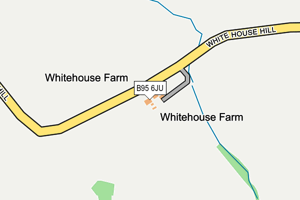
B95 6JU is located in the Kinwarton electoral ward, within the local authority district of Stratford-on-Avon and the English Parliamentary constituency of Stratford-on-Avon. The Sub Integrated Care Board (ICB) Location is NHS Coventry and Warwickshire ICB - B2M3M and the police force is Warwickshire. This postcode has been in use since January 1980.


GetTheData
Source: OS OpenMap – Local (Ordnance Survey)
Source: OS VectorMap District (Ordnance Survey)
Licence: Open Government Licence (requires attribution)
| Easting | 415005 |
| Northing | 260705 |
| Latitude | 52.244327 |
| Longitude | -1.781657 |
GetTheData
Source: Open Postcode Geo
Licence: Open Government Licence
| Country | England |
| Postcode District | B95 |
➜ See where B95 is on a map | |
GetTheData
Source: Land Registry Price Paid Data
Licence: Open Government Licence
Elevation or altitude of B95 6JU as distance above sea level:
| Metres | Feet | |
|---|---|---|
| Elevation | 70m | 230ft |
Elevation is measured from the approximate centre of the postcode, to the nearest point on an OS contour line from OS Terrain 50, which has contour spacing of ten vertical metres.
➜ How high above sea level am I? Find the elevation of your current position using your device's GPS.
GetTheData
Source: Open Postcode Elevation
Licence: Open Government Licence
| Ward | Kinwarton |
| Constituency | Stratford-on-avon |
GetTheData
Source: ONS Postcode Database
Licence: Open Government Licence
| Alcester Road | Little Alne | 1,132m |
| Guild Road (Brook Road) | Aston Cantlow | 1,337m |
| Kings Head (Brook Road) | Aston Cantlow | 1,374m |
| Bearley Station | 2.1km |
| Wootton Wawen Station | 2.5km |
| Wilmcote Station | 2.9km |
GetTheData
Source: NaPTAN
Licence: Open Government Licence
GetTheData
Source: ONS Postcode Database
Licence: Open Government Licence


➜ Get more ratings from the Food Standards Agency
GetTheData
Source: Food Standards Agency
Licence: FSA terms & conditions
| Last Collection | |||
|---|---|---|---|
| Location | Mon-Fri | Sat | Distance |
| Salters Lane Newnham | 12:00 | 07:00 | 1,059m |
| Little Alne | 09:00 | 08:40 | 1,171m |
| Navigation Road | 09:00 | 08:30 | 2,451m |
GetTheData
Source: Dracos
Licence: Creative Commons Attribution-ShareAlike
The below table lists the International Territorial Level (ITL) codes (formerly Nomenclature of Territorial Units for Statistics (NUTS) codes) and Local Administrative Units (LAU) codes for B95 6JU:
| ITL 1 Code | Name |
|---|---|
| TLG | West Midlands (England) |
| ITL 2 Code | Name |
| TLG1 | Herefordshire, Worcestershire and Warwickshire |
| ITL 3 Code | Name |
| TLG13 | Warwickshire CC |
| LAU 1 Code | Name |
| E07000221 | Stratford-on-Avon |
GetTheData
Source: ONS Postcode Directory
Licence: Open Government Licence
The below table lists the Census Output Area (OA), Lower Layer Super Output Area (LSOA), and Middle Layer Super Output Area (MSOA) for B95 6JU:
| Code | Name | |
|---|---|---|
| OA | E00158974 | |
| LSOA | E01031187 | Stratford-on-Avon 007A |
| MSOA | E02006510 | Stratford-on-Avon 007 |
GetTheData
Source: ONS Postcode Directory
Licence: Open Government Licence
| B95 6HR | Bearley Road | 793m |
| B95 6DU | 814m | |
| B95 6DT | 1086m | |
| B95 6HL | Grey Mill Lane | 1101m |
| B95 6HS | Bearley Road | 1123m |
| B95 6HX | Sunnyside | 1135m |
| B95 6HW | 1176m | |
| B95 6HU | Chapel Lane | 1191m |
| B95 6HT | Pear Tree Gardens | 1191m |
| B95 6HE | Pennyford Lane | 1195m |
GetTheData
Source: Open Postcode Geo; Land Registry Price Paid Data
Licence: Open Government Licence