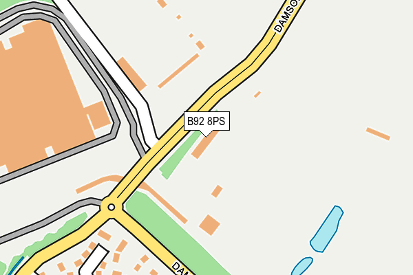
B92 8PS is located in the Bickenhill electoral ward, within the metropolitan district of Solihull and the English Parliamentary constituency of Meriden. The Sub Integrated Care Board (ICB) Location is NHS Birmingham and Solihull ICB - 15E and the police force is West Midlands. This postcode has been in use since June 2016.


GetTheData
Source: OS OpenMap – Local (Ordnance Survey)
Source: OS VectorMap District (Ordnance Survey)
Licence: Open Government Licence (requires attribution)
| Easting | 416682 |
| Northing | 282208 |
| Latitude | 52.437593 |
| Longitude | -1.756035 |
GetTheData
Source: Open Postcode Geo
Licence: Open Government Licence
| Country | England |
| Postcode District | B92 |
➜ See where B92 is on a map | |
GetTheData
Source: Land Registry Price Paid Data
Licence: Open Government Licence
Elevation or altitude of B92 8PS as distance above sea level:
| Metres | Feet | |
|---|---|---|
| Elevation | 120m | 394ft |
Elevation is measured from the approximate centre of the postcode, to the nearest point on an OS contour line from OS Terrain 50, which has contour spacing of ten vertical metres.
➜ How high above sea level am I? Find the elevation of your current position using your device's GPS.
GetTheData
Source: Open Postcode Elevation
Licence: Open Government Licence
| Ward | Bickenhill |
| Constituency | Meriden |
GetTheData
Source: ONS Postcode Database
Licence: Open Government Licence
| Landrover Works (Damson Lane) | Elmdon Park | 145m |
| Huxbey Drive (Damson Parkway) | Elmdon Park | 214m |
| Land Rover Works (Damson Lane) | Elmdon Park | 225m |
| Land Rover Works (Damson Lane) | Elmdon Park | 317m |
| Joiners Croft (Whar Hall Rd) | Elmdon Park | 382m |
| Birmingham International Station | 2.5km |
| Olton Station | 3.3km |
| Marston Green Station | 3.3km |
GetTheData
Source: NaPTAN
Licence: Open Government Licence
GetTheData
Source: ONS Postcode Database
Licence: Open Government Licence


➜ Get more ratings from the Food Standards Agency
GetTheData
Source: Food Standards Agency
Licence: FSA terms & conditions
| Last Collection | |||
|---|---|---|---|
| Location | Mon-Fri | Sat | Distance |
| Wharrhall Road | 17:00 | 12:00 | 359m |
| Cloudbridge Drive / De Moram G | 17:30 | 12:00 | 1,026m |
| Damson Lane / Coppice Road | 17:15 | 12:00 | 1,070m |
GetTheData
Source: Dracos
Licence: Creative Commons Attribution-ShareAlike
The below table lists the International Territorial Level (ITL) codes (formerly Nomenclature of Territorial Units for Statistics (NUTS) codes) and Local Administrative Units (LAU) codes for B92 8PS:
| ITL 1 Code | Name |
|---|---|
| TLG | West Midlands (England) |
| ITL 2 Code | Name |
| TLG3 | West Midlands |
| ITL 3 Code | Name |
| TLG32 | Solihull |
| LAU 1 Code | Name |
| E08000029 | Solihull |
GetTheData
Source: ONS Postcode Directory
Licence: Open Government Licence
The below table lists the Census Output Area (OA), Lower Layer Super Output Area (LSOA), and Middle Layer Super Output Area (MSOA) for B92 8PS:
| Code | Name | |
|---|---|---|
| OA | E00051111 | |
| LSOA | E01010115 | Solihull 015A |
| MSOA | E02002095 | Solihull 015 |
GetTheData
Source: ONS Postcode Directory
Licence: Open Government Licence
| B92 0PD | Rosse Court | 209m |
| B92 0PF | Markham Crescent | 242m |
| B92 0PJ | Windridge Crescent | 296m |
| B92 0PG | Whar Hall Road | 323m |
| B92 0PE | Whar Hall Road | 324m |
| B92 0PN | Huxbey Drive | 326m |
| B92 9EN | Damson Grove | 334m |
| B92 0PW | Limbury Grove | 360m |
| B92 0PS | Kendal Grove | 393m |
| B92 9EH | Damson Lane | 407m |
GetTheData
Source: Open Postcode Geo; Land Registry Price Paid Data
Licence: Open Government Licence