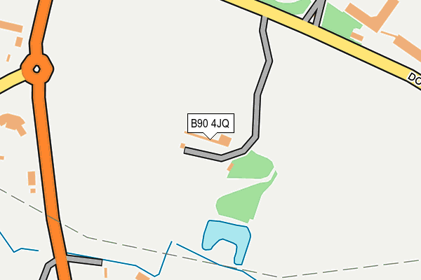
B90 4JQ lies on Dog Kennel Lane in Shirley, Solihull. B90 4JQ is located in the Blythe electoral ward, within the metropolitan district of Solihull and the English Parliamentary constituency of Meriden. The Sub Integrated Care Board (ICB) Location is NHS Birmingham and Solihull ICB - 15E and the police force is West Midlands. This postcode has been in use since November 2005.


GetTheData
Source: OS OpenMap – Local (Ordnance Survey)
Source: OS VectorMap District (Ordnance Survey)
Licence: Open Government Licence (requires attribution)
| Easting | 412217 |
| Northing | 277031 |
| Latitude | 52.391169 |
| Longitude | -1.821902 |
GetTheData
Source: Open Postcode Geo
Licence: Open Government Licence
| Street | Dog Kennel Lane |
| Locality | Shirley |
| Town/City | Solihull |
| Country | England |
| Postcode District | B90 |
➜ See where B90 is on a map | |
GetTheData
Source: Land Registry Price Paid Data
Licence: Open Government Licence
Elevation or altitude of B90 4JQ as distance above sea level:
| Metres | Feet | |
|---|---|---|
| Elevation | 140m | 459ft |
Elevation is measured from the approximate centre of the postcode, to the nearest point on an OS contour line from OS Terrain 50, which has contour spacing of ten vertical metres.
➜ How high above sea level am I? Find the elevation of your current position using your device's GPS.
GetTheData
Source: Open Postcode Elevation
Licence: Open Government Licence
| Ward | Blythe |
| Constituency | Meriden |
GetTheData
Source: ONS Postcode Database
Licence: Open Government Licence
| Cheswick Green Inn (Tanworth Lane) | Three May Poles | 245m |
| Cheswick Green Inn (Tanworth Lane) | Three May Poles | 267m |
| Dog Kennel Lane (Blackford Rd) | Three May Poles | 290m |
| Cheswick Green Inn (Dickens Heath Rd) | Three May Poles | 328m |
| Dog Kennel Lane (Blackford Rd) | Three May Poles | 328m |
| Whitlocks End Station | 2km |
| Shirley Station | 2.1km |
| Wythall Station | 3.2km |
GetTheData
Source: NaPTAN
Licence: Open Government Licence
GetTheData
Source: ONS Postcode Database
Licence: Open Government Licence


➜ Get more ratings from the Food Standards Agency
GetTheData
Source: Food Standards Agency
Licence: FSA terms & conditions
| Last Collection | |||
|---|---|---|---|
| Location | Mon-Fri | Sat | Distance |
| Blackford Road / Stratford Road | 17:45 | 11:30 | 663m |
| Tanworth Lane | 17:30 | 11:30 | 775m |
| Cranmore Boulevard Post Office | 18:30 | 11:30 | 894m |
GetTheData
Source: Dracos
Licence: Creative Commons Attribution-ShareAlike
The below table lists the International Territorial Level (ITL) codes (formerly Nomenclature of Territorial Units for Statistics (NUTS) codes) and Local Administrative Units (LAU) codes for B90 4JQ:
| ITL 1 Code | Name |
|---|---|
| TLG | West Midlands (England) |
| ITL 2 Code | Name |
| TLG3 | West Midlands |
| ITL 3 Code | Name |
| TLG32 | Solihull |
| LAU 1 Code | Name |
| E08000029 | Solihull |
GetTheData
Source: ONS Postcode Directory
Licence: Open Government Licence
The below table lists the Census Output Area (OA), Lower Layer Super Output Area (LSOA), and Middle Layer Super Output Area (MSOA) for B90 4JQ:
| Code | Name | |
|---|---|---|
| OA | E00051491 | |
| LSOA | E01032886 | Solihull 029G |
| MSOA | E02002109 | Solihull 029 |
GetTheData
Source: ONS Postcode Directory
Licence: Open Government Licence
| B90 4EA | Tanworth Lane | 260m |
| B90 4JG | Dog Kennel Lane | 278m |
| B90 4JH | Dog Kennel Lane | 301m |
| B90 4DU | Tanworth Lane | 349m |
| B90 4DA | Blackford Road | 377m |
| B90 4BX | Blackford Road | 413m |
| B90 4DB | Tanworth Lane | 445m |
| B90 4DN | Heath Drive | 472m |
| B90 4BZ | Tanworth Lane | 493m |
| B90 4DD | Tanworth Lane | 497m |
GetTheData
Source: Open Postcode Geo; Land Registry Price Paid Data
Licence: Open Government Licence