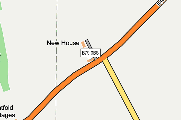
B79 0BS lies on Ashby Road in Tamworth. B79 0BS is located in the Mease Valley electoral ward, within the local authority district of Lichfield and the English Parliamentary constituency of Tamworth. The Sub Integrated Care Board (ICB) Location is NHS Staffordshire and Stoke-on-Trent ICB - 05Q and the police force is Staffordshire. This postcode has been in use since January 1980.


GetTheData
Source: OS OpenMap – Local (Ordnance Survey)
Source: OS VectorMap District (Ordnance Survey)
Licence: Open Government Licence (requires attribution)
| Easting | 424614 |
| Northing | 307026 |
| Latitude | 52.660401 |
| Longitude | -1.637526 |
GetTheData
Source: Open Postcode Geo
Licence: Open Government Licence
| Street | Ashby Road |
| Town/City | Tamworth |
| Country | England |
| Postcode District | B79 |
➜ See where B79 is on a map | |
GetTheData
Source: Land Registry Price Paid Data
Licence: Open Government Licence
Elevation or altitude of B79 0BS as distance above sea level:
| Metres | Feet | |
|---|---|---|
| Elevation | 80m | 262ft |
Elevation is measured from the approximate centre of the postcode, to the nearest point on an OS contour line from OS Terrain 50, which has contour spacing of ten vertical metres.
➜ How high above sea level am I? Find the elevation of your current position using your device's GPS.
GetTheData
Source: Open Postcode Elevation
Licence: Open Government Licence
| Ward | Mease Valley |
| Constituency | Tamworth |
GetTheData
Source: ONS Postcode Database
Licence: Open Government Licence
| Clifton Lane (Ashby Rd) | Statfold | 962m |
| Clifton Lane (Ashby Rd) | Statfold | 1,000m |
| Hangmans Lane (Ashby Road) | Seckington | 1,598m |
| Hangmans Lane (Ashby Road) | Seckington | 1,605m |
| Tamworth High Level Station | 4.2km |
| Tamworth Station | 4.2km |
| Polesworth Station | 4.3km |
GetTheData
Source: NaPTAN
Licence: Open Government Licence
| Percentage of properties with Next Generation Access | 100.0% |
| Percentage of properties with Superfast Broadband | 0.0% |
| Percentage of properties with Ultrafast Broadband | 0.0% |
| Percentage of properties with Full Fibre Broadband | 0.0% |
Superfast Broadband is between 30Mbps and 300Mbps
Ultrafast Broadband is > 300Mbps
| Median download speed | 13.5Mbps |
| Average download speed | 13.4Mbps |
| Maximum download speed | 21.97Mbps |
| Median upload speed | 1.2Mbps |
| Average upload speed | 1.0Mbps |
| Maximum upload speed | 1.20Mbps |
| Percentage of properties unable to receive 2Mbps | 0.0% |
| Percentage of properties unable to receive 5Mbps | 0.0% |
| Percentage of properties unable to receive 10Mbps | 0.0% |
| Percentage of properties unable to receive 30Mbps | 100.0% |
GetTheData
Source: Ofcom
Licence: Ofcom Terms of Use (requires attribution)
GetTheData
Source: ONS Postcode Database
Licence: Open Government Licence


➜ Get more ratings from the Food Standards Agency
GetTheData
Source: Food Standards Agency
Licence: FSA terms & conditions
| Last Collection | |||
|---|---|---|---|
| Location | Mon-Fri | Sat | Distance |
| Mildenhall Off Wigginton Road | 17:15 | 11:30 | 3,703m |
| Pennymoor | 17:00 | 11:30 | 3,826m |
| Perrycrofts Crescent / Farm Cl | 17:15 | 11:30 | 3,852m |
GetTheData
Source: Dracos
Licence: Creative Commons Attribution-ShareAlike
The below table lists the International Territorial Level (ITL) codes (formerly Nomenclature of Territorial Units for Statistics (NUTS) codes) and Local Administrative Units (LAU) codes for B79 0BS:
| ITL 1 Code | Name |
|---|---|
| TLG | West Midlands (England) |
| ITL 2 Code | Name |
| TLG2 | Shropshire and Staffordshire |
| ITL 3 Code | Name |
| TLG24 | Staffordshire CC |
| LAU 1 Code | Name |
| E07000194 | Lichfield |
GetTheData
Source: ONS Postcode Directory
Licence: Open Government Licence
The below table lists the Census Output Area (OA), Lower Layer Super Output Area (LSOA), and Middle Layer Super Output Area (MSOA) for B79 0BS:
| Code | Name | |
|---|---|---|
| OA | E00150393 | |
| LSOA | E01029516 | Lichfield 008A |
| MSOA | E02006153 | Lichfield 008 |
GetTheData
Source: ONS Postcode Directory
Licence: Open Government Licence
| B79 0BT | Ashby Road | 369m |
| B79 0BP | New Road | 576m |
| B79 0BJ | Ashby Road | 1485m |
| B79 0LD | Church Lane | 1495m |
| B79 0LA | 1642m | |
| B79 0DT | New Road | 1676m |
| B79 0DU | Pear Tree Close | 1703m |
| B79 0DR | Milner Drive | 1857m |
| B79 0DP | Main Road | 1874m |
| B79 0DS | Main Road | 1905m |
GetTheData
Source: Open Postcode Geo; Land Registry Price Paid Data
Licence: Open Government Licence