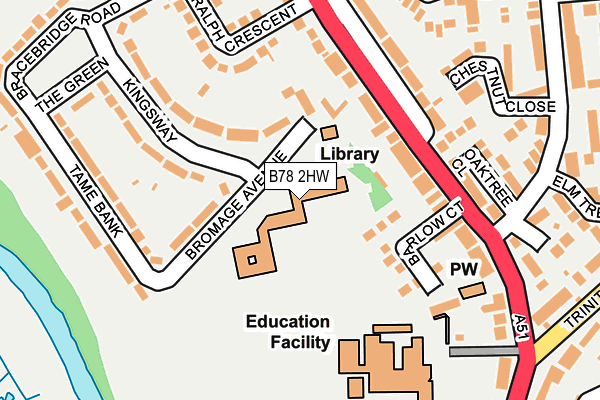
B78 2HW is located in the Kingsbury electoral ward, within the local authority district of North Warwickshire and the English Parliamentary constituency of North Warwickshire. The Sub Integrated Care Board (ICB) Location is NHS Coventry and Warwickshire ICB - B2M3M and the police force is Warwickshire. This postcode has been in use since January 1980.


GetTheData
Source: OS OpenMap – Local (Ordnance Survey)
Source: OS VectorMap District (Ordnance Survey)
Licence: Open Government Licence (requires attribution)
| Easting | 421490 |
| Northing | 296700 |
| Latitude | 52.567706 |
| Longitude | -1.684380 |
GetTheData
Source: Open Postcode Geo
Licence: Open Government Licence
| Country | England |
| Postcode District | B78 |
➜ See where B78 is on a map ➜ Where is Kingsbury? | |
GetTheData
Source: Land Registry Price Paid Data
Licence: Open Government Licence
Elevation or altitude of B78 2HW as distance above sea level:
| Metres | Feet | |
|---|---|---|
| Elevation | 70m | 230ft |
Elevation is measured from the approximate centre of the postcode, to the nearest point on an OS contour line from OS Terrain 50, which has contour spacing of ten vertical metres.
➜ How high above sea level am I? Find the elevation of your current position using your device's GPS.
GetTheData
Source: Open Postcode Elevation
Licence: Open Government Licence
| Ward | Kingsbury |
| Constituency | North Warwickshire |
GetTheData
Source: ONS Postcode Database
Licence: Open Government Licence
| Barlow Court (Tamworth Road) | Kingsbury | 136m |
| Barlow Court (Tamworth Road) | Kingsbury | 155m |
| Ralph Crescent (Tamworth Road) | Kingsbury | 164m |
| Ralph Crescent (Tamworth Road) | Kingsbury | 212m |
| Kingsbury School (Private Road) | Kingsbury | 216m |
| Wilnecote (Staffs) Station | 4.8km |
GetTheData
Source: NaPTAN
Licence: Open Government Licence
GetTheData
Source: ONS Postcode Database
Licence: Open Government Licence


➜ Get more ratings from the Food Standards Agency
GetTheData
Source: Food Standards Agency
Licence: FSA terms & conditions
| Last Collection | |||
|---|---|---|---|
| Location | Mon-Fri | Sat | Distance |
| Tamworth Road Kingsbury | 16:00 | 11:30 | 315m |
| Kingsbury Post Office | 16:30 | 11:00 | 356m |
| Sycamore Road Opposite Willow | 16:00 | 11:30 | 405m |
GetTheData
Source: Dracos
Licence: Creative Commons Attribution-ShareAlike
The below table lists the International Territorial Level (ITL) codes (formerly Nomenclature of Territorial Units for Statistics (NUTS) codes) and Local Administrative Units (LAU) codes for B78 2HW:
| ITL 1 Code | Name |
|---|---|
| TLG | West Midlands (England) |
| ITL 2 Code | Name |
| TLG1 | Herefordshire, Worcestershire and Warwickshire |
| ITL 3 Code | Name |
| TLG13 | Warwickshire CC |
| LAU 1 Code | Name |
| E07000218 | North Warwickshire |
GetTheData
Source: ONS Postcode Directory
Licence: Open Government Licence
The below table lists the Census Output Area (OA), Lower Layer Super Output Area (LSOA), and Middle Layer Super Output Area (MSOA) for B78 2HW:
| Code | Name | |
|---|---|---|
| OA | E00158207 | |
| LSOA | E01031033 | North Warwickshire 004C |
| MSOA | E02006471 | North Warwickshire 004 |
GetTheData
Source: ONS Postcode Directory
Licence: Open Government Licence
| B78 2HN | Bromage Avenue | 78m |
| B78 2HB | Barlow Court | 109m |
| B78 2HH | Tamworth Road | 142m |
| B78 2HR | Kingsway | 152m |
| B78 2HX | Tamworth Road | 158m |
| B78 2JF | Oak Tree Close | 189m |
| B78 2HJ | Tamworth Road | 198m |
| B78 2HS | Tame Bank | 234m |
| B78 2HL | Ralph Crescent | 235m |
| B78 2JA | Chestnut Close | 237m |
GetTheData
Source: Open Postcode Geo; Land Registry Price Paid Data
Licence: Open Government Licence