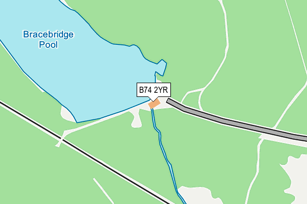
B74 2YR is located in the Sutton Four Oaks electoral ward, within the metropolitan district of Birmingham and the English Parliamentary constituency of Sutton Coldfield. The Sub Integrated Care Board (ICB) Location is NHS Birmingham and Solihull ICB - 15E and the police force is West Midlands. This postcode has been in use since April 2019.


GetTheData
Source: OS OpenMap – Local (Ordnance Survey)
Source: OS VectorMap District (Ordnance Survey)
Licence: Open Government Licence (requires attribution)
| Easting | 410100 |
| Northing | 297950 |
| Latitude | 52.579287 |
| Longitude | -1.852376 |
GetTheData
Source: Open Postcode Geo
Licence: Open Government Licence
| Country | England |
| Postcode District | B74 |
➜ See where B74 is on a map ➜ Where is Royal Sutton Coldfield? | |
GetTheData
Source: Land Registry Price Paid Data
Licence: Open Government Licence
Elevation or altitude of B74 2YR as distance above sea level:
| Metres | Feet | |
|---|---|---|
| Elevation | 140m | 459ft |
Elevation is measured from the approximate centre of the postcode, to the nearest point on an OS contour line from OS Terrain 50, which has contour spacing of ten vertical metres.
➜ How high above sea level am I? Find the elevation of your current position using your device's GPS.
GetTheData
Source: Open Postcode Elevation
Licence: Open Government Licence
| Ward | Sutton Four Oaks |
| Constituency | Sutton Coldfield |
GetTheData
Source: ONS Postcode Database
Licence: Open Government Licence
| Parkfield Lodge (Streetly Lane) | Four Oaks | 969m |
| Parkfield Lodge (Streetly Lane) | Four Oaks | 991m |
| Crown Lane (Streetly Lane) | Four Oaks | 1,002m |
| Crown Lane (Streetly Lane) | Four Oaks | 1,003m |
| Bennett Rd (Streetly Lane) | Four Oaks | 1,056m |
| Four Oaks Station | 1.7km |
| Butlers Lane Station | 1.8km |
| Sutton Coldfield Station | 2.5km |
GetTheData
Source: NaPTAN
Licence: Open Government Licence
GetTheData
Source: ONS Postcode Database
Licence: Open Government Licence


➜ Get more ratings from the Food Standards Agency
GetTheData
Source: Food Standards Agency
Licence: FSA terms & conditions
| Last Collection | |||
|---|---|---|---|
| Location | Mon-Fri | Sat | Distance |
| Hartopp Road / Bracebridge Road | 17:15 | 11:30 | 731m |
| Belwell Lane / Walsall Road | 17:15 | 11:30 | 1,109m |
| Streetly Lane / Park View Road | 17:15 | 11:30 | 1,202m |
GetTheData
Source: Dracos
Licence: Creative Commons Attribution-ShareAlike
The below table lists the International Territorial Level (ITL) codes (formerly Nomenclature of Territorial Units for Statistics (NUTS) codes) and Local Administrative Units (LAU) codes for B74 2YR:
| ITL 1 Code | Name |
|---|---|
| TLG | West Midlands (England) |
| ITL 2 Code | Name |
| TLG3 | West Midlands |
| ITL 3 Code | Name |
| TLG31 | Birmingham |
| LAU 1 Code | Name |
| E08000025 | Birmingham |
GetTheData
Source: ONS Postcode Directory
Licence: Open Government Licence
The below table lists the Census Output Area (OA), Lower Layer Super Output Area (LSOA), and Middle Layer Super Output Area (MSOA) for B74 2YR:
| Code | Name | |
|---|---|---|
| OA | E00047754 | |
| LSOA | E01009424 | Birmingham 004B |
| MSOA | E02001830 | Birmingham 004 |
GetTheData
Source: ONS Postcode Directory
Licence: Open Government Licence
| B74 2RF | The Moorlands | 560m |
| B74 2RA | Clarry Drive | 580m |
| B74 2QZ | Heaton Drive | 629m |
| B74 2QT | Clarry Drive | 662m |
| B74 2RB | Hartopp Road | 669m |
| B74 2RD | Applecross | 685m |
| B74 2RE | Hartopp Road | 718m |
| B74 2QY | Hartopp Road | 735m |
| B74 2QU | Parklands Drive | 740m |
| B74 2RQ | Hartopp Road | 793m |
GetTheData
Source: Open Postcode Geo; Land Registry Price Paid Data
Licence: Open Government Licence