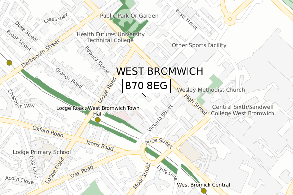
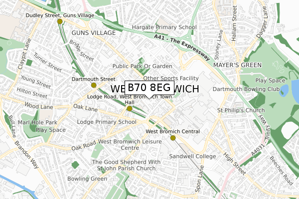
B70 8EG lies on Lombard Street West in West Bromwich. B70 8EG is located in the West Bromwich Central electoral ward, within the metropolitan district of Sandwell and the English Parliamentary constituency of West Bromwich East. The Sub Integrated Care Board (ICB) Location is NHS Black Country ICB - D2P2L and the police force is West Midlands. This postcode has been in use since January 1980.


GetTheData
Source: OS Open Zoomstack (Ordnance Survey)
Licence: Open Government Licence (requires attribution)
Attribution: Contains OS data © Crown copyright and database right 2025
Source: Open Postcode Geo
Licence: Open Government Licence (requires attribution)
Attribution: Contains OS data © Crown copyright and database right 2025; Contains Royal Mail data © Royal Mail copyright and database right 2025; Source: Office for National Statistics licensed under the Open Government Licence v.3.0
| Easting | 400265 |
| Northing | 291276 |
| Latitude | 52.519380 |
| Longitude | -1.997519 |
GetTheData
Source: Open Postcode Geo
Licence: Open Government Licence
| Street | Lombard Street West |
| Town/City | West Bromwich |
| Country | England |
| Postcode District | B70 |
➜ See where B70 is on a map ➜ Where is West Bromwich? | |
GetTheData
Source: Land Registry Price Paid Data
Licence: Open Government Licence
Elevation or altitude of B70 8EG as distance above sea level:
| Metres | Feet | |
|---|---|---|
| Elevation | 160m | 525ft |
Elevation is measured from the approximate centre of the postcode, to the nearest point on an OS contour line from OS Terrain 50, which has contour spacing of ten vertical metres.
➜ How high above sea level am I? Find the elevation of your current position using your device's GPS.
GetTheData
Source: Open Postcode Elevation
Licence: Open Government Licence
| Ward | West Bromwich Central |
| Constituency | West Bromwich East |
GetTheData
Source: ONS Postcode Database
Licence: Open Government Licence
| West Bromwich Town Hall (High St) | Carters Green | 105m |
| West Bromwich Town Hall (High St) | Carters Green | 122m |
| West Bromwich Town Hall (High St) | Carters Green | 129m |
| Victoria St (Price St) | Lamberts End | 144m |
| Victoria St (High St) | Carters Green | 149m |
| Lodge Road-west Bromwich Town Hall (Metro Stop) (Lodge Rd) | Lamberts End | 169m |
| West Bromwich Central (Midland Metro Stop) (West Bromwich Ringway) | West Bromwich | 359m |
| Dartmouth Street (Midland Metro Stop) (Dartmouth St) | Lamberts End | 491m |
| Dudley Street Guns Village (Midland Metro Stop) (Dudley St) | Guns Village | 987m |
| Trinity Way (Midland Metro Stop) (Trinity Way) | West Bromwich | 1,060m |
| Sandwell & Dudley Station | 1.5km |
| Smethwick Galton Bridge Station | 2.3km |
| The Hawthorns Station | 2.8km |
GetTheData
Source: NaPTAN
Licence: Open Government Licence
| Percentage of properties with Next Generation Access | 100.0% |
| Percentage of properties with Superfast Broadband | 100.0% |
| Percentage of properties with Ultrafast Broadband | 100.0% |
| Percentage of properties with Full Fibre Broadband | 0.0% |
Superfast Broadband is between 30Mbps and 300Mbps
Ultrafast Broadband is > 300Mbps
| Median download speed | 20.6Mbps |
| Average download speed | 35.5Mbps |
| Maximum download speed | 80.00Mbps |
| Median upload speed | 1.3Mbps |
| Average upload speed | 6.9Mbps |
| Maximum upload speed | 20.00Mbps |
| Percentage of properties unable to receive 2Mbps | 0.0% |
| Percentage of properties unable to receive 5Mbps | 0.0% |
| Percentage of properties unable to receive 10Mbps | 0.0% |
| Percentage of properties unable to receive 30Mbps | 0.0% |
GetTheData
Source: Ofcom
Licence: Ofcom Terms of Use (requires attribution)
GetTheData
Source: ONS Postcode Database
Licence: Open Government Licence


➜ Get more ratings from the Food Standards Agency
GetTheData
Source: Food Standards Agency
Licence: FSA terms & conditions
| Last Collection | |||
|---|---|---|---|
| Location | Mon-Fri | Sat | Distance |
| Oxford Road / Lodge Road | 17:30 | 12:00 | 297m |
| Dartmouth Street / Edward St | 17:30 | 12:00 | 343m |
| Temple Street / High Street | 18:30 | 12:00 | 408m |
GetTheData
Source: Dracos
Licence: Creative Commons Attribution-ShareAlike
The below table lists the International Territorial Level (ITL) codes (formerly Nomenclature of Territorial Units for Statistics (NUTS) codes) and Local Administrative Units (LAU) codes for B70 8EG:
| ITL 1 Code | Name |
|---|---|
| TLG | West Midlands (England) |
| ITL 2 Code | Name |
| TLG3 | West Midlands |
| ITL 3 Code | Name |
| TLG37 | Sandwell |
| LAU 1 Code | Name |
| E08000028 | Sandwell |
GetTheData
Source: ONS Postcode Directory
Licence: Open Government Licence
The below table lists the Census Output Area (OA), Lower Layer Super Output Area (LSOA), and Middle Layer Super Output Area (MSOA) for B70 8EG:
| Code | Name | |
|---|---|---|
| OA | E00051075 | |
| LSOA | E01010106 | Sandwell 019D |
| MSOA | E02002061 | Sandwell 019 |
GetTheData
Source: ONS Postcode Directory
Licence: Open Government Licence
| B70 8NN | Edward Street | 88m |
| B70 8ET | Victoria Street | 107m |
| B70 8EX | Victoria Street | 110m |
| B70 8AQ | High Street | 118m |
| B70 8NX | Lodge Road | 158m |
| B70 8LU | High Street | 165m |
| B70 8ND | High Street | 200m |
| B70 8PH | Osborne Road | 209m |
| B70 8NU | Edward Street | 231m |
| B70 8PA | Lodge Road | 239m |
GetTheData
Source: Open Postcode Geo; Land Registry Price Paid Data
Licence: Open Government Licence