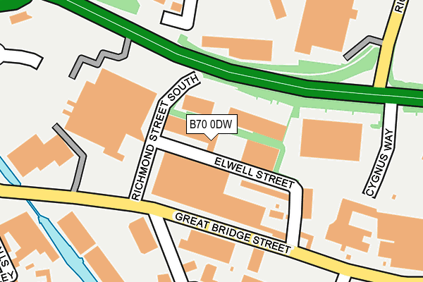
B70 0DW is located in the Great Bridge electoral ward, within the metropolitan district of Sandwell and the English Parliamentary constituency of West Bromwich West. The Sub Integrated Care Board (ICB) Location is NHS Black Country ICB - D2P2L and the police force is West Midlands. This postcode has been in use since January 1980.


GetTheData
Source: OS OpenMap – Local (Ordnance Survey)
Source: OS VectorMap District (Ordnance Survey)
Licence: Open Government Licence (requires attribution)
| Easting | 398333 |
| Northing | 292438 |
| Latitude | 52.529808 |
| Longitude | -2.026003 |
GetTheData
Source: Open Postcode Geo
Licence: Open Government Licence
| Country | England |
| Postcode District | B70 |
➜ See where B70 is on a map ➜ Where is West Bromwich? | |
GetTheData
Source: Land Registry Price Paid Data
Licence: Open Government Licence
Elevation or altitude of B70 0DW as distance above sea level:
| Metres | Feet | |
|---|---|---|
| Elevation | 130m | 427ft |
Elevation is measured from the approximate centre of the postcode, to the nearest point on an OS contour line from OS Terrain 50, which has contour spacing of ten vertical metres.
➜ How high above sea level am I? Find the elevation of your current position using your device's GPS.
GetTheData
Source: Open Postcode Elevation
Licence: Open Government Licence
| Ward | Great Bridge |
| Constituency | West Bromwich West |
GetTheData
Source: ONS Postcode Database
Licence: Open Government Licence
| Richmond St (Great Bridge St) | Great Bridge | 111m |
| Richmond St (Great Bridge St) | Great Bridge | 122m |
| Asda Superstore (Asda Superstore Grounds) | Great Bridge | 196m |
| Ryder St (Great Bridge St) | Swan Village | 282m |
| Whitehall Rd (Great Bridge St) | Great Bridge | 316m |
| Black Lake (Midland Metro Stop) (Black Lake) | Black Lake | 1,026m |
| Dudley Street Guns Village (Midland Metro Stop) (Dudley St) | Guns Village | 1,291m |
| Dartmouth Street (Midland Metro Stop) (Dartmouth St) | Lamberts End | 1,789m |
| Dudley Port Station | 1.7km |
| Sandwell & Dudley Station | 2.5km |
| Tipton Station | 2.7km |
GetTheData
Source: NaPTAN
Licence: Open Government Licence
GetTheData
Source: ONS Postcode Database
Licence: Open Government Licence


➜ Get more ratings from the Food Standards Agency
GetTheData
Source: Food Standards Agency
Licence: FSA terms & conditions
| Last Collection | |||
|---|---|---|---|
| Location | Mon-Fri | Sat | Distance |
| Great Bridge St Opposite Charl | 17:30 | 12:00 | 111m |
| Sheepwash Lane | 18:30 | 11:30 | 430m |
| Great Bridge Post Office | 18:30 | 12:00 | 481m |
GetTheData
Source: Dracos
Licence: Creative Commons Attribution-ShareAlike
The below table lists the International Territorial Level (ITL) codes (formerly Nomenclature of Territorial Units for Statistics (NUTS) codes) and Local Administrative Units (LAU) codes for B70 0DW:
| ITL 1 Code | Name |
|---|---|
| TLG | West Midlands (England) |
| ITL 2 Code | Name |
| TLG3 | West Midlands |
| ITL 3 Code | Name |
| TLG37 | Sandwell |
| LAU 1 Code | Name |
| E08000028 | Sandwell |
GetTheData
Source: ONS Postcode Directory
Licence: Open Government Licence
The below table lists the Census Output Area (OA), Lower Layer Super Output Area (LSOA), and Middle Layer Super Output Area (MSOA) for B70 0DW:
| Code | Name | |
|---|---|---|
| OA | E00050472 | |
| LSOA | E01009981 | Sandwell 018A |
| MSOA | E02002060 | Sandwell 018 |
GetTheData
Source: ONS Postcode Directory
Licence: Open Government Licence
| B70 0DN | Elwell Street | 76m |
| B70 0DJ | Great Bridge Street | 119m |
| B70 0BG | William Street | 200m |
| B70 0BF | The Great Bridge Centre | 255m |
| DY4 7LH | Tinsley Street | 343m |
| B70 0AZ | Charles Street Industrial Estate | 378m |
| B70 0BP | Great Bridge Street | 425m |
| B70 0LR | Wolseley Road | 432m |
| B70 0DT | Brickhouse Lane | 433m |
| DY4 7HF | Great Bridge | 436m |
GetTheData
Source: Open Postcode Geo; Land Registry Price Paid Data
Licence: Open Government Licence