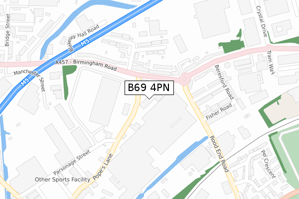
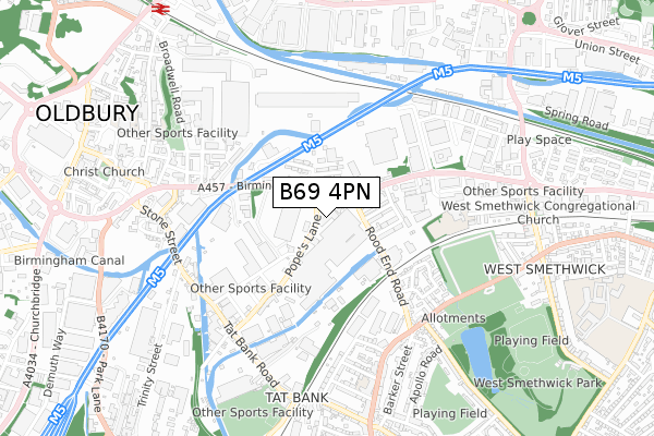
B69 4PN is located in the Oldbury electoral ward, within the metropolitan district of Sandwell and the English Parliamentary constituency of West Bromwich West. The Sub Integrated Care Board (ICB) Location is NHS Black Country ICB - D2P2L and the police force is West Midlands. This postcode has been in use since March 1983.


GetTheData
Source: OS Open Zoomstack (Ordnance Survey)
Licence: Open Government Licence (requires attribution)
Attribution: Contains OS data © Crown copyright and database right 2025
Source: Open Postcode Geo
Licence: Open Government Licence (requires attribution)
Attribution: Contains OS data © Crown copyright and database right 2025; Contains Royal Mail data © Royal Mail copyright and database right 2025; Source: Office for National Statistics licensed under the Open Government Licence v.3.0
| Easting | 399934 |
| Northing | 289285 |
| Latitude | 52.501466 |
| Longitude | -2.002402 |
GetTheData
Source: Open Postcode Geo
Licence: Open Government Licence
| Country | England |
| Postcode District | B69 |
➜ See where B69 is on a map ➜ Where is Oldbury? | |
GetTheData
Source: Land Registry Price Paid Data
Licence: Open Government Licence
Elevation or altitude of B69 4PN as distance above sea level:
| Metres | Feet | |
|---|---|---|
| Elevation | 150m | 492ft |
Elevation is measured from the approximate centre of the postcode, to the nearest point on an OS contour line from OS Terrain 50, which has contour spacing of ten vertical metres.
➜ How high above sea level am I? Find the elevation of your current position using your device's GPS.
GetTheData
Source: Open Postcode Elevation
Licence: Open Government Licence
| Ward | Oldbury |
| Constituency | West Bromwich West |
GetTheData
Source: ONS Postcode Database
Licence: Open Government Licence
| Rood End Rd (Birmingham Rd) | Tat Bank | 70m |
| Rood End Rd (Birmingham Rd) | Tat Bank | 85m |
| Anchor Bridge (Birmingham Rd) | Tat Bank | 315m |
| Anchor Bridge (Birmingham Rd) | Tat Bank | 376m |
| Sandwell Business Park (Oldbury Rd) | Rood End | 473m |
| Trinity Way (Midland Metro Stop) (Trinity Way) | West Bromwich | 1,503m |
| Kenrick Park (Midland Metro Stop) (Roebuck Lane) | West Bromwich | 1,562m |
| Langley Green Station | 0.9km |
| Sandwell & Dudley Station | 1km |
| Smethwick Galton Bridge Station | 1.5km |
GetTheData
Source: NaPTAN
Licence: Open Government Licence
Estimated total energy consumption in B69 4PN by fuel type, 2015.
| Consumption (kWh) | 57,282 |
|---|---|
| Meter count | 6 |
| Mean (kWh/meter) | 9,547 |
| Median (kWh/meter) | 7,118 |
GetTheData
Source: Postcode level gas estimates: 2015 (experimental)
Source: Postcode level electricity estimates: 2015 (experimental)
Licence: Open Government Licence
GetTheData
Source: ONS Postcode Database
Licence: Open Government Licence


➜ Get more ratings from the Food Standards Agency
GetTheData
Source: Food Standards Agency
Licence: FSA terms & conditions
| Last Collection | |||
|---|---|---|---|
| Location | Mon-Fri | Sat | Distance |
| Frazer St | 17:30 | 12:00 | 165m |
| Rood End Post Office | 17:15 | 12:00 | 531m |
| 6 Simpson St Birmingham St | 17:30 | 12:00 | 730m |
GetTheData
Source: Dracos
Licence: Creative Commons Attribution-ShareAlike
The below table lists the International Territorial Level (ITL) codes (formerly Nomenclature of Territorial Units for Statistics (NUTS) codes) and Local Administrative Units (LAU) codes for B69 4PN:
| ITL 1 Code | Name |
|---|---|
| TLG | West Midlands (England) |
| ITL 2 Code | Name |
| TLG3 | West Midlands |
| ITL 3 Code | Name |
| TLG37 | Sandwell |
| LAU 1 Code | Name |
| E08000028 | Sandwell |
GetTheData
Source: ONS Postcode Directory
Licence: Open Government Licence
The below table lists the Census Output Area (OA), Lower Layer Super Output Area (LSOA), and Middle Layer Super Output Area (MSOA) for B69 4PN:
| Code | Name | |
|---|---|---|
| OA | E00050671 | |
| LSOA | E01010019 | Sandwell 024B |
| MSOA | E02002066 | Sandwell 024 |
GetTheData
Source: ONS Postcode Directory
Licence: Open Government Licence
| B69 4EH | Birmingham Road | 120m |
| B69 4EW | Birmingham Road | 171m |
| B69 4ER | Seymour Road | 178m |
| B69 4ES | Blakeley Hall Road | 186m |
| B69 4EA | Sandwell Court | 205m |
| B69 4EP | Seymour Road | 206m |
| B69 4EQ | Birmingham Road | 217m |
| B69 4ET | Blakeley Hall Road | 236m |
| B69 4EL | Fisher Road | 247m |
| B69 4HB | Beresford Road | 286m |
GetTheData
Source: Open Postcode Geo; Land Registry Price Paid Data
Licence: Open Government Licence