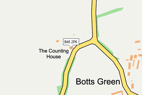
B46 2PA is located in the Curdworth electoral ward, within the local authority district of North Warwickshire and the English Parliamentary constituency of North Warwickshire. The Sub Integrated Care Board (ICB) Location is NHS Coventry and Warwickshire ICB - B2M3M and the police force is Warwickshire. This postcode has been in use since January 1980.


GetTheData
Source: OS OpenMap – Local (Ordnance Survey)
Source: OS VectorMap District (Ordnance Survey)
Licence: Open Government Licence (requires attribution)
| Easting | 424141 |
| Northing | 292551 |
| Latitude | 52.530297 |
| Longitude | -1.645570 |
GetTheData
Source: Open Postcode Geo
Licence: Open Government Licence
| Country | England |
| Postcode District | B46 |
➜ See where B46 is on a map | |
GetTheData
Source: Land Registry Price Paid Data
Licence: Open Government Licence
Elevation or altitude of B46 2PA as distance above sea level:
| Metres | Feet | |
|---|---|---|
| Elevation | 100m | 328ft |
Elevation is measured from the approximate centre of the postcode, to the nearest point on an OS contour line from OS Terrain 50, which has contour spacing of ten vertical metres.
➜ How high above sea level am I? Find the elevation of your current position using your device's GPS.
GetTheData
Source: Open Postcode Elevation
Licence: Open Government Licence
| Ward | Curdworth |
| Constituency | North Warwickshire |
GetTheData
Source: ONS Postcode Database
Licence: Open Government Licence
| Gate Lane (Coventry Road) | Nether Whitacre | 1,043m |
| The Gate (Gate Lane) | Nether Whitacre | 1,087m |
| Crossroads (Nuneaton Road) | Furnace End | 1,354m |
| Bray Bank (Atherstone Road) | Furnace End | 1,355m |
| Bulls Head (Coleshill Road) | Furnace End | 1,452m |
| Coleshill Parkway Station | 4.5km |
GetTheData
Source: NaPTAN
Licence: Open Government Licence
GetTheData
Source: ONS Postcode Database
Licence: Open Government Licence

➜ Get more ratings from the Food Standards Agency
GetTheData
Source: Food Standards Agency
Licence: FSA terms & conditions
| Last Collection | |||
|---|---|---|---|
| Location | Mon-Fri | Sat | Distance |
| Nether Whitacre | 09:00 | 07:30 | 1,101m |
| Coleshill Road Furnace End | 16:15 | 08:00 | 1,451m |
| Shustoke | 16:15 | 08:30 | 1,651m |
GetTheData
Source: Dracos
Licence: Creative Commons Attribution-ShareAlike
The below table lists the International Territorial Level (ITL) codes (formerly Nomenclature of Territorial Units for Statistics (NUTS) codes) and Local Administrative Units (LAU) codes for B46 2PA:
| ITL 1 Code | Name |
|---|---|
| TLG | West Midlands (England) |
| ITL 2 Code | Name |
| TLG1 | Herefordshire, Worcestershire and Warwickshire |
| ITL 3 Code | Name |
| TLG13 | Warwickshire CC |
| LAU 1 Code | Name |
| E07000218 | North Warwickshire |
GetTheData
Source: ONS Postcode Directory
Licence: Open Government Licence
The below table lists the Census Output Area (OA), Lower Layer Super Output Area (LSOA), and Middle Layer Super Output Area (MSOA) for B46 2PA:
| Code | Name | |
|---|---|---|
| OA | E00158153 | |
| LSOA | E01031024 | North Warwickshire 004B |
| MSOA | E02006471 | North Warwickshire 004 |
GetTheData
Source: ONS Postcode Directory
Licence: Open Government Licence
| B46 2NY | Botts Green | 304m |
| B46 2PE | Botts Green | 473m |
| B46 2NX | Botts Green Lane | 673m |
| B46 2PH | Tamworth Road | 718m |
| B46 2PL | Tamworth Road | 725m |
| B46 2PJ | Tamworth Road | 740m |
| B46 2DP | Tamworth Road | 770m |
| B46 2NU | Pound Lane | 857m |
| B46 2DX | Highfields | 933m |
| B46 2DH | Ridley Lane | 948m |
GetTheData
Source: Open Postcode Geo; Land Registry Price Paid Data
Licence: Open Government Licence