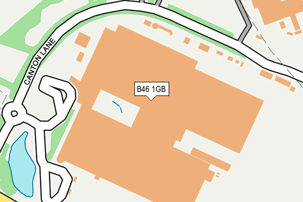
B46 1GB is located in the Curdworth electoral ward, within the local authority district of North Warwickshire and the English Parliamentary constituency of North Warwickshire. The Sub Integrated Care Board (ICB) Location is NHS Coventry and Warwickshire ICB - B2M3M and the police force is Warwickshire. This postcode has been in use since June 2000.


GetTheData
Source: OS OpenMap – Local (Ordnance Survey)
Source: OS VectorMap District (Ordnance Survey)
Licence: Open Government Licence (requires attribution)
| Easting | 420372 |
| Northing | 292150 |
| Latitude | 52.526846 |
| Longitude | -1.701152 |
GetTheData
Source: Open Postcode Geo
Licence: Open Government Licence
| Country | England |
| Postcode District | B46 |
➜ See where B46 is on a map ➜ Where is Coleshill? | |
GetTheData
Source: Land Registry Price Paid Data
Licence: Open Government Licence
Elevation or altitude of B46 1GB as distance above sea level:
| Metres | Feet | |
|---|---|---|
| Elevation | 80m | 262ft |
Elevation is measured from the approximate centre of the postcode, to the nearest point on an OS contour line from OS Terrain 50, which has contour spacing of ten vertical metres.
➜ How high above sea level am I? Find the elevation of your current position using your device's GPS.
GetTheData
Source: Open Postcode Elevation
Licence: Open Government Licence
| Ward | Curdworth |
| Constituency | North Warwickshire |
GetTheData
Source: ONS Postcode Database
Licence: Open Government Licence
| Canton Lane (Faraday Avenue) | Hams Hall | 466m |
| Dfl (Edison Road) | Hams Hall | 707m |
| Dfl (Edison Road) | Hams Hall | 708m |
| Hams Hall (Edison Road) | Hams Hall | 753m |
| Hams Hall (Edison Road) | Hams Hall | 766m |
| Coleshill Parkway Station | 1.2km |
| Water Orton Station | 3km |
GetTheData
Source: NaPTAN
Licence: Open Government Licence
GetTheData
Source: ONS Postcode Database
Licence: Open Government Licence


➜ Get more ratings from the Food Standards Agency
GetTheData
Source: Food Standards Agency
Licence: FSA terms & conditions
| Last Collection | |||
|---|---|---|---|
| Location | Mon-Fri | Sat | Distance |
| Lea Marston Post Office | 16:00 | 09:30 | 1,205m |
| Gorsey Lane / Station Road | 17:30 | 07:00 | 1,504m |
| Whitacre Heath Post Office | 16:00 | 09:30 | 1,601m |
GetTheData
Source: Dracos
Licence: Creative Commons Attribution-ShareAlike
The below table lists the International Territorial Level (ITL) codes (formerly Nomenclature of Territorial Units for Statistics (NUTS) codes) and Local Administrative Units (LAU) codes for B46 1GB:
| ITL 1 Code | Name |
|---|---|
| TLG | West Midlands (England) |
| ITL 2 Code | Name |
| TLG1 | Herefordshire, Worcestershire and Warwickshire |
| ITL 3 Code | Name |
| TLG13 | Warwickshire CC |
| LAU 1 Code | Name |
| E07000218 | North Warwickshire |
GetTheData
Source: ONS Postcode Directory
Licence: Open Government Licence
The below table lists the Census Output Area (OA), Lower Layer Super Output Area (LSOA), and Middle Layer Super Output Area (MSOA) for B46 1GB:
| Code | Name | |
|---|---|---|
| OA | E00168279 | |
| LSOA | E01031024 | North Warwickshire 004B |
| MSOA | E02006471 | North Warwickshire 004 |
GetTheData
Source: ONS Postcode Directory
Licence: Open Government Licence
| B46 1AQ | Hams Hall Distribution Park | 341m |
| B46 1AL | Faraday Avenue | 447m |
| B46 2EF | Barnes Wood Lane | 1103m |
| B76 0BJ | Church Lane | 1123m |
| B76 0BW | School Lane | 1184m |
| B76 0BL | Hams Lane | 1197m |
| B76 0BP | The Green | 1223m |
| B46 2EP | Birmingham Road | 1272m |
| B76 0BN | Birmingham Road | 1274m |
| B76 0BS | Paddys Row | 1320m |
GetTheData
Source: Open Postcode Geo; Land Registry Price Paid Data
Licence: Open Government Licence