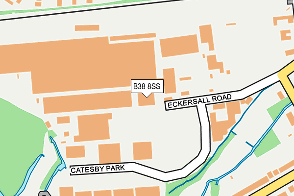
B38 8SS is located in the King's Norton North electoral ward, within the metropolitan district of Birmingham and the English Parliamentary constituency of Birmingham, Northfield. The Sub Integrated Care Board (ICB) Location is NHS Birmingham and Solihull ICB - 15E and the police force is West Midlands. This postcode has been in use since January 1980.


GetTheData
Source: OS OpenMap – Local (Ordnance Survey)
Source: OS VectorMap District (Ordnance Survey)
Licence: Open Government Licence (requires attribution)
| Easting | 404350 |
| Northing | 279301 |
| Latitude | 52.411708 |
| Longitude | -1.937468 |
GetTheData
Source: Open Postcode Geo
Licence: Open Government Licence
| Country | England |
| Postcode District | B38 |
➜ See where B38 is on a map ➜ Where is Birmingham? | |
GetTheData
Source: Land Registry Price Paid Data
Licence: Open Government Licence
Elevation or altitude of B38 8SS as distance above sea level:
| Metres | Feet | |
|---|---|---|
| Elevation | 140m | 459ft |
Elevation is measured from the approximate centre of the postcode, to the nearest point on an OS contour line from OS Terrain 50, which has contour spacing of ten vertical metres.
➜ How high above sea level am I? Find the elevation of your current position using your device's GPS.
GetTheData
Source: Open Postcode Elevation
Licence: Open Government Licence
| Ward | King's Norton North |
| Constituency | Birmingham, Northfield |
GetTheData
Source: ONS Postcode Database
Licence: Open Government Licence
| Wychall Lane (Westhill Rd) | Cotteridge | 199m |
| Kings Norton Park (Wychall Lane) | King's Norton | 216m |
| Station Rd (Camp Lane) | Cotteridge | 236m |
| Meadow Hill Rd (Wychall Lane) | Wychall | 242m |
| Station Rd (Camp Lane) | Cotteridge | 263m |
| Kings Norton Station | 0.5km |
| Bournville Station | 1.9km |
| Northfield Station | 2km |
GetTheData
Source: NaPTAN
Licence: Open Government Licence
GetTheData
Source: ONS Postcode Database
Licence: Open Government Licence


➜ Get more ratings from the Food Standards Agency
GetTheData
Source: Food Standards Agency
Licence: FSA terms & conditions
| Last Collection | |||
|---|---|---|---|
| Location | Mon-Fri | Sat | Distance |
| Westhill Road | 17:15 | 12:30 | 201m |
| Meadow Hill Road / Wychall Road | 17:15 | 12:30 | 231m |
| Middleton Hall Road / Station Road | 17:15 | 12:30 | 426m |
GetTheData
Source: Dracos
Licence: Creative Commons Attribution-ShareAlike
The below table lists the International Territorial Level (ITL) codes (formerly Nomenclature of Territorial Units for Statistics (NUTS) codes) and Local Administrative Units (LAU) codes for B38 8SS:
| ITL 1 Code | Name |
|---|---|
| TLG | West Midlands (England) |
| ITL 2 Code | Name |
| TLG3 | West Midlands |
| ITL 3 Code | Name |
| TLG31 | Birmingham |
| LAU 1 Code | Name |
| E08000025 | Birmingham |
GetTheData
Source: ONS Postcode Directory
Licence: Open Government Licence
The below table lists the Census Output Area (OA), Lower Layer Super Output Area (LSOA), and Middle Layer Super Output Area (MSOA) for B38 8SS:
| Code | Name | |
|---|---|---|
| OA | E00046224 | |
| LSOA | E01009116 | Birmingham 127D |
| MSOA | E02001953 | Birmingham 127 |
GetTheData
Source: ONS Postcode Directory
Licence: Open Government Licence
| B38 8SX | Westhill Road | 167m |
| B38 8TA | Wychall Lane | 176m |
| B38 8SN | Station Road | 229m |
| B38 8TE | Wychall Lane | 232m |
| B30 1AD | Redwood Road | 263m |
| B38 8TG | Westhill Road | 281m |
| B30 1AE | Redwood Road | 304m |
| B38 8SL | Camp Lane | 317m |
| B38 8DE | Meadow Hill Road | 336m |
| B30 1AU | Redwood Close | 345m |
GetTheData
Source: Open Postcode Geo; Land Registry Price Paid Data
Licence: Open Government Licence