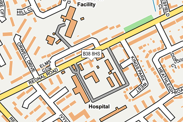
B38 8HS is located in the Longbridge & West Heath electoral ward, within the metropolitan district of Birmingham and the English Parliamentary constituency of Birmingham, Northfield. The Sub Integrated Care Board (ICB) Location is NHS Birmingham and Solihull ICB - 15E and the police force is West Midlands. This postcode has been in use since January 1980.


GetTheData
Source: OS OpenMap – Local (Ordnance Survey)
Source: OS VectorMap District (Ordnance Survey)
Licence: Open Government Licence (requires attribution)
| Easting | 403227 |
| Northing | 277862 |
| Latitude | 52.398765 |
| Longitude | -1.953998 |
GetTheData
Source: Open Postcode Geo
Licence: Open Government Licence
| Country | England |
| Postcode District | B38 |
➜ See where B38 is on a map ➜ Where is Birmingham? | |
GetTheData
Source: Land Registry Price Paid Data
Licence: Open Government Licence
Elevation or altitude of B38 8HS as distance above sea level:
| Metres | Feet | |
|---|---|---|
| Elevation | 170m | 558ft |
Elevation is measured from the approximate centre of the postcode, to the nearest point on an OS contour line from OS Terrain 50, which has contour spacing of ten vertical metres.
➜ How high above sea level am I? Find the elevation of your current position using your device's GPS.
GetTheData
Source: Open Postcode Elevation
Licence: Open Government Licence
| Ward | Longbridge & West Heath |
| Constituency | Birmingham, Northfield |
GetTheData
Source: ONS Postcode Database
Licence: Open Government Licence
| West Heath Hospital (Rednal Rd) | West Heath | 86m |
| West Heath Hospital (Rednal Rd) | West Heath | 119m |
| Redhill Rd (Rednal Rd) | West Heath | 259m |
| Grange Farm Drive (Rednal Rd) | West Heath | 291m |
| Grange Farm Drive (Rednal Rd) | West Heath | 316m |
| Northfield Station | 1.3km |
| Longbridge Station | 1.9km |
| Kings Norton Station | 2.3km |
GetTheData
Source: NaPTAN
Licence: Open Government Licence
| Percentage of properties with Next Generation Access | 100.0% |
| Percentage of properties with Superfast Broadband | 100.0% |
| Percentage of properties with Ultrafast Broadband | 100.0% |
| Percentage of properties with Full Fibre Broadband | 100.0% |
Superfast Broadband is between 30Mbps and 300Mbps
Ultrafast Broadband is > 300Mbps
| Percentage of properties unable to receive 2Mbps | 0.0% |
| Percentage of properties unable to receive 5Mbps | 0.0% |
| Percentage of properties unable to receive 10Mbps | 0.0% |
| Percentage of properties unable to receive 30Mbps | 0.0% |
GetTheData
Source: Ofcom
Licence: Ofcom Terms of Use (requires attribution)
GetTheData
Source: ONS Postcode Database
Licence: Open Government Licence


➜ Get more ratings from the Food Standards Agency
GetTheData
Source: Food Standards Agency
Licence: FSA terms & conditions
| Last Collection | |||
|---|---|---|---|
| Location | Mon-Fri | Sat | Distance |
| Rednal Road Opp West Heath Hospi | 17:30 | 12:30 | 67m |
| The Fordrough / Opposite Wakef | 17:30 | 12:30 | 362m |
| Redditch Road / Redhill Road | 17:30 | 12:30 | 478m |
GetTheData
Source: Dracos
Licence: Creative Commons Attribution-ShareAlike
The below table lists the International Territorial Level (ITL) codes (formerly Nomenclature of Territorial Units for Statistics (NUTS) codes) and Local Administrative Units (LAU) codes for B38 8HS:
| ITL 1 Code | Name |
|---|---|
| TLG | West Midlands (England) |
| ITL 2 Code | Name |
| TLG3 | West Midlands |
| ITL 3 Code | Name |
| TLG31 | Birmingham |
| LAU 1 Code | Name |
| E08000025 | Birmingham |
GetTheData
Source: ONS Postcode Directory
Licence: Open Government Licence
The below table lists the Census Output Area (OA), Lower Layer Super Output Area (LSOA), and Middle Layer Super Output Area (MSOA) for B38 8HS:
| Code | Name | |
|---|---|---|
| OA | E00046191 | |
| LSOA | E01009112 | Birmingham 127C |
| MSOA | E02001953 | Birmingham 127 |
GetTheData
Source: ONS Postcode Directory
Licence: Open Government Licence
| B38 8HT | Rednal Road | 94m |
| B38 8LE | Kings Park West | 120m |
| B38 8HX | Rednal Road | 122m |
| B38 8JE | Rothley Walk | 150m |
| B38 8JH | Birstall Way | 151m |
| B38 8HY | Elms Close | 153m |
| B38 8HP | Rednal Road | 164m |
| B38 8JD | Ivy House Road | 179m |
| B38 8LF | Kings Park West | 193m |
| B38 8JG | Ivy House Road | 211m |
GetTheData
Source: Open Postcode Geo; Land Registry Price Paid Data
Licence: Open Government Licence