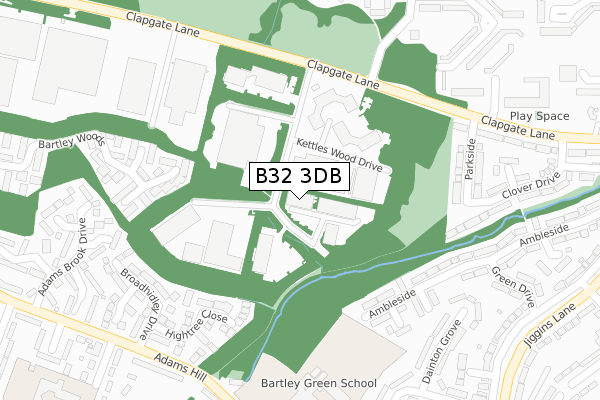
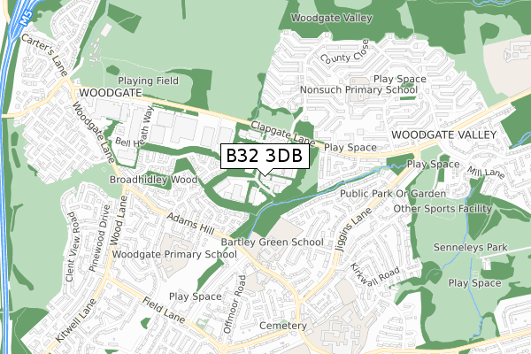
B32 3DB is located in the Bartley Green electoral ward, within the metropolitan district of Birmingham and the English Parliamentary constituency of Birmingham, Edgbaston. The Sub Integrated Care Board (ICB) Location is NHS Birmingham and Solihull ICB - 15E and the police force is West Midlands. This postcode has been in use since August 1992.


GetTheData
Source: OS Open Zoomstack (Ordnance Survey)
Licence: Open Government Licence (requires attribution)
Attribution: Contains OS data © Crown copyright and database right 2025
Source: Open Postcode Geo
Licence: Open Government Licence (requires attribution)
Attribution: Contains OS data © Crown copyright and database right 2025; Contains Royal Mail data © Royal Mail copyright and database right 2025; Source: Office for National Statistics licensed under the Open Government Licence v.3.0
| Easting | 400130 |
| Northing | 282514 |
| Latitude | 52.440610 |
| Longitude | -1.999508 |
GetTheData
Source: Open Postcode Geo
Licence: Open Government Licence
| Country | England |
| Postcode District | B32 |
➜ See where B32 is on a map ➜ Where is Birmingham? | |
GetTheData
Source: Land Registry Price Paid Data
Licence: Open Government Licence
Elevation or altitude of B32 3DB as distance above sea level:
| Metres | Feet | |
|---|---|---|
| Elevation | 180m | 591ft |
Elevation is measured from the approximate centre of the postcode, to the nearest point on an OS contour line from OS Terrain 50, which has contour spacing of ten vertical metres.
➜ How high above sea level am I? Find the elevation of your current position using your device's GPS.
GetTheData
Source: Open Postcode Elevation
Licence: Open Government Licence
| Ward | Bartley Green |
| Constituency | Birmingham, Edgbaston |
GetTheData
Source: ONS Postcode Database
Licence: Open Government Licence
| Sommerfield Rd (Clapgate Lane) | Woodgate Valley South | 233m |
| Sommerfield Rd (Clapgate Lane) | Woodgate Valley South | 246m |
| Sommerfield Rd (Clapgate Lane) | Woodgate Valley South | 251m |
| Romsley Rd (Adams Hill) | Bartley Green | 350m |
| Romsley Rd (Adams Hill) | Bartley Green | 400m |
| Northfield Station | 4.3km |
| Selly Oak Station | 4.3km |
| University Station | 4.4km |
GetTheData
Source: NaPTAN
Licence: Open Government Licence
Estimated total energy consumption in B32 3DB by fuel type, 2015.
| Consumption (kWh) | 179,163 |
|---|---|
| Meter count | 10 |
| Mean (kWh/meter) | 17,916 |
| Median (kWh/meter) | 14,011 |
GetTheData
Source: Postcode level gas estimates: 2015 (experimental)
Source: Postcode level electricity estimates: 2015 (experimental)
Licence: Open Government Licence
GetTheData
Source: ONS Postcode Database
Licence: Open Government Licence


➜ Get more ratings from the Food Standards Agency
GetTheData
Source: Food Standards Agency
Licence: FSA terms & conditions
| Last Collection | |||
|---|---|---|---|
| Location | Mon-Fri | Sat | Distance |
| Trimpley Road / Adams Hill | 17:15 | 12:00 | 525m |
| Jiggins Lane / Modbury Avenue | 17:30 | 11:30 | 548m |
| Bartley Green Post Offfice | 17:30 | 12:00 | 650m |
GetTheData
Source: Dracos
Licence: Creative Commons Attribution-ShareAlike
The below table lists the International Territorial Level (ITL) codes (formerly Nomenclature of Territorial Units for Statistics (NUTS) codes) and Local Administrative Units (LAU) codes for B32 3DB:
| ITL 1 Code | Name |
|---|---|
| TLG | West Midlands (England) |
| ITL 2 Code | Name |
| TLG3 | West Midlands |
| ITL 3 Code | Name |
| TLG31 | Birmingham |
| LAU 1 Code | Name |
| E08000025 | Birmingham |
GetTheData
Source: ONS Postcode Directory
Licence: Open Government Licence
The below table lists the Census Output Area (OA), Lower Layer Super Output Area (LSOA), and Middle Layer Super Output Area (MSOA) for B32 3DB:
| Code | Name | |
|---|---|---|
| OA | E00045303 | |
| LSOA | E01008920 | Birmingham 094B |
| MSOA | E02001920 | Birmingham 094 |
GetTheData
Source: ONS Postcode Directory
Licence: Open Government Licence
| B32 3DE | Clapgate Lane | 201m |
| B32 3RJ | Poplarwoods | 219m |
| B32 3HX | Ambleside | 248m |
| B32 3QP | Hightree Close | 260m |
| B32 3HY | Ambleside | 269m |
| B32 3DG | Parkside | 272m |
| B32 3RL | Fernwoods | 276m |
| B32 3HZ | The Knoll | 277m |
| B32 3RQ | Birchwoods | 292m |
| B32 3QN | Broadhidley Drive | 315m |
GetTheData
Source: Open Postcode Geo; Land Registry Price Paid Data
Licence: Open Government Licence