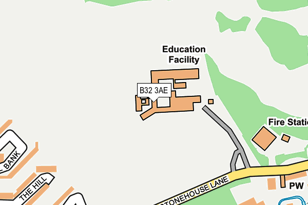
B32 3AE is located in the Bartley Green electoral ward, within the metropolitan district of Birmingham and the English Parliamentary constituency of Birmingham, Edgbaston. The Sub Integrated Care Board (ICB) Location is NHS Birmingham and Solihull ICB - 15E and the police force is West Midlands. This postcode has been in use since January 1980.


GetTheData
Source: OS OpenMap – Local (Ordnance Survey)
Source: OS VectorMap District (Ordnance Survey)
Licence: Open Government Licence (requires attribution)
| Easting | 401291 |
| Northing | 283087 |
| Latitude | 52.445745 |
| Longitude | -1.982433 |
GetTheData
Source: Open Postcode Geo
Licence: Open Government Licence
| Country | England |
| Postcode District | B32 |
➜ See where B32 is on a map ➜ Where is Birmingham? | |
GetTheData
Source: Land Registry Price Paid Data
Licence: Open Government Licence
Elevation or altitude of B32 3AE as distance above sea level:
| Metres | Feet | |
|---|---|---|
| Elevation | 160m | 525ft |
Elevation is measured from the approximate centre of the postcode, to the nearest point on an OS contour line from OS Terrain 50, which has contour spacing of ten vertical metres.
➜ How high above sea level am I? Find the elevation of your current position using your device's GPS.
GetTheData
Source: Open Postcode Elevation
Licence: Open Government Licence
| Ward | Bartley Green |
| Constituency | Birmingham, Edgbaston |
GetTheData
Source: ONS Postcode Database
Licence: Open Government Licence
| Hillcrest School (Stonehouse Lane) | California | 194m |
| Hillcrest School (Stonehouse Lane) | California | 221m |
| Hillcrest School (West Boulevard) | California | 319m |
| Simmons Leasow (Stonehouse Lane) | Woodgate Valley South | 321m |
| Barnes Hill (Stonehouse Lane) | California | 332m |
| University Station | 3.2km |
| Selly Oak Station | 3.2km |
| Northfield Station | 4.3km |
GetTheData
Source: NaPTAN
Licence: Open Government Licence
GetTheData
Source: ONS Postcode Database
Licence: Open Government Licence


➜ Get more ratings from the Food Standards Agency
GetTheData
Source: Food Standards Agency
Licence: FSA terms & conditions
| Last Collection | |||
|---|---|---|---|
| Location | Mon-Fri | Sat | Distance |
| 314 Stonehouse Lane | 16:00 | 12:00 | 317m |
| Gravel Bank Woodgate Valley | 16:00 | 12:00 | 438m |
| Stonebrook Way / Barnes Hill | 17:30 | 12:30 | 456m |
GetTheData
Source: Dracos
Licence: Creative Commons Attribution-ShareAlike
The below table lists the International Territorial Level (ITL) codes (formerly Nomenclature of Territorial Units for Statistics (NUTS) codes) and Local Administrative Units (LAU) codes for B32 3AE:
| ITL 1 Code | Name |
|---|---|
| TLG | West Midlands (England) |
| ITL 2 Code | Name |
| TLG3 | West Midlands |
| ITL 3 Code | Name |
| TLG31 | Birmingham |
| LAU 1 Code | Name |
| E08000025 | Birmingham |
GetTheData
Source: ONS Postcode Directory
Licence: Open Government Licence
The below table lists the Census Output Area (OA), Lower Layer Super Output Area (LSOA), and Middle Layer Super Output Area (MSOA) for B32 3AE:
| Code | Name | |
|---|---|---|
| OA | E00045286 | |
| LSOA | E01008919 | Birmingham 095A |
| MSOA | E02001921 | Birmingham 095 |
GetTheData
Source: ONS Postcode Directory
Licence: Open Government Licence
| B32 3RP | Simmons Leasow | 286m |
| B32 3RS | The Hill | 289m |
| B32 3AG | Stonehouse Lane | 322m |
| B32 3SG | Gravel Bank | 324m |
| B32 3AH | Stonehouse Lane | 327m |
| B32 3SQ | Gravel Bank | 339m |
| B32 3AL | Stonehouse Lane | 344m |
| B32 3RT | The Hill | 373m |
| B32 3AD | Stonehouse Lane | 373m |
| B32 3BJ | Rush Green | 378m |
GetTheData
Source: Open Postcode Geo; Land Registry Price Paid Data
Licence: Open Government Licence