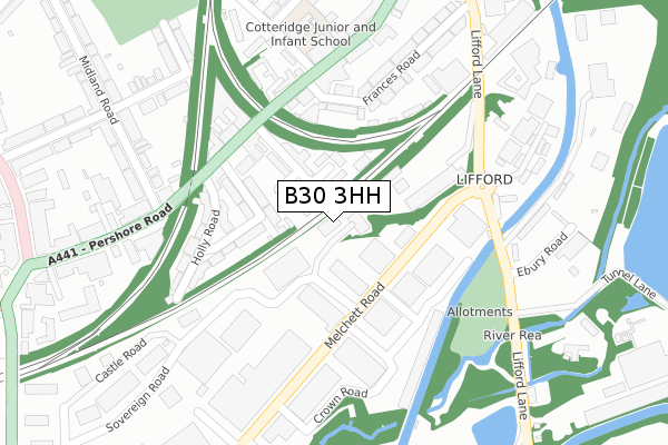
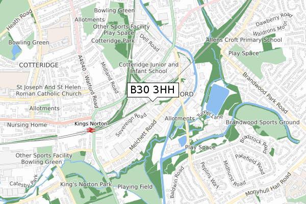
B30 3HH is located in the King's Norton North electoral ward, within the metropolitan district of Birmingham and the English Parliamentary constituency of Birmingham, Northfield. The Sub Integrated Care Board (ICB) Location is NHS Birmingham and Solihull ICB - 15E and the police force is West Midlands. This postcode has been in use since September 1991.


GetTheData
Source: OS Open Zoomstack (Ordnance Survey)
Licence: Open Government Licence (requires attribution)
Attribution: Contains OS data © Crown copyright and database right 2025
Source: Open Postcode Geo
Licence: Open Government Licence (requires attribution)
Attribution: Contains OS data © Crown copyright and database right 2025; Contains Royal Mail data © Royal Mail copyright and database right 2025; Source: Office for National Statistics licensed under the Open Government Licence v.3.0
| Easting | 405284 |
| Northing | 279842 |
| Latitude | 52.416564 |
| Longitude | -1.923729 |
GetTheData
Source: Open Postcode Geo
Licence: Open Government Licence
| Country | England |
| Postcode District | B30 |
➜ See where B30 is on a map ➜ Where is Birmingham? | |
GetTheData
Source: Land Registry Price Paid Data
Licence: Open Government Licence
Elevation or altitude of B30 3HH as distance above sea level:
| Metres | Feet | |
|---|---|---|
| Elevation | 150m | 492ft |
Elevation is measured from the approximate centre of the postcode, to the nearest point on an OS contour line from OS Terrain 50, which has contour spacing of ten vertical metres.
➜ How high above sea level am I? Find the elevation of your current position using your device's GPS.
GetTheData
Source: Open Postcode Elevation
Licence: Open Government Licence
| Ward | King's Norton North |
| Constituency | Birmingham, Northfield |
GetTheData
Source: ONS Postcode Database
Licence: Open Government Licence
| Breedon Rd (Pershore Rd) | Lifford | 186m |
| Breedon Rd (Pershore Rd) | Lifford | 206m |
| Midland Rd (Pershore Rd) | Cotteridge | 226m |
| Midland Rd (Pershore Rd) | Cotteridge | 231m |
| Breedon Cross Bridge (Pershore Rd) | Lifford | 298m |
| Kings Norton Station | 0.6km |
| Bournville Station | 1.2km |
| Selly Oak Station | 2.9km |
GetTheData
Source: NaPTAN
Licence: Open Government Licence
GetTheData
Source: ONS Postcode Database
Licence: Open Government Licence


➜ Get more ratings from the Food Standards Agency
GetTheData
Source: Food Standards Agency
Licence: FSA terms & conditions
| Last Collection | |||
|---|---|---|---|
| Location | Mon-Fri | Sat | Distance |
| Cotteridge | 17:15 | 12:30 | 193m |
| St Agnes Church | 17:15 | 12:30 | 306m |
| Kings Norton Business Centre | 18:30 | 352m | |
GetTheData
Source: Dracos
Licence: Creative Commons Attribution-ShareAlike
The below table lists the International Territorial Level (ITL) codes (formerly Nomenclature of Territorial Units for Statistics (NUTS) codes) and Local Administrative Units (LAU) codes for B30 3HH:
| ITL 1 Code | Name |
|---|---|
| TLG | West Midlands (England) |
| ITL 2 Code | Name |
| TLG3 | West Midlands |
| ITL 3 Code | Name |
| TLG31 | Birmingham |
| LAU 1 Code | Name |
| E08000025 | Birmingham |
GetTheData
Source: ONS Postcode Directory
Licence: Open Government Licence
The below table lists the Census Output Area (OA), Lower Layer Super Output Area (LSOA), and Middle Layer Super Output Area (MSOA) for B30 3HH:
| Code | Name | |
|---|---|---|
| OA | E00046223 | |
| LSOA | E01009119 | Birmingham 123C |
| MSOA | E02001949 | Birmingham 123 |
GetTheData
Source: ONS Postcode Directory
Licence: Open Government Licence
| B30 3ET | Hudsons View | 62m |
| B30 3BE | Hudsons Drive | 64m |
| B30 3AZ | Cotteridge Road | 120m |
| B30 3AY | Laurel Road | 156m |
| B30 3AU | Pershore Road | 176m |
| B30 3BG | Pershore Road | 190m |
| B30 3DN | Pershore Road | 205m |
| B30 3AX | Holly Road | 210m |
| B30 3DU | Frances Road | 233m |
| B30 3DP | Pershore Road | 246m |
GetTheData
Source: Open Postcode Geo; Land Registry Price Paid Data
Licence: Open Government Licence