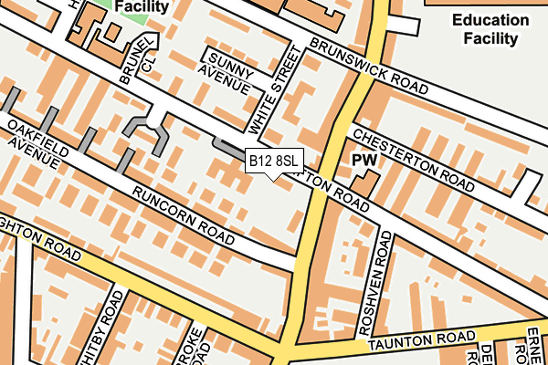
B12 8SL is located in the Sparkbrook & Balsall Heath East electoral ward, within the metropolitan district of Birmingham and the English Parliamentary constituency of Birmingham, Hall Green. The Sub Integrated Care Board (ICB) Location is NHS Birmingham and Solihull ICB - 15E and the police force is West Midlands. This postcode has been in use since April 1985.


GetTheData
Source: OS OpenMap – Local (Ordnance Survey)
Source: OS VectorMap District (Ordnance Survey)
Licence: Open Government Licence (requires attribution)
| Easting | 408369 |
| Northing | 284082 |
| Latitude | 52.454629 |
| Longitude | -1.878272 |
GetTheData
Source: Open Postcode Geo
Licence: Open Government Licence
| Country | England |
| Postcode District | B12 |
➜ See where B12 is on a map ➜ Where is Birmingham? | |
GetTheData
Source: Land Registry Price Paid Data
Licence: Open Government Licence
Elevation or altitude of B12 8SL as distance above sea level:
| Metres | Feet | |
|---|---|---|
| Elevation | 130m | 427ft |
Elevation is measured from the approximate centre of the postcode, to the nearest point on an OS contour line from OS Terrain 50, which has contour spacing of ten vertical metres.
➜ How high above sea level am I? Find the elevation of your current position using your device's GPS.
GetTheData
Source: Open Postcode Elevation
Licence: Open Government Licence
| Ward | Sparkbrook & Balsall Heath East |
| Constituency | Birmingham, Hall Green |
GetTheData
Source: ONS Postcode Database
Licence: Open Government Licence
| Balsall Heath Park (Taunton Rd) | Balsall Heath | 181m |
| Balsall Heath Park (Taunton Rd) | Balsall Heath | 184m |
| Fullham Rd (Stoney Lane) | Sparkbrook | 318m |
| Clifton Rd (Stoney Lane) | Balsall Heath | 328m |
| Fullham Rd (Stoney Lane) | Sparkbrook | 344m |
| Small Heath Station | 1.6km |
| Bordesley Station | 1.9km |
| Tyseley Station | 2.7km |
GetTheData
Source: NaPTAN
Licence: Open Government Licence
| Percentage of properties with Next Generation Access | 80.0% |
| Percentage of properties with Superfast Broadband | 80.0% |
| Percentage of properties with Ultrafast Broadband | 80.0% |
| Percentage of properties with Full Fibre Broadband | 0.0% |
Superfast Broadband is between 30Mbps and 300Mbps
Ultrafast Broadband is > 300Mbps
| Percentage of properties unable to receive 2Mbps | 0.0% |
| Percentage of properties unable to receive 5Mbps | 0.0% |
| Percentage of properties unable to receive 10Mbps | 20.0% |
| Percentage of properties unable to receive 30Mbps | 20.0% |
GetTheData
Source: Ofcom
Licence: Ofcom Terms of Use (requires attribution)
GetTheData
Source: ONS Postcode Database
Licence: Open Government Licence


➜ Get more ratings from the Food Standards Agency
GetTheData
Source: Food Standards Agency
Licence: FSA terms & conditions
| Last Collection | |||
|---|---|---|---|
| Location | Mon-Fri | Sat | Distance |
| Brighton Road Opposite Kingswood | 18:15 | 12:30 | 252m |
| Brunswick Road / Stoney Lane | 17:45 | 12:30 | 310m |
| Church Road Post Office | 17:30 | 12:30 | 325m |
GetTheData
Source: Dracos
Licence: Creative Commons Attribution-ShareAlike
The below table lists the International Territorial Level (ITL) codes (formerly Nomenclature of Territorial Units for Statistics (NUTS) codes) and Local Administrative Units (LAU) codes for B12 8SL:
| ITL 1 Code | Name |
|---|---|
| TLG | West Midlands (England) |
| ITL 2 Code | Name |
| TLG3 | West Midlands |
| ITL 3 Code | Name |
| TLG31 | Birmingham |
| LAU 1 Code | Name |
| E08000025 | Birmingham |
GetTheData
Source: ONS Postcode Directory
Licence: Open Government Licence
The below table lists the Census Output Area (OA), Lower Layer Super Output Area (LSOA), and Middle Layer Super Output Area (MSOA) for B12 8SL:
| Code | Name | |
|---|---|---|
| OA | E00047516 | |
| LSOA | E01009377 | Birmingham 083C |
| MSOA | E02001909 | Birmingham 083 |
GetTheData
Source: ONS Postcode Directory
Licence: Open Government Licence
| B12 8RD | Laurel Avenue | 56m |
| B12 8RB | Runcorn Road | 87m |
| B12 8SF | White Street | 95m |
| B12 8QY | Runcorn Road | 102m |
| B12 8JY | Ladypool Road | 105m |
| B12 8JU | Ladypool Road | 115m |
| B12 8QZ | Poplar Avenue | 116m |
| B12 8RF | Myrtle Avenue | 118m |
| B12 8RZ | Ash Grove | 119m |
| B12 8BX | Roshven Road | 134m |
GetTheData
Source: Open Postcode Geo; Land Registry Price Paid Data
Licence: Open Government Licence