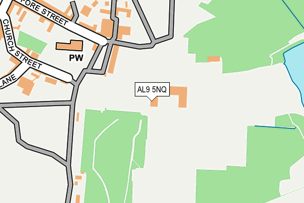
AL9 5NQ is located in the Hatfield East electoral ward, within the local authority district of Welwyn Hatfield and the English Parliamentary constituency of Welwyn Hatfield. The Sub Integrated Care Board (ICB) Location is NHS Hertfordshire and West Essex ICB - 06K and the police force is Hertfordshire. This postcode has been in use since January 1980.


GetTheData
Source: OS OpenMap – Local (Ordnance Survey)
Source: OS VectorMap District (Ordnance Survey)
Licence: Open Government Licence (requires attribution)
| Easting | 523659 |
| Northing | 208376 |
| Latitude | 51.760425 |
| Longitude | -0.209653 |
GetTheData
Source: Open Postcode Geo
Licence: Open Government Licence
| Country | England |
| Postcode District | AL9 |
➜ See where AL9 is on a map ➜ Where is Hatfield? | |
GetTheData
Source: Land Registry Price Paid Data
Licence: Open Government Licence
Elevation or altitude of AL9 5NQ as distance above sea level:
| Metres | Feet | |
|---|---|---|
| Elevation | 100m | 328ft |
Elevation is measured from the approximate centre of the postcode, to the nearest point on an OS contour line from OS Terrain 50, which has contour spacing of ten vertical metres.
➜ How high above sea level am I? Find the elevation of your current position using your device's GPS.
GetTheData
Source: Open Postcode Elevation
Licence: Open Government Licence
| Ward | Hatfield East |
| Constituency | Welwyn Hatfield |
GetTheData
Source: ONS Postcode Database
Licence: Open Government Licence
| St Etheldreda's Drive (French Horn Lane) | Hatfield | 514m |
| Hatfield Railway Station (Private Road) | Hatfield | 518m |
| Hatfield Railway Station (Private Road) | Hatfield | 527m |
| Hatfield Railway Station (Private Road) | Hatfield | 534m |
| Hatfield Railway Station (Private Road) | Hatfield | 537m |
| Hatfield (Herts) Station | 0.6km |
| Welham Green Station | 2.7km |
| Brookmans Park Station | 4.4km |
GetTheData
Source: NaPTAN
Licence: Open Government Licence
GetTheData
Source: ONS Postcode Database
Licence: Open Government Licence


➜ Get more ratings from the Food Standards Agency
GetTheData
Source: Food Standards Agency
Licence: FSA terms & conditions
| Last Collection | |||
|---|---|---|---|
| Location | Mon-Fri | Sat | Distance |
| The Park Fore Street | 17:00 | 12:00 | 169m |
| Salisbury Square P O | 18:00 | 12:00 | 465m |
| Hatfield Station | 17:00 | 12:00 | 541m |
GetTheData
Source: Dracos
Licence: Creative Commons Attribution-ShareAlike
The below table lists the International Territorial Level (ITL) codes (formerly Nomenclature of Territorial Units for Statistics (NUTS) codes) and Local Administrative Units (LAU) codes for AL9 5NQ:
| ITL 1 Code | Name |
|---|---|
| TLH | East |
| ITL 2 Code | Name |
| TLH2 | Bedfordshire and Hertfordshire |
| ITL 3 Code | Name |
| TLH23 | Hertfordshire CC |
| LAU 1 Code | Name |
| E07000241 | Welwyn Hatfield |
GetTheData
Source: ONS Postcode Directory
Licence: Open Government Licence
The below table lists the Census Output Area (OA), Lower Layer Super Output Area (LSOA), and Middle Layer Super Output Area (MSOA) for AL9 5NQ:
| Code | Name | |
|---|---|---|
| OA | E00121500 | |
| LSOA | E01023926 | Welwyn Hatfield 011C |
| MSOA | E02004990 | Welwyn Hatfield 011 |
GetTheData
Source: ONS Postcode Directory
Licence: Open Government Licence
| AL9 5AR | Church Street | 223m |
| AL9 5AJ | The Close | 253m |
| AL9 5AH | Fore Street | 276m |
| AL9 5AN | Fore Street | 295m |
| AL9 5AW | Church Street | 304m |
| AL9 5AS | Church Street | 315m |
| AL9 5HX | Church Lane | 338m |
| AL9 5HY | Jacobs Ladder | 338m |
| AL9 5HZ | The Broadway | 349m |
| AL9 5AX | Park Street | 363m |
GetTheData
Source: Open Postcode Geo; Land Registry Price Paid Data
Licence: Open Government Licence