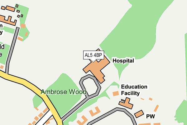
AL5 4BP is located in the Harpenden North & Rural electoral ward, within the local authority district of St Albans and the English Parliamentary constituency of Hitchin and Harpenden. The Sub Integrated Care Board (ICB) Location is NHS Hertfordshire and West Essex ICB - 06N and the police force is Hertfordshire. This postcode has been in use since January 1983.


GetTheData
Source: OS OpenMap – Local (Ordnance Survey)
Source: OS VectorMap District (Ordnance Survey)
Licence: Open Government Licence (requires attribution)
| Easting | 513087 |
| Northing | 215661 |
| Latitude | 51.828130 |
| Longitude | -0.360392 |
GetTheData
Source: Open Postcode Geo
Licence: Open Government Licence
| Country | England |
| Postcode District | AL5 |
➜ See where AL5 is on a map | |
GetTheData
Source: Land Registry Price Paid Data
Licence: Open Government Licence
Elevation or altitude of AL5 4BP as distance above sea level:
| Metres | Feet | |
|---|---|---|
| Elevation | 130m | 427ft |
Elevation is measured from the approximate centre of the postcode, to the nearest point on an OS contour line from OS Terrain 50, which has contour spacing of ten vertical metres.
➜ How high above sea level am I? Find the elevation of your current position using your device's GPS.
GetTheData
Source: Open Postcode Elevation
Licence: Open Government Licence
| Ward | Harpenden North & Rural |
| Constituency | Hitchin And Harpenden |
GetTheData
Source: ONS Postcode Database
Licence: Open Government Licence
| Dell Close (Westfield Road) | Harpenden | 451m |
| Dell Close (Westfield Road) | Harpenden | 471m |
| Masefield Road (Westfield Road) | Harpenden | 527m |
| Masefield Road (Westfield Road) | Harpenden | 536m |
| Bramble Close (Hollybush Lane) | Harpenden | 547m |
| Harpenden Station | 1.6km |
| Luton Airport Parkway Station | 5.5km |
GetTheData
Source: NaPTAN
Licence: Open Government Licence
GetTheData
Source: ONS Postcode Database
Licence: Open Government Licence


➜ Get more ratings from the Food Standards Agency
GetTheData
Source: Food Standards Agency
Licence: FSA terms & conditions
| Last Collection | |||
|---|---|---|---|
| Location | Mon-Fri | Sat | Distance |
| Ambrose Lane | 18:30 | 12:00 | 319m |
| Westfield Road | 17:00 | 11:45 | 607m |
| Luton Road P.o. | 18:00 | 12:00 | 608m |
GetTheData
Source: Dracos
Licence: Creative Commons Attribution-ShareAlike
The below table lists the International Territorial Level (ITL) codes (formerly Nomenclature of Territorial Units for Statistics (NUTS) codes) and Local Administrative Units (LAU) codes for AL5 4BP:
| ITL 1 Code | Name |
|---|---|
| TLH | East |
| ITL 2 Code | Name |
| TLH2 | Bedfordshire and Hertfordshire |
| ITL 3 Code | Name |
| TLH23 | Hertfordshire CC |
| LAU 1 Code | Name |
| E07000240 | St Albans |
GetTheData
Source: ONS Postcode Directory
Licence: Open Government Licence
The below table lists the Census Output Area (OA), Lower Layer Super Output Area (LSOA), and Middle Layer Super Output Area (MSOA) for AL5 4BP:
| Code | Name | |
|---|---|---|
| OA | E00120303 | |
| LSOA | E01023690 | St Albans 001A |
| MSOA | E02004924 | St Albans 001 |
GetTheData
Source: ONS Postcode Directory
Licence: Open Government Licence
| AL5 4BU | Ambrose Lane | 318m |
| AL5 4DG | Ambrose Lane | 375m |
| AL5 4HT | Lindley Close | 385m |
| AL5 4DB | Bloomfield Road | 394m |
| AL5 4DD | Bloomfield Road | 406m |
| AL5 4HS | Lindley Close | 411m |
| AL5 4LQ | Highmoor | 413m |
| AL5 4BS | Hillside Road | 421m |
| AL5 4BT | Hillside Road | 421m |
| AL5 4LG | Springfield Crescent | 426m |
GetTheData
Source: Open Postcode Geo; Land Registry Price Paid Data
Licence: Open Government Licence