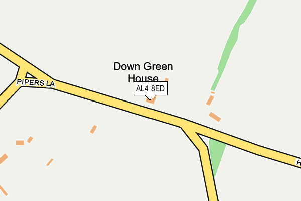
AL4 8ED is located in the Sandridge & Wheathampstead electoral ward, within the local authority district of St Albans and the English Parliamentary constituency of Hitchin and Harpenden. The Sub Integrated Care Board (ICB) Location is NHS Hertfordshire and West Essex ICB - 06N and the police force is Hertfordshire. This postcode has been in use since January 1980.


GetTheData
Source: OS OpenMap – Local (Ordnance Survey)
Source: OS VectorMap District (Ordnance Survey)
Licence: Open Government Licence (requires attribution)
| Easting | 516687 |
| Northing | 213723 |
| Latitude | 51.809980 |
| Longitude | -0.308804 |
GetTheData
Source: Open Postcode Geo
Licence: Open Government Licence
| Country | England |
| Postcode District | AL4 |
➜ See where AL4 is on a map | |
GetTheData
Source: Land Registry Price Paid Data
Licence: Open Government Licence
Elevation or altitude of AL4 8ED as distance above sea level:
| Metres | Feet | |
|---|---|---|
| Elevation | 120m | 394ft |
Elevation is measured from the approximate centre of the postcode, to the nearest point on an OS contour line from OS Terrain 50, which has contour spacing of ten vertical metres.
➜ How high above sea level am I? Find the elevation of your current position using your device's GPS.
GetTheData
Source: Open Postcode Elevation
Licence: Open Government Licence
| Ward | Sandridge & Wheathampstead |
| Constituency | Hitchin And Harpenden |
GetTheData
Source: ONS Postcode Database
Licence: Open Government Licence
| Cottages (Lower Luton Road) | The Folly | 740m |
| Church (Brewhouse Hill) | Wheathampstead | 748m |
| Cottages (Lower Luton Road) | The Folly | 765m |
| Church (Brewhouse Hill) | Wheathampstead | 773m |
| Folly Fields (Lower Luton Road) | The Folly | 854m |
| Harpenden Station | 3km |
GetTheData
Source: NaPTAN
Licence: Open Government Licence
| Percentage of properties with Next Generation Access | 0.0% |
| Percentage of properties with Superfast Broadband | 0.0% |
| Percentage of properties with Ultrafast Broadband | 0.0% |
| Percentage of properties with Full Fibre Broadband | 0.0% |
Superfast Broadband is between 30Mbps and 300Mbps
Ultrafast Broadband is > 300Mbps
| Percentage of properties unable to receive 2Mbps | 0.0% |
| Percentage of properties unable to receive 5Mbps | 0.0% |
| Percentage of properties unable to receive 10Mbps | 0.0% |
| Percentage of properties unable to receive 30Mbps | 100.0% |
GetTheData
Source: Ofcom
Licence: Ofcom Terms of Use (requires attribution)
GetTheData
Source: ONS Postcode Database
Licence: Open Government Licence


➜ Get more ratings from the Food Standards Agency
GetTheData
Source: Food Standards Agency
Licence: FSA terms & conditions
| Last Collection | |||
|---|---|---|---|
| Location | Mon-Fri | Sat | Distance |
| Amwell | 16:15 | 10:15 | 580m |
| The Folly Wheathampstead | 17:00 | 10:15 | 845m |
| Butterfield Road | 16:15 | 10:00 | 888m |
GetTheData
Source: Dracos
Licence: Creative Commons Attribution-ShareAlike
The below table lists the International Territorial Level (ITL) codes (formerly Nomenclature of Territorial Units for Statistics (NUTS) codes) and Local Administrative Units (LAU) codes for AL4 8ED:
| ITL 1 Code | Name |
|---|---|
| TLH | East |
| ITL 2 Code | Name |
| TLH2 | Bedfordshire and Hertfordshire |
| ITL 3 Code | Name |
| TLH23 | Hertfordshire CC |
| LAU 1 Code | Name |
| E07000240 | St Albans |
GetTheData
Source: ONS Postcode Directory
Licence: Open Government Licence
The below table lists the Census Output Area (OA), Lower Layer Super Output Area (LSOA), and Middle Layer Super Output Area (MSOA) for AL4 8ED:
| Code | Name | |
|---|---|---|
| OA | E00120585 | |
| LSOA | E01023749 | St Albans 004D |
| MSOA | E02004927 | St Albans 004 |
GetTheData
Source: ONS Postcode Directory
Licence: Open Government Licence
| AL4 8EB | Down Green Lane | 483m |
| AL4 8EA | Amwell Lane | 555m |
| AL4 8DZ | Amwell Lane | 578m |
| AL4 8AH | Brewhouse Hill | 592m |
| AL4 8AJ | Hilltop View | 593m |
| AL5 1AF | Pipers Lane | 628m |
| AL4 8EE | Leasey Bridge Lane | 639m |
| AL4 8QQ | Butterfield Road | 642m |
| AL4 8DY | High Ash Road | 685m |
| AL4 8AQ | Brewhouse Hill | 692m |
GetTheData
Source: Open Postcode Geo; Land Registry Price Paid Data
Licence: Open Government Licence