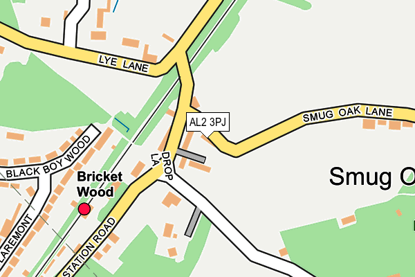
AL2 3PJ is located in the St Stephen electoral ward, within the local authority district of St Albans and the English Parliamentary constituency of St Albans. The Sub Integrated Care Board (ICB) Location is NHS Hertfordshire and West Essex ICB - 06N and the police force is Hertfordshire. This postcode has been in use since January 1980.


GetTheData
Source: OS OpenMap – Local (Ordnance Survey)
Source: OS VectorMap District (Ordnance Survey)
Licence: Open Government Licence (requires attribution)
| Easting | 513658 |
| Northing | 202134 |
| Latitude | 51.706447 |
| Longitude | -0.356508 |
GetTheData
Source: Open Postcode Geo
Licence: Open Government Licence
| Country | England |
| Postcode District | AL2 |
➜ See where AL2 is on a map ➜ Where is Bricket Wood? | |
GetTheData
Source: Land Registry Price Paid Data
Licence: Open Government Licence
Elevation or altitude of AL2 3PJ as distance above sea level:
| Metres | Feet | |
|---|---|---|
| Elevation | 80m | 262ft |
Elevation is measured from the approximate centre of the postcode, to the nearest point on an OS contour line from OS Terrain 50, which has contour spacing of ten vertical metres.
➜ How high above sea level am I? Find the elevation of your current position using your device's GPS.
GetTheData
Source: Open Postcode Elevation
Licence: Open Government Licence
| Ward | St Stephen |
| Constituency | St Albans |
GetTheData
Source: ONS Postcode Database
Licence: Open Government Licence
| Green (Lye Lane) | Smug Oak | 141m |
| Green (Lye Lane) | Smug Oak | 147m |
| Lye Lane (Park Street Lane) | Smug Oak | 212m |
| Lye Lane (Park Street Lane) | Smug Oak | 213m |
| South Riding (Black Boy Wood) | Bricket Wood | 414m |
| Bricket Wood Station | 0.2km |
| How Wood (Herts) Station | 1.5km |
| Park Street Station | 2.4km |
GetTheData
Source: NaPTAN
Licence: Open Government Licence
GetTheData
Source: ONS Postcode Database
Licence: Open Government Licence


➜ Get more ratings from the Food Standards Agency
GetTheData
Source: Food Standards Agency
Licence: FSA terms & conditions
| Last Collection | |||
|---|---|---|---|
| Location | Mon-Fri | Sat | Distance |
| Oakwood Road Post Office | 18:30 | 12:00 | 752m |
| Ferndene | 17:30 | 12:00 | 988m |
| How Wood P.o | 18:30 | 12:00 | 1,512m |
GetTheData
Source: Dracos
Licence: Creative Commons Attribution-ShareAlike
The below table lists the International Territorial Level (ITL) codes (formerly Nomenclature of Territorial Units for Statistics (NUTS) codes) and Local Administrative Units (LAU) codes for AL2 3PJ:
| ITL 1 Code | Name |
|---|---|
| TLH | East |
| ITL 2 Code | Name |
| TLH2 | Bedfordshire and Hertfordshire |
| ITL 3 Code | Name |
| TLH23 | Hertfordshire CC |
| LAU 1 Code | Name |
| E07000240 | St Albans |
GetTheData
Source: ONS Postcode Directory
Licence: Open Government Licence
The below table lists the Census Output Area (OA), Lower Layer Super Output Area (LSOA), and Middle Layer Super Output Area (MSOA) for AL2 3PJ:
| Code | Name | |
|---|---|---|
| OA | E00120451 | |
| LSOA | E01023717 | St Albans 020A |
| MSOA | E02004943 | St Albans 020 |
GetTheData
Source: ONS Postcode Directory
Licence: Open Government Licence
| AL2 3PW | Station Road | 55m |
| AL2 3PF | Station Road | 58m |
| AL2 3PE | Railway Cottages | 116m |
| AL2 3PH | Drop Lane | 142m |
| AL2 3LN | Black Boy Wood | 177m |
| AL2 3TL | Lye Lane | 187m |
| AL2 3PQ | Station Road | 231m |
| AL2 3LW | Black Boy Wood | 254m |
| AL2 3TH | Lye Lane | 289m |
| AL2 3PN | Smug Oak Lane | 293m |
GetTheData
Source: Open Postcode Geo; Land Registry Price Paid Data
Licence: Open Government Licence