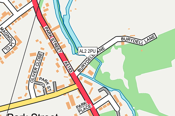
AL2 2PU lies on Burydell Lane in Park Street, St. Albans. AL2 2PU is located in the Park Street electoral ward, within the local authority district of St Albans and the English Parliamentary constituency of St Albans. The Sub Integrated Care Board (ICB) Location is NHS Hertfordshire and West Essex ICB - 06N and the police force is Hertfordshire. This postcode has been in use since September 1991.


GetTheData
Source: OS OpenMap – Local (Ordnance Survey)
Source: OS VectorMap District (Ordnance Survey)
Licence: Open Government Licence (requires attribution)
| Easting | 514890 |
| Northing | 204008 |
| Latitude | 51.723039 |
| Longitude | -0.338069 |
GetTheData
Source: Open Postcode Geo
Licence: Open Government Licence
| Street | Burydell Lane |
| Locality | Park Street |
| Town/City | St. Albans |
| Country | England |
| Postcode District | AL2 |
➜ See where AL2 is on a map ➜ Where is Park Street? | |
GetTheData
Source: Land Registry Price Paid Data
Licence: Open Government Licence
Elevation or altitude of AL2 2PU as distance above sea level:
| Metres | Feet | |
|---|---|---|
| Elevation | 70m | 230ft |
Elevation is measured from the approximate centre of the postcode, to the nearest point on an OS contour line from OS Terrain 50, which has contour spacing of ten vertical metres.
➜ How high above sea level am I? Find the elevation of your current position using your device's GPS.
GetTheData
Source: Open Postcode Elevation
Licence: Open Government Licence
| Ward | Park Street |
| Constituency | St Albans |
GetTheData
Source: ONS Postcode Database
Licence: Open Government Licence
| War Memorial (Park Street) | Park Street | 64m |
| War Memorial (Park Street) | Park Street | 81m |
| Park Street Railway Station (Park Street) | Park Street | 163m |
| Oliver Close (Park Street Lane) | Park Street | 170m |
| Oliver Close (Park Street Lane) | Park Street | 178m |
| Park Street Station | 0.3km |
| How Wood (Herts) Station | 0.7km |
| St Albans Abbey Station | 2.4km |
GetTheData
Source: NaPTAN
Licence: Open Government Licence
| Percentage of properties with Next Generation Access | 100.0% |
| Percentage of properties with Superfast Broadband | 100.0% |
| Percentage of properties with Ultrafast Broadband | 100.0% |
| Percentage of properties with Full Fibre Broadband | 0.0% |
Superfast Broadband is between 30Mbps and 300Mbps
Ultrafast Broadband is > 300Mbps
| Percentage of properties unable to receive 2Mbps | 0.0% |
| Percentage of properties unable to receive 5Mbps | 0.0% |
| Percentage of properties unable to receive 10Mbps | 0.0% |
| Percentage of properties unable to receive 30Mbps | 0.0% |
GetTheData
Source: Ofcom
Licence: Ofcom Terms of Use (requires attribution)
GetTheData
Source: ONS Postcode Database
Licence: Open Government Licence


➜ Get more ratings from the Food Standards Agency
GetTheData
Source: Food Standards Agency
Licence: FSA terms & conditions
| Last Collection | |||
|---|---|---|---|
| Location | Mon-Fri | Sat | Distance |
| Mount Drive | 17:30 | 12:00 | 530m |
| Orchard Drive | 17:30 | 12:00 | 612m |
| How Wood P.o | 18:30 | 12:00 | 949m |
GetTheData
Source: Dracos
Licence: Creative Commons Attribution-ShareAlike
The below table lists the International Territorial Level (ITL) codes (formerly Nomenclature of Territorial Units for Statistics (NUTS) codes) and Local Administrative Units (LAU) codes for AL2 2PU:
| ITL 1 Code | Name |
|---|---|
| TLH | East |
| ITL 2 Code | Name |
| TLH2 | Bedfordshire and Hertfordshire |
| ITL 3 Code | Name |
| TLH23 | Hertfordshire CC |
| LAU 1 Code | Name |
| E07000240 | St Albans |
GetTheData
Source: ONS Postcode Directory
Licence: Open Government Licence
The below table lists the Census Output Area (OA), Lower Layer Super Output Area (LSOA), and Middle Layer Super Output Area (MSOA) for AL2 2PU:
| Code | Name | |
|---|---|---|
| OA | E00120456 | |
| LSOA | E01023720 | St Albans 019C |
| MSOA | E02004942 | St Albans 019 |
GetTheData
Source: ONS Postcode Directory
Licence: Open Government Licence
| AL2 2PG | Burydell Lane | 40m |
| AL2 2JE | Burydell Lane | 46m |
| AL2 2PH | Park Street | 85m |
| AL2 2QA | Park Street | 90m |
| AL2 2PW | Park Street | 91m |
| AL2 2PS | Park Street | 106m |
| AL2 2PR | Park Street | 114m |
| AL2 2PT | Park Street | 127m |
| AL2 2PQ | Burydell Lane | 132m |
| AL2 2ND | Park Street Lane | 142m |
GetTheData
Source: Open Postcode Geo; Land Registry Price Paid Data
Licence: Open Government Licence