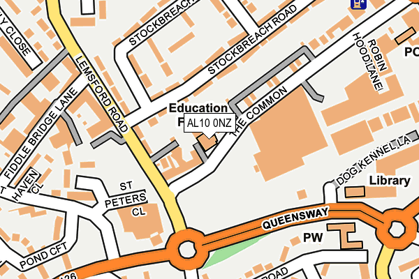
AL10 0NZ lies on The Common in Hatfield. AL10 0NZ is located in the Hatfield Central electoral ward, within the local authority district of Welwyn Hatfield and the English Parliamentary constituency of Welwyn Hatfield. The Sub Integrated Care Board (ICB) Location is NHS Hertfordshire and West Essex ICB - 06K and the police force is Hertfordshire. This postcode has been in use since April 1985.


GetTheData
Source: OS OpenMap – Local (Ordnance Survey)
Source: OS VectorMap District (Ordnance Survey)
Licence: Open Government Licence (requires attribution)
| Easting | 522223 |
| Northing | 208625 |
| Latitude | 51.762977 |
| Longitude | -0.230362 |
GetTheData
Source: Open Postcode Geo
Licence: Open Government Licence
| Street | The Common |
| Town/City | Hatfield |
| Country | England |
| Postcode District | AL10 |
➜ See where AL10 is on a map ➜ Where is Hatfield? | |
GetTheData
Source: Land Registry Price Paid Data
Licence: Open Government Licence
Elevation or altitude of AL10 0NZ as distance above sea level:
| Metres | Feet | |
|---|---|---|
| Elevation | 80m | 262ft |
Elevation is measured from the approximate centre of the postcode, to the nearest point on an OS contour line from OS Terrain 50, which has contour spacing of ten vertical metres.
➜ How high above sea level am I? Find the elevation of your current position using your device's GPS.
GetTheData
Source: Open Postcode Elevation
Licence: Open Government Licence
| Ward | Hatfield Central |
| Constituency | Welwyn Hatfield |
GetTheData
Source: ONS Postcode Database
Licence: Open Government Licence
| Swim Centre (Lemsford Road) | Roe Green | 96m |
| Swim Centre (Lemsford Road) | Roe Green | 104m |
| Asda (Queensway) | Roe Green | 134m |
| Town Centre (Queensway) | Hatfield | 216m |
| St Albans Road West (Cavendish Way) | Roe Green | 258m |
| Hatfield (Herts) Station | 1km |
| Welham Green Station | 3.3km |
| Welwyn Garden City Station | 4.6km |
GetTheData
Source: NaPTAN
Licence: Open Government Licence
GetTheData
Source: ONS Postcode Database
Licence: Open Government Licence


➜ Get more ratings from the Food Standards Agency
GetTheData
Source: Food Standards Agency
Licence: FSA terms & conditions
| Last Collection | |||
|---|---|---|---|
| Location | Mon-Fri | Sat | Distance |
| The Cinema | 18:30 | 12:00 | 45m |
| Market Place | 18:30 | 12:00 | 284m |
| Hatfield Enquiry Office | 18:45 | 12:00 | 339m |
GetTheData
Source: Dracos
Licence: Creative Commons Attribution-ShareAlike
The below table lists the International Territorial Level (ITL) codes (formerly Nomenclature of Territorial Units for Statistics (NUTS) codes) and Local Administrative Units (LAU) codes for AL10 0NZ:
| ITL 1 Code | Name |
|---|---|
| TLH | East |
| ITL 2 Code | Name |
| TLH2 | Bedfordshire and Hertfordshire |
| ITL 3 Code | Name |
| TLH23 | Hertfordshire CC |
| LAU 1 Code | Name |
| E07000241 | Welwyn Hatfield |
GetTheData
Source: ONS Postcode Directory
Licence: Open Government Licence
The below table lists the Census Output Area (OA), Lower Layer Super Output Area (LSOA), and Middle Layer Super Output Area (MSOA) for AL10 0NZ:
| Code | Name | |
|---|---|---|
| OA | E00121461 | |
| LSOA | E01023920 | Welwyn Hatfield 012A |
| MSOA | E02004991 | Welwyn Hatfield 012 |
GetTheData
Source: ONS Postcode Directory
Licence: Open Government Licence
| AL10 0LU | The Common | 42m |
| AL10 0BD | Stockbreach Road | 83m |
| AL10 0LY | Galleycroft Court | 83m |
| AL10 0DH | Lemsford Road | 99m |
| AL10 0BB | Stockbreach Road | 105m |
| AL10 0LZ | Lothair Court | 122m |
| AL10 0AZ | Stockbreach Close | 143m |
| AL10 0FG | Lemsford Road | 156m |
| AL10 0DJ | Lemsford Road | 163m |
| AL10 0NA | Broomfield Court | 164m |
GetTheData
Source: Open Postcode Geo; Land Registry Price Paid Data
Licence: Open Government Licence