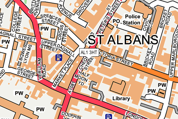
AL1 3HT is located in the St Peters electoral ward, within the local authority district of St Albans and the English Parliamentary constituency of St Albans. The Sub Integrated Care Board (ICB) Location is NHS Hertfordshire and West Essex ICB - 06N and the police force is Hertfordshire. This postcode has been in use since February 1984.


GetTheData
Source: OS OpenMap – Local (Ordnance Survey)
Source: OS VectorMap District (Ordnance Survey)
Licence: Open Government Licence (requires attribution)
| Easting | 514769 |
| Northing | 207215 |
| Latitude | 51.751881 |
| Longitude | -0.338787 |
GetTheData
Source: Open Postcode Geo
Licence: Open Government Licence
| Country | England |
| Postcode District | AL1 |
➜ See where AL1 is on a map ➜ Where is St Albans? | |
GetTheData
Source: Land Registry Price Paid Data
Licence: Open Government Licence
Elevation or altitude of AL1 3HT as distance above sea level:
| Metres | Feet | |
|---|---|---|
| Elevation | 110m | 361ft |
Elevation is measured from the approximate centre of the postcode, to the nearest point on an OS contour line from OS Terrain 50, which has contour spacing of ten vertical metres.
➜ How high above sea level am I? Find the elevation of your current position using your device's GPS.
GetTheData
Source: Open Postcode Elevation
Licence: Open Government Licence
| Ward | St Peters |
| Constituency | St Albans |
GetTheData
Source: ONS Postcode Database
Licence: Open Government Licence
| Town Hall (Chequer Street) | St Albans | 24m |
| Police Station (Victoria Street) | St Albans | 63m |
| Town Hall (Chequer Street) | St Albans | 78m |
| Police Station (Victoria Street) | St Albans | 108m |
| St Peter's Street (St Peters Street) | St Albans | 126m |
| St Albans City Station | 0.8km |
| St Albans Abbey Station | 0.8km |
| Park Street Station | 2.9km |
GetTheData
Source: NaPTAN
Licence: Open Government Licence
GetTheData
Source: ONS Postcode Database
Licence: Open Government Licence


➜ Get more ratings from the Food Standards Agency
GetTheData
Source: Food Standards Agency
Licence: FSA terms & conditions
| Last Collection | |||
|---|---|---|---|
| Location | Mon-Fri | Sat | Distance |
| Market Place | 18:40 | 12:00 | 132m |
| St Peters Street West High St | 18:30 | 12:00 | 199m |
| Spencer Street | 18:30 | 12:00 | 223m |
GetTheData
Source: Dracos
Licence: Creative Commons Attribution-ShareAlike
The below table lists the International Territorial Level (ITL) codes (formerly Nomenclature of Territorial Units for Statistics (NUTS) codes) and Local Administrative Units (LAU) codes for AL1 3HT:
| ITL 1 Code | Name |
|---|---|
| TLH | East |
| ITL 2 Code | Name |
| TLH2 | Bedfordshire and Hertfordshire |
| ITL 3 Code | Name |
| TLH23 | Hertfordshire CC |
| LAU 1 Code | Name |
| E07000240 | St Albans |
GetTheData
Source: ONS Postcode Directory
Licence: Open Government Licence
The below table lists the Census Output Area (OA), Lower Layer Super Output Area (LSOA), and Middle Layer Super Output Area (MSOA) for AL1 3HT:
| Code | Name | |
|---|---|---|
| OA | E00120481 | |
| LSOA | E01023727 | St Albans 012B |
| MSOA | E02004935 | St Albans 012 |
GetTheData
Source: ONS Postcode Directory
Licence: Open Government Licence
| AL1 3HS | The Maltings | 25m |
| AL1 3YD | Chequer Street | 34m |
| AL1 3LZ | Half Moon Mews | 54m |
| AL1 3YS | Art School Yard | 57m |
| AL1 3LF | St Peters Street | 66m |
| AL3 5DL | Market Place | 68m |
| AL3 5DP | Market Place | 78m |
| AL3 5DG | Market Place | 84m |
| AL1 3XZ | Chequer Street | 87m |
| AL1 1LS | Westbourne Mews | 93m |
GetTheData
Source: Open Postcode Geo; Land Registry Price Paid Data
Licence: Open Government Licence