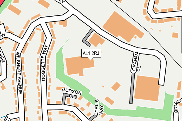
AL1 2RJ is located in the Sopwell electoral ward, within the local authority district of St Albans and the English Parliamentary constituency of St Albans. The Sub Integrated Care Board (ICB) Location is NHS Hertfordshire and West Essex ICB - 06N and the police force is Hertfordshire. This postcode has been in use since May 1994.


GetTheData
Source: OS OpenMap – Local (Ordnance Survey)
Source: OS VectorMap District (Ordnance Survey)
Licence: Open Government Licence (requires attribution)
| Easting | 514617 |
| Northing | 206084 |
| Latitude | 51.741753 |
| Longitude | -0.341337 |
GetTheData
Source: Open Postcode Geo
Licence: Open Government Licence
| Country | England |
| Postcode District | AL1 |
➜ See where AL1 is on a map ➜ Where is St Albans? | |
GetTheData
Source: Land Registry Price Paid Data
Licence: Open Government Licence
Elevation or altitude of AL1 2RJ as distance above sea level:
| Metres | Feet | |
|---|---|---|
| Elevation | 90m | 295ft |
Elevation is measured from the approximate centre of the postcode, to the nearest point on an OS contour line from OS Terrain 50, which has contour spacing of ten vertical metres.
➜ How high above sea level am I? Find the elevation of your current position using your device's GPS.
GetTheData
Source: Open Postcode Elevation
Licence: Open Government Licence
| Ward | Sopwell |
| Constituency | St Albans |
GetTheData
Source: ONS Postcode Database
Licence: Open Government Licence
| Wilshere Avenue (Doggetts Way) | St Julians | 160m |
| Wilshere Avenue (Doggetts Way) | St Julians | 181m |
| Maynard Drive (Doggetts Way) | St Julians | 191m |
| Griffiths Way | St Albans | 245m |
| Doggetts Way | St Julians | 253m |
| St Albans Abbey Station | 0.3km |
| St Albans City Station | 1.4km |
| Park Street Station | 1.8km |
GetTheData
Source: NaPTAN
Licence: Open Government Licence
GetTheData
Source: ONS Postcode Database
Licence: Open Government Licence


➜ Get more ratings from the Food Standards Agency
GetTheData
Source: Food Standards Agency
Licence: FSA terms & conditions
| Last Collection | |||
|---|---|---|---|
| Location | Mon-Fri | Sat | Distance |
| Dellfield | 17:30 | 12:00 | 343m |
| The Brambles | 17:30 | 12:00 | 353m |
| St Stephens P.o | 17:30 | 12:00 | 455m |
GetTheData
Source: Dracos
Licence: Creative Commons Attribution-ShareAlike
The below table lists the International Territorial Level (ITL) codes (formerly Nomenclature of Territorial Units for Statistics (NUTS) codes) and Local Administrative Units (LAU) codes for AL1 2RJ:
| ITL 1 Code | Name |
|---|---|
| TLH | East |
| ITL 2 Code | Name |
| TLH2 | Bedfordshire and Hertfordshire |
| ITL 3 Code | Name |
| TLH23 | Hertfordshire CC |
| LAU 1 Code | Name |
| E07000240 | St Albans |
GetTheData
Source: ONS Postcode Directory
Licence: Open Government Licence
The below table lists the Census Output Area (OA), Lower Layer Super Output Area (LSOA), and Middle Layer Super Output Area (MSOA) for AL1 2RJ:
| Code | Name | |
|---|---|---|
| OA | E00120540 | |
| LSOA | E01023737 | St Albans 017A |
| MSOA | E02004940 | St Albans 017 |
GetTheData
Source: ONS Postcode Directory
Licence: Open Government Licence
| AL1 2JU | Hudson Close | 126m |
| AL1 2NF | Doggetts Way | 141m |
| AL1 2NG | Doggetts Way | 176m |
| AL1 2JF | Cyrils Way | 187m |
| AL1 2PJ | Wilshere Avenue | 223m |
| AL1 2JT | Maynard Drive | 236m |
| AL1 2BD | Leyland Avenue | 244m |
| AL1 2PH | Wilshere Avenue | 259m |
| AL1 2NH | Tavistock Avenue | 271m |
| AL1 2AZ | St Julians Road | 282m |
GetTheData
Source: Open Postcode Geo; Land Registry Price Paid Data
Licence: Open Government Licence