Zakaria Muslim Girl's High School (Closed) - Batley
Zakaria Muslim Girl's High School (Closed) is located in Batley (WF17).
| Address | 111, Warwick Road, Batley, WF17 6AJ |
| Management Type | School/College/University (in house) |
| Management Group | Education |
| Owner Type | Other Independent School |
| Owner Group | Education |
| Education Phase | Not applicable |
| Closure Date | 1st Jan 2019 |
| Closure Reason | Strategic Review - facility/site not being replaced |
Facilities
| Status Notes | School hall. |
| Closure Date | 1st Jan 2019 |
| Closure Reason | Strategic Review - facility/site not being replaced |
| Accessibility | Private Use |
| Management Type | School/College/University (in house) |
| Year Built | 1982 |
| Changing Rooms | Yes |
| Date Record Checked | 13th Sep 2019 |
| Opening Times | Detailed Timings |
Facility specifics
| Area | 256m² |
| Floor Matting | Don't Know |
| Gymnastics Trampoline Use | Don't Know |
| Length | 16m |
| Moveable Balance Apparatus | Don't Know |
| Moveable Large Apparatus | Don't Know |
| Moveable Rebound Apparatus | Don't Know |
| Moveable Trampolines | Don't Know |
| Width | 16m |
| Small Apparatus | Don't Know |
| Swinging and Hanging Apparatus | Don't Know |
Contact
Where is Zakaria Muslim Girl's High School (Closed)?
| Sub Building Name | |
| Building Name | |
| Building Number | 111 |
| Dependent Thoroughfare | |
| Thoroughfare Name | WARWICK ROAD |
| Double Dependent Locality | |
| Dependent Locality | |
| PostTown | BATLEY |
| Postcode | WF17 6AJ |
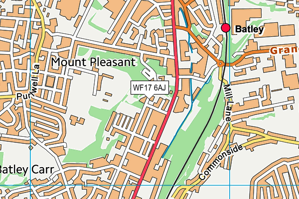
Zakaria Muslim Girl's High School (Closed) on a map

Zakaria Muslim Girl's High School (Closed) geodata
| Easting | 424645 |
| Northing | 423539 |
| Latitude | 53.7077 |
| Longitude | -1.628123 |
| Local Authority Name | Kirklees |
| Local Authority Code | E08000034 |
| Parliamentary Constituency Name | Batley and Spen |
| Parliamentary Constituency Code | E14000548 |
| Region Name | Yorkshire and the Humber |
| Region Code | E15000003 |
| Ward Name | Batley East |
| Ward Code | E05001390 |
| Output Area Code | E00055543 |
About this data
This data is open data sourced from Active Places Power and licenced under the Active Places Open Data Licence.
| toid | osgb1000032338554 |
| Created On | 27th Jul 2004 |
| Audited On | 6th Sep 2018 |
| Checked On | 6th Sep 2018 |
