Wrangle Parish Hall
Wrangle Parish Hall is located in Wrangle, Boston (PE22), and offers Sports Hall.
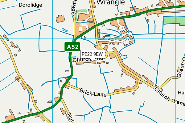
| Address | WRANGLE PARISH HALL, Church End, Church End, Wrangle, Boston, PE22 9EW |
| Car Park | Yes |
| Car Park Capacity | 50 |
| Management Type | Community Organisation |
| Management Group | Others |
| Owner Type | Community Organisation |
| Owner Group | Community Organisation |
| Education Phase | Not applicable |
Facilities
| Accessibility | Sports Club / Community Association |
| Management Type | Community Organisation |
| Year Built | 1957 |
| Year Refurbished | 2000 |
| Changing Rooms | No |
| Date Record Checked | 29th Dec 2022 |
Opening times
| Access description | Sports Club / Community Association |
|---|
| Opening time | 08:00 |
| Closing time | 20:00 |
| Period open for | Every day |
Facility specifics
| Area | 180m² |
| Floor Matting | Don't Know |
| Gymnastics Trampoline Use | Don't Know |
| Length | 18m |
| Moveable Balance Apparatus | Don't Know |
| Moveable Large Apparatus | Don't Know |
| Moveable Rebound Apparatus | Don't Know |
| Moveable Trampolines | Don't Know |
| Width | 10m |
| Small Apparatus | Don't Know |
| Swinging and Hanging Apparatus | Don't Know |
Disabled access
| Disabled Access | Yes |
| Disabled Parking | Yes |
| Finding/Reaching Entrance | Yes |
| Reception Area | Yes |
| Doorways | Yes |
| Disabled Changing Facilities | Yes |
| Activity Areas | Yes |
| Disabled Toilets | Yes |
| Social Areas | Yes |
| Spectator Areas | Yes |
| Emergency Exits | Yes |
Contact
Disabled access
Disabled access for Wrangle Parish Hall
| Disabled Access | Yes |
| Disabled Parking | Yes |
| Finding/Reaching Entrance | Yes |
| Reception Area | Yes |
| Doorways | Yes |
| Disabled Changing Facilities | Yes |
| Activity Areas | Yes |
| Disabled Toilets | Yes |
| Social Areas | Yes |
| Spectator Areas | Yes |
| Emergency Exits | Yes |
Where is Wrangle Parish Hall?
| Sub Building Name | |
| Building Name | WRANGLE PARISH HALL |
| Building Number | 0 |
| Dependent Thoroughfare | CHURCH END |
| Thoroughfare Name | CHURCH END |
| Double Dependent Locality | |
| Dependent Locality | WRANGLE |
| PostTown | BOSTON |
| Postcode | PE22 9EW |
Wrangle Parish Hall on a map

Wrangle Parish Hall geodata
| Easting | 542439.13 |
| Northing | 350925.38 |
| Latitude | 53.036644 |
| Longitude | 0.122881 |
| Local Authority Name | Boston |
| Local Authority Code | E07000136 |
| Parliamentary Constituency Name | Boston and Skegness |
| Parliamentary Constituency Code | E14000582 |
| Region Name | East Midlands |
| Region Code | E15000004 |
| Ward Name | Old Leake and Wrangle |
| Ward Code | E05009626 |
| Output Area Code | E00132059 |
About this data
This data is open data sourced from Active Places Power and licenced under the Active Places Open Data Licence.
| Created On | 12th Aug 2005 |
| Audited On | 29th Dec 2022 |
| Checked On | 29th Dec 2022 |
