Woodland View Primary School - Huthwaite
Woodland View Primary School is located in Huthwaite, Sutton-in-ashfield (NG17), and offers Grass Pitches.
| Address | Barker Street, Huthwaite, Sutton-in-ashfield, NG17 2LH |
| Car Park | Yes |
| Car Park Capacity | 20 |
| Management Type | School/College/University (in house) |
| Management Group | Education |
| Owner Type | Community school |
| Owner Group | Education |
| Education Phase | Primary |
Facilities
| Accessibility | Private Use |
| Management Type | School/College/University (in house) |
| Changing Rooms | No |
| Date Record Created | 2nd Mar 2017 |
| Date Record Checked | 18th Oct 2023 |
| Opening Times | Dawn To Dusk |
Facility specifics
Disabled access
| Disabled Access | Yes |
| Disabled Parking | Yes |
| Finding/Reaching Entrance | Yes |
| Reception Area | Yes |
| Doorways | Yes |
| Disabled Changing Facilities | Yes |
| Activity Areas | Yes |
| Disabled Toilets | Yes |
| Emergency Exits | Yes |
| Notes | Lift |
| Closure Date | 1st Mar 2018 |
| Closure Reason | Redevelopment - loss due to development project (e.g. major schemes such as HS2, new roads, area regeneration or smaller local development) |
| Accessibility | Private Use |
| Management Type | School/College/University (in house) |
| Changing Rooms | No |
| Date Record Created | 2nd Mar 2017 |
| Date Record Checked | 18th Oct 2023 |
| Opening Times | Dawn To Dusk |
Facility specifics
Disabled access
| Disabled Access | Yes |
| Disabled Parking | Yes |
| Finding/Reaching Entrance | Yes |
| Reception Area | Yes |
| Doorways | Yes |
| Activity Areas | Yes |
| Disabled Toilets | Yes |
| Emergency Exits | Yes |
Contact
Disabled access
Disabled access for Woodland View Primary School
| Disabled Access | Yes |
| Disabled Parking | Yes |
| Finding/Reaching Entrance | Yes |
| Reception Area | Yes |
| Doorways | Yes |
| Disabled Changing Facilities | Yes |
| Activity Areas | Yes |
| Disabled Toilets | Yes |
| Emergency Exits | Yes |
| Notes | Lift |
Where is Woodland View Primary School?
| Sub Building Name | |
| Building Name | |
| Building Number | 0 |
| Dependent Thoroughfare | |
| Thoroughfare Name | BARKER STREET |
| Double Dependent Locality | |
| Dependent Locality | HUTHWAITE |
| PostTown | SUTTON-IN-ASHFIELD |
| Postcode | NG17 2LH |
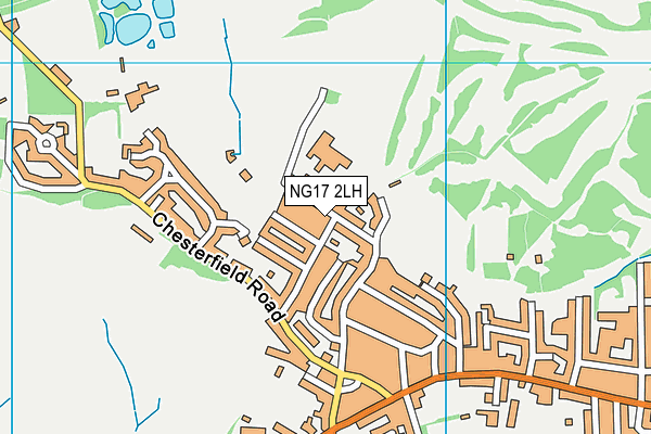
Woodland View Primary School on a map

Woodland View Primary School geodata
| Easting | 446717 |
| Northing | 359777 |
| Latitude | 53.133113 |
| Longitude | -1.303199 |
| Local Authority Name | Ashfield |
| Local Authority Code | E07000170 |
| Parliamentary Constituency Name | Ashfield |
| Parliamentary Constituency Code | E14000535 |
| Region Name | East Midlands |
| Region Code | E15000004 |
| Ward Name | Huthwaite & Brierley |
| Ward Code | E05010682 |
| Output Area Code | E00142588 |
About this data
This data is open data sourced from Active Places Power and licenced under the Active Places Open Data Licence.
| toid | osgb1000022350424 |
| Created On | 2nd Mar 2017 |
| Audited On | 18th Oct 2023 |
| Checked On | 18th Oct 2023 |
