Wimbledon High School Sport Ground
Wimbledon High School Sport Ground is located in Wimbledon, London (SW19), and offers Artificial Grass Pitch, and Outdoor Tennis Courts.
| Address | PAVILION, WIMBLEDON HIGH SCHOOL PLAYING FIELD, Nursery Road, Wimbledon, London, SW19 4JA |
| Car Park | Yes |
| Car Park Capacity | 7 |
| Management Type | School/College/University (in house) |
| Management Group | Education |
| Owner Type | Other Independent School |
| Owner Group | Education |
| Education Phase | All through |
Aliases
Wimbledon High School Sport Ground is also known as:
- Nursery Road Playing Fields
Facilities
| Status Notes | AGP is marked out as a MUGA. Includes markings for tennis and football. |
| Accessibility | Private Use |
| Management Type | School/College/University (in house) |
| Year Built | 2001 |
| Changing Rooms | Yes |
| Date Record Checked | 13th Apr 2023 |
Opening times
| Access description | Private Use |
|---|
| Opening time | 09:00 |
| Closing time | 17:00 |
| Period open for | Monday-Friday |
Facility specifics
| Area | 5220m² |
| Floodlit | Yes |
| Indoor | No |
| Length | 90m |
| Width | 58m |
| WR22 Compliant Pitch | No |
| Status Notes | MUGA - Tennis courts over-marked with netball courts |
| Accessibility | Private Use |
| Management Type | School/College/University (in house) |
| Year Built | 2002 |
| Year Refurbished | 2015 |
| Changing Rooms | Yes |
| Date Record Created | 17th Dec 2019 |
| Date Record Checked | 13th Apr 2023 |
Opening times
| Access description | Private Use |
|---|
| Opening time | 09:00 |
| Closing time | 17:00 |
| Period open for | Monday-Friday |
Facility specifics
| Floodlit | Yes |
| Overmarked | Yes |
| Surface Type | Concrete |
Contact
Where is Wimbledon High School Sport Ground?
| Sub Building Name | PAVILION |
| Building Name | WIMBLEDON HIGH SCHOOL PLAYING FIELD |
| Building Number | 0 |
| Dependent Thoroughfare | |
| Thoroughfare Name | NURSERY ROAD |
| Double Dependent Locality | |
| Dependent Locality | WIMBLEDON |
| PostTown | LONDON |
| Postcode | SW19 4JA |
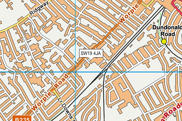
Wimbledon High School Sport Ground on a map

Wimbledon High School Sport Ground geodata
| Easting | 524139.92 |
| Northing | 170078.66 |
| Latitude | 51.416143 |
| Longitude | -0.216221 |
| Local Authority Name | Merton |
| Local Authority Code | E09000024 |
| Parliamentary Constituency Name | Wimbledon |
| Parliamentary Constituency Code | E14001040 |
| Region Name | London |
| Region Code | E15000007 |
| Ward Name | Hillside |
| Ward Code | E05013816 |
| Output Area Code | E00017206 |
About this data
This data is open data sourced from Active Places Power and licenced under the Active Places Open Data Licence.
| toid | osgb1000041400943 |
| Created On | 21st Jul 2004 |
| Audited On | 13th Apr 2023 |
| Checked On | 13th Apr 2023 |
