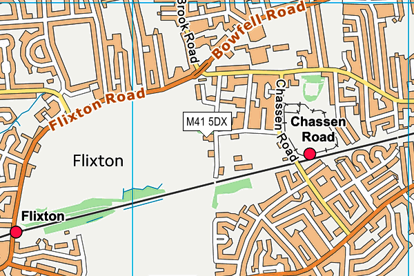
William Wroe Golf Course (Closed) - Urmston
William Wroe Golf Course (Closed) is located in Urmston, Manchester (M41).
| Address | Penny Bridge Lane, Urmston, Manchester, M41 5DX |
| Car Park | Yes |
| Car Park Capacity | 100 |
| Management Type | Trust |
| Management Group | Trust |
| Owner Type | Local Authority |
| Owner Group | Local Authority |
| Education Phase | Not Known |
| Closure Date | 31st Mar 2017 |
| Closure Reason | Financial - insolvency, facilities uneconomic etc |
Facilities
| Closure Date | 31st Mar 2017 |
| Closure Reason | Financial - insolvency, facilities uneconomic etc |
| Accessibility | Pay and Play |
| Management Type | Trust |
| Year Built | 1973 |
| Changing Rooms | Yes |
| Year Changing Rooms Refurbished | 2012 |
| Date Record Checked | 21st Apr 2017 |
| Opening Times | Dawn To Dusk |
Facility specifics
Disabled access
| Disabled Access | Yes |
| Finding/Reaching Entrance | Yes |
| Reception Area | Yes |
| Doorways | Yes |
| Disabled Changing Facilities | Yes |
| Activity Areas | Yes |
| Disabled Toilets | Yes |
| Emergency Exits | Yes |
Contact
Disabled access
Disabled access for William Wroe Golf Course (Closed)
| Disabled Access | Yes |
| Finding/Reaching Entrance | Yes |
| Reception Area | Yes |
| Doorways | Yes |
| Disabled Changing Facilities | Yes |
| Activity Areas | Yes |
| Disabled Toilets | Yes |
| Emergency Exits | Yes |
Where is William Wroe Golf Course (Closed)?
| Sub Building Name | |
| Building Name | |
| Building Number | 0 |
| Dependent Thoroughfare | |
| Thoroughfare Name | Penny Bridge Lane |
| Double Dependent Locality | |
| Dependent Locality | Urmston |
| PostTown | Manchester |
| Postcode | M41 5DX |
William Wroe Golf Course (Closed) on a map

William Wroe Golf Course (Closed) geodata
| Easting | 375282 |
| Northing | 394448.92 |
| Latitude | 53.446221 |
| Longitude | -2.373624 |
| Local Authority Name | Trafford |
| Local Authority Code | E08000009 |
| Parliamentary Constituency Name | Stretford and Urmston |
| Parliamentary Constituency Code | E14000979 |
| Region Name | North West |
| Region Code | E15000002 |
| Ward Name | Flixton |
| Ward Code | E05000828 |
| Output Area Code | E00031065 |
About this data
This data is open data sourced from Active Places Power and licenced under the Active Places Open Data Licence.
| Created On | 26th Apr 2004 |
| Audited On | 12th May 2016 |
| Checked On | 21st Apr 2017 |
