Wigan Warriors (Edge Hall Road Community Stadium) - Orrell
Wigan Warriors (Edge Hall Road Community Stadium) is located in Orrell (WN5), and offers Grass Pitches.
| Address | COMMUNITY STADIUM, Edge Hall Road, Orrell, WN5 8TL |
| Car Park | Yes |
| Car Park Capacity | 75 |
| Management Type | Sport Club |
| Management Group | Others |
| Owner Type | Local Authority |
| Owner Group | Local Authority |
| Education Phase | Not applicable |
Aliases
Wigan Warriors (Edge Hall Road Community Stadium) is also known as:
- Edge Hall Road
- Wigan Warriors (Fairhurst Accountants Community Stadium)
- Wigan Warriors (The Co-operative Community Stadium)
Facilities
| Accessibility | Private Use |
| Management Type | Sport Club |
| Year Built | 1950 |
| Changing Rooms | Yes |
| Date Record Created | 30th Jan 2019 |
| Date Record Checked | 22nd Aug 2023 |
Opening times
| Access description | Private Use |
|---|
| Opening time | 08:00 |
| Closing time | 22:00 |
| Period open for | Every day |
Facility specifics
Disabled access
| Disabled Access | Yes |
| Disabled Parking | Yes |
| Finding/Reaching Entrance | Yes |
| Reception Area | Yes |
| Doorways | Yes |
| Activity Areas | Yes |
| Social Areas | Yes |
| Spectator Areas | Yes |
| Emergency Exits | Yes |
Contact
Disabled access
Disabled access for Wigan Warriors (Edge Hall Road Community Stadium)
| Disabled Access | Yes |
| Disabled Parking | Yes |
| Finding/Reaching Entrance | Yes |
| Reception Area | Yes |
| Doorways | Yes |
| Activity Areas | Yes |
| Social Areas | Yes |
| Spectator Areas | Yes |
| Emergency Exits | Yes |
Where is Wigan Warriors (Edge Hall Road Community Stadium)?
| Sub Building Name | |
| Building Name | COMMUNITY STADIUM |
| Building Number | 0 |
| Dependent Thoroughfare | |
| Thoroughfare Name | EDGE HALL ROAD |
| Double Dependent Locality | |
| Dependent Locality | |
| PostTown | ORRELL |
| Postcode | WN5 8TL |
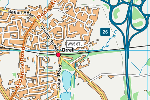
Wigan Warriors (Edge Hall Road Community Stadium) on a map

Wigan Warriors (Edge Hall Road Community Stadium) geodata
| Easting | 353282 |
| Northing | 404093 |
| Latitude | 53.531404 |
| Longitude | -2.706276 |
| Local Authority Name | Wigan |
| Local Authority Code | E08000010 |
| Parliamentary Constituency Name | Makerfield |
| Parliamentary Constituency Code | E14000805 |
| Region Name | North West |
| Region Code | E15000002 |
| Ward Name | Orrell |
| Ward Code | E05000856 |
| Output Area Code | E00032266 |
About this data
This data is open data sourced from Active Places Power and licenced under the Active Places Open Data Licence.
| toid | osgb1000000221331205 |
| Created On | 30th Jan 2019 |
| Audited On | 22nd Aug 2023 |
| Checked On | 22nd Aug 2023 |
