Whitesmore School (Closed) - Birmingham
Whitesmore School (Closed) is located in Birmingham (B37).
| Address | Chapelhouse Road, Birmingham, B37 5JS |
| Car Park | Yes |
| Car Park Capacity | 100 |
| Management Type | Not Known |
| Management Group | Not Known |
| Owner Type | Community school |
| Owner Group | Education |
| Education Phase | Secondary |
| Closure Date | 31st Aug 2006 |
| Closure Reason | Unclassified |
Facilities
| Closure Date | 31st Aug 2006 |
| Closure Reason | Unclassified |
| Accessibility | Private Use |
| Management Type | Not Known |
| Year Built | 1969 |
| Changing Rooms | Yes |
| Date Record Checked | 30th Nov 2006 |
| Opening Times | Detailed Timings |
Facility specifics
| Area | 594m² |
| Floor Matting | Don't Know |
| Gymnastics Trampoline Use | Don't Know |
| Length | 0m |
| Moveable Balance Apparatus | Don't Know |
| Moveable Large Apparatus | Don't Know |
| Moveable Rebound Apparatus | Don't Know |
| Width | 0m |
| Moveable Trampolines | Don't Know |
| Small Apparatus | Don't Know |
| Swinging and Hanging Apparatus | Don't Know |
| Closure Date | 31st Aug 2006 |
| Closure Reason | Unclassified |
| Accessibility | Private Use |
| Management Type | Not Known |
| Year Built | 1969 |
| Changing Rooms | Yes |
| Date Record Checked | 30th Nov 2006 |
| Opening Times | Detailed Timings |
Facility specifics
| Area | 0m² |
| Floor Matting | Don't Know |
| Gymnastics Trampoline Use | Don't Know |
| Length | 0m |
| Moveable Balance Apparatus | Don't Know |
| Moveable Large Apparatus | Don't Know |
| Moveable Rebound Apparatus | Don't Know |
| Moveable Trampolines | Don't Know |
| Width | 0m |
| Small Apparatus | Don't Know |
| Swinging and Hanging Apparatus | Don't Know |
| Closure Date | 31st Aug 2006 |
| Closure Reason | Unclassified |
| Accessibility | Private Use |
| Management Type | Not Known |
| Year Built | 1969 |
| Changing Rooms | Yes |
| Date Record Checked | 30th Nov 2006 |
| Opening Times | Detailed Timings |
Facility specifics
| Access to Pool Hoist | No |
| Area | 160m² |
| Diving Boards | No |
| Length | 20m |
| Maximum Depth | 1.4m |
| Minimum Depth | 0.8m |
| Movable Floor | No |
| Width | 8m |
| Closure Date | 31st Aug 2006 |
| Closure Reason | Unclassified |
| Accessibility | Private Use |
| Management Type | Not Known |
| Changing Rooms | Yes |
| Date Record Checked | 30th Nov 2006 |
| Opening Times | Detailed Timings |
Facility specifics
Where is Whitesmore School (Closed)?
| Sub Building Name | |
| Building Name | |
| Building Number | 0 |
| Dependent Thoroughfare | |
| Thoroughfare Name | Chapelhouse Road |
| Double Dependent Locality | |
| Dependent Locality | |
| PostTown | Birmingham |
| Postcode | B37 5JS |
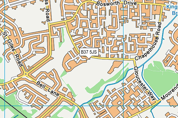
Whitesmore School (Closed) on a map

Whitesmore School (Closed) geodata
| Easting | 416624 |
| Northing | 286275 |
| Latitude | 52.474157 |
| Longitude | -1.756687 |
| Local Authority Name | Solihull |
| Local Authority Code | E08000029 |
| Parliamentary Constituency Name | Meriden |
| Parliamentary Constituency Code | E14000812 |
| Region Name | West Midlands |
| Region Code | E15000005 |
| Ward Name | Kingshurst and Fordbridge |
| Ward Code | E05001290 |
| Output Area Code | E00051274 |
About this data
This data is open data sourced from Active Places Power and licenced under the Active Places Open Data Licence.
| Created On | 14th Dec 2014 |
| Audited On | 26th Jan 2015 |
| Checked On | 30th Nov 2006 |
