Wear Barton Road (Closed) - Exeter
Wear Barton Road (Closed) is located in Exeter (EX2).
| Address | Wear Barton Road, Exeter, EX2 7EH |
| Management Type | Sport Club |
| Management Group | Others |
| Owner Type | Other |
| Owner Group | Others |
| Education Phase | Not applicable |
| Closure Date | 1st Jul 2020 |
| Closure Reason | Redevelopment - loss due to development project (e.g. major schemes such as HS2, new roads, area regeneration or smaller local development) |
Facilities
| Closure Date | 1st Jul 2020 |
| Closure Reason | Redevelopment - loss due to development project (e.g. major schemes such as HS2, new roads, area regeneration or smaller local development) |
| Accessibility | Sports Club / Community Association |
| Management Type | Sport Club |
| Year Built | 1985 |
| Changing Rooms | Yes |
| Date Record Checked | 7th Jan 2021 |
| Opening Times | Dawn To Dusk |
Facility specifics
Disabled access
| Disabled Access | Yes |
| Activity Areas | Yes |
| Closure Date | 1st Jul 2020 |
| Closure Reason | Redevelopment - loss due to development project (e.g. major schemes such as HS2, new roads, area regeneration or smaller local development) |
| Accessibility | Sports Club / Community Association |
| Management Type | Sport Club |
| Year Built | 1985 |
| Changing Rooms | Yes |
| Date Record Checked | 7th Jan 2021 |
Opening times
| Access description | Sports Club / Community Association |
|---|
| Opening time | 09:00 |
| Closing time | 17:00 |
| Period open for | Weekend |
| |
| Access description | Private Use |
|---|
| Opening time | 09:00 |
| Closing time | 17:00 |
| Period open for | Monday-Friday |
Facility specifics
Disabled access
| Disabled Access | Yes |
| Activity Areas | Yes |
| Spectator Areas | Yes |
| Emergency Exits | Yes |
Contact
Disabled access
Disabled access for Wear Barton Road (Closed)
| Disabled Access | Yes |
| Activity Areas | Yes |
Where is Wear Barton Road (Closed)?
| Sub Building Name | |
| Building Name | |
| Building Number | 0 |
| Dependent Thoroughfare | |
| Thoroughfare Name | Wear Barton Road |
| Double Dependent Locality | |
| Dependent Locality | |
| PostTown | Exeter |
| Postcode | EX2 7EH |
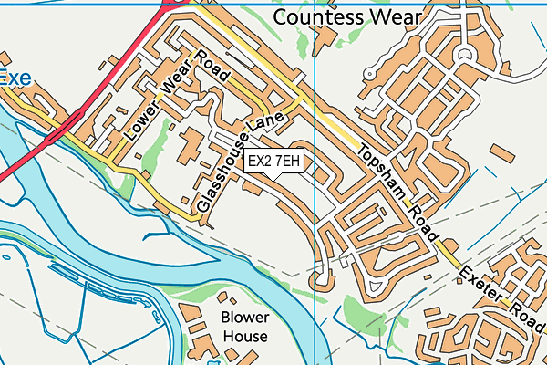
Wear Barton Road (Closed) on a map

Wear Barton Road (Closed) geodata
| Easting | 294848 |
| Northing | 89487 |
| Latitude | 50.695493 |
| Longitude | -3.49017 |
| Local Authority Name | Exeter |
| Local Authority Code | E07000041 |
| Parliamentary Constituency Name | Exeter |
| Parliamentary Constituency Code | E14000698 |
| Region Name | South West |
| Region Code | E15000009 |
| Ward Name | Topsham |
| Ward Code | E05011023 |
| Output Area Code | E00101305 |
About this data
This data is open data sourced from Active Places Power and licenced under the Active Places Open Data Licence.
| Created On | 5th Feb 2007 |
| Audited On | 4th Jan 2021 |
| Checked On | 4th Jan 2021 |
